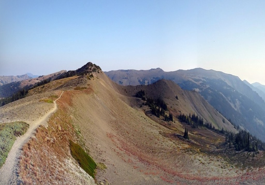

This is a great trail to take someone whom you want to lure into hiking. You start with great views that seem to only get better. There are also plenty of reasons to stop and take in the moment. Please stay on the trail and don’t step on the delicate high alpine vegetation.
Lillian Ridge Trail starts at a trailhead at the end of the Obstruction Point Road. It is above tree line and stays at or above tree line with a few detours through krummholz. The vistas extend deep into the Olympics clear to the Cascades. Glacier-cloaked Mount Olympus commands the westward view.
If you look to the northeast, you’ll probably see Mount Baker looking like a big white tooth. This trail often runs at or near ridgelines and catches breezes well, so bugs are rarely a problem.
There is no water along or even near the trail, so you’ll need to tote your own. However, you will get to see water; the alpine basins below feature sparkling tarns and streams. When the breezes are just right you’ll hear the rush of the streams.
Take time to stop and watch the sky for ravens, hawks and eagles riding the winds and thermals. You can take this trail much farther than you’d want to take a budding hiker. Turn around while the hike is still fun. There is more uphill effort on the way back to the trailhead.
Lillian Ridge

-
 Length
- 4.0 miles, roundtrip
-
 Elevation Gain
- 200 feet
-
 Highest Point
- 6,100 feet
Enjoy majestic mountain panoramas from this relatively low-effort, high-vista hike on the Olympic Peninsula.
Continue reading
Hiking Lillian Ridge
Map & Directions
 Trailhead
Before You Go
Parking Pass/Entry Fee
National Park PassWTA Pro Tip: Save a copy of our directions before you leave! App-based driving directions aren't always accurate and data connections may be unreliable as you drive to the trailhead.
Getting There
In Port Angeles, turn south on Race Street. Race becomes Hurricane Ridge Road. You’ll drive past the Vistor Center, then past the fee collection booth - unless you need to pay a fee - and wind up the the 17 miles to Hurricane Ridge.
The road to Obstruction Point leaves Hurricane Ridge Road east of the Ridge parking area. Obstruction Point Road is 7.6 miles of gravel, with some tight switchbacks, and is one-lane wide with pullouts. This is not a good road for trailers or RVs.
It takes a steep downhill path from Hurricane Ridge Road and may be difficult for some to initially spot. The trailhead is at the end of the road.


