

The Monument Creek Trail used to be one of the season’s earliest access into the Pasayten Wilderness, opening in late May. The hike up the Lost River valley was an easy warmup to the exhausting 4600-foot climb after the Eureka Creek bridge to Pistol Pass. The collapse of the Eureka Creek bridge in 2006 makes the trip beyond only for the intrepid hikers looking for a real challenge, as — even though the bridge has been recently rebuilt, and more maintenance on this part of the trail may be on the horizon — the trail beyond has not been maintained for decades. But, enough history…
Your hike up the Lost River Valley starts as a forest walk through Ponderosa pine and Douglas-fir with a few views of the river or ridges above. It then transitions to a number of rockslide crossings and finishes with a cedar grove and traverse along the base of cliffs to the steep-walled Eureka Creek valley. All along the way, you'll enjoy listening to the sound of the river. After reaching the end, backtrack to the wilderness boundary and take the side trail to access the gravel bar and a few sitting logs by the river.
The formal trail is crisscrossed by game trails heading down to the only reliable summer water source, the Lost River. Four informal trails take off from the main trail at unmarked junctions. At 0.1 mile is an unmarked junction with an access trail that comes directly from the Lost River Road (used in winter).
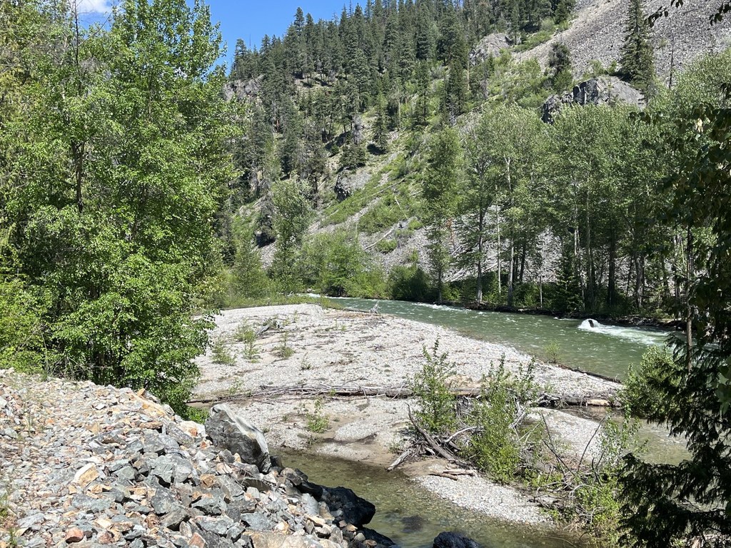
At one mile from the trailhead is a trail to a hunter’s camp on the ridge and on to Scramble Point. 1.3 miles in is another trail to a hunter’s camp, which also has a steep boot trail down 150 vertical feet to the river for water access. At 3.0 miles, find the wilderness boundary, and an access trail to a camp and large gravel bar by the river.
Views along the trail are somewhat limited. The first view of the river is at 0.7 miles, with a bit more expansive view of Pistol Peaks at 2.2 miles. Each of the many rockslide crossings offer views to varying degrees.
The trail is used year-round. In winter, it can be access for snowshoe or ski trips from the Yellowjacket snowmobile SnoPark via a 0.7 mile road walk to the access trail. In spring, after the snow has melted, the flowers start blooming, adding color to the trip. By summer, the flowers have faded but the forest shade is welcome in the midday heat. DO note that rattlesnakes may be around though. In fall, the colors change to browns, reds, and oranges (some on leaves, some on hunters).
WTA Pro Tip: The side channel crossing on the access trail for the gravel bar provides a small-scale example of the Methow Valley hydrology. In spring, the channel can be over a foot deep, but by 70 yards downstream it has percolated into the gravel bar, only to reappear at 20 yards before it re-enters the main channel. About four miles upstream from Mazama, the entire Methow River does the same thing in fall, on a much larger scale.
 Trailhead


