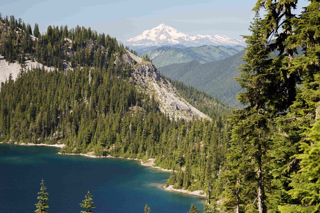

Scenic Marmot Lake is reachable from both Highway 2 or the Salmon La Sac area, but either way will be a challenge -- it's 14 miles via Deception Pass, or more than 10 miles from the Tucquala Meadows Trailhead. It's worth noting that from Highway 2, the trail passes the lake before boomeranging from Deception Pass back north to Marmot Lake. The more direct route to the lake is via Tucquala Meadows.
From the Deception Pass trailhead, you'll hike five miles through mossy forest into the Alpine Lakes wilderness. Campsites dot the trail, two, three, and five miles in, making this section a great option for overnight backpacking--you can make your own adventure along this section of trail.
At the 4.8 mile mark is the junction with the Tonga Ridge Trail, which makes for a great day hike, but you'll continue straight south. After another 2.5 miles arrive at a second junction. A left turn here connects to the Pacific Crest Trail in one uphill mile, but again, you'll continue straight another 3.4 miles to Deception Pass, where you'll turn north onto the Lake Clarice trail and descend three miles to yet another junction.
A left turn here will take you to Marmot Lake in .7 miles; taking the right trail brings you to Lake Clarice in .9 miles.
From Tucquala Meadows trail, take the Deception Pass trail past Hyas Lake to a junction 4.4 miles in. Continue past this junction for 0.6 miles to Deception Pass, and follow the directions as listed above to Marmot Lake.
Marmot Lake

-
 Length
- 16.0 miles, roundtrip
-
 Highest Point
- 4,500 feet
Scenic Marmot Lake is reachable from both Highway 2 or the Salmon La Sac area, but either way will be a challenge -- it's 14 miles via Deception Pass, or more than 10 miles from the Tucquala Meadows Trailhead.
Continue reading
Hiking Marmot Lake

WTA worked here in 2024, 2023, 2021, 2016 and 2015!
Map & Directions
 Trailhead
Before You Go
Parking Pass/Entry Fee
Northwest Forest PassWTA Pro Tip: Save a copy of our directions before you leave! App-based driving directions aren't always accurate and data connections may be unreliable as you drive to the trailhead.
Getting There
Access the Deception Pass trailhead from Highway 2. Drive east to mile marker 56.6, found between the Skykomish and Stevens Pass. Turn south onto Deception Creek Road (FR 6088), and continue for one mile to the trailhead.
Access the Tucquala Meadows trailhead from I-90. From I-90 take exit 80. Drive north on SR-903 to Salmon La Sac. Fork right and continue up Cle Elum Valley Road (FR-4330) for 12 rough miles to the trailhead.


