

From the stone staircase at Paradise, climb steeply on the asphalt Skyline Trail. Follow signs to stay on the Skyline Trail until, at half a mile, you see a sign for the Deadhorse Creek Trail. Veer left (north) at that junction to connect with Deadhorse.
At the next junction, go hard left (southwest) on the Deadhorse Creek Trail. In 250 feet, a small sign on the right announces the Moraine Trail. Go right, leaving asphalt behind, shortly passing a sign reading “End of maintained trail. Travel safely causing minimum impact beyond here.”
Pass through a small stand of trees, then descend gently into the open. A ridge to your right now separates you from the often crowded area you just left. Continue gently downhill on pleasant trail. When you see the trail divide, avoid the left (lower) trail. Both paths go to the same place, but the lower trail drops steeply through treacherously loose and slippery terrain. Instead, just continue straight on the upper trail.
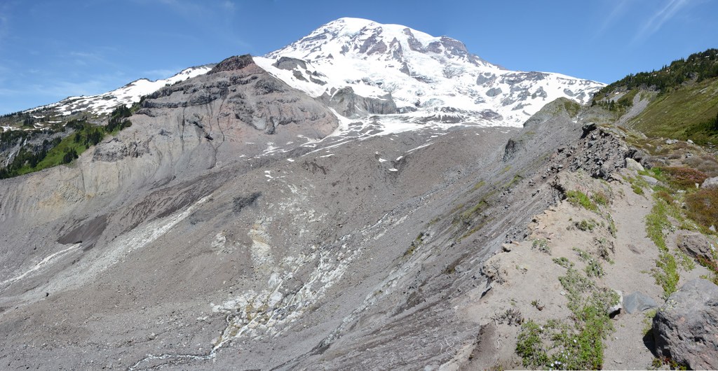
At 1 mile, step across the stream and walk to the edge of the moraine at 1.1 miles, where it connects with the lower trail. Before you wander the edge of the moraine for varied views, notice that the trail below is unsafe in places, simply too close to the loose gravelly edge of the moraine.
Admire the broad Nisqually River valley and what remains of the Nisqually Glacier several hundred feet below, or just gaze at the summit. When you are ready, return to the asphalt paths the way you came, and then decide where to go next.
WTA Pro Tip: You can obtain a free copy of the “Paradise Area Trails” map, featuring this hike and more, from the Longmire Wilderness Information Center or Paradise Visitor Center.
 Trailhead


