Trails for everyone, forever

Home Go Hiking Hiking Guide Creekside Loop
WTA is a nonprofit that needs you

We're just as excited as you to get the summer hiking season started. We're psyched our website, app and work for trails help you get outside.

But we're a nonprofit that runs on donations from regular people. If everyone who visited this site this holiday weekend donated $9/month, it would fully fund our work for the next 2 years. Time spent outdoors is priceless, but every donation large or small helps us support those experiences for everyone. Thank you and happy hiking!


Please take 2 minS to chip in $9

link

Creekside Loop

Snoqualmie Region > North Bend Area
47.4880, -121.7231 Map & Directions
Length
0.2 miles, roundtrip
Elevation Gain
10 feet
Highest Point
690 feet
Calculated Difficulty About Calculated Difficulty
Easy
The Creek Side loop is a great option for little kids to discover nature. Photo by Jessica Wynne. Full-size image
  • Wildflowers/Meadows
  • Dogs allowed on leash
  • Good for kids
  • Fall foliage
  • Rivers

Parking Pass/Entry Fee

Discover Pass
Saved to My Backpack

A barrier-free trail that uses part of the Mount Si trail to give just about anyone a taste of the Mount Si Natural Resource Conservation Area. It can be used to add variety to your Mount Si hike, or as an easy leg stretch after a picnic in the recreation area. This trail manages to feature a variety of wildflowers, ferns, moss-laden trees, and two bridges in its short duration. Continue reading

Rating
0.00 out of 5

(0 votes) Log in to rate

Hiking Creekside Loop

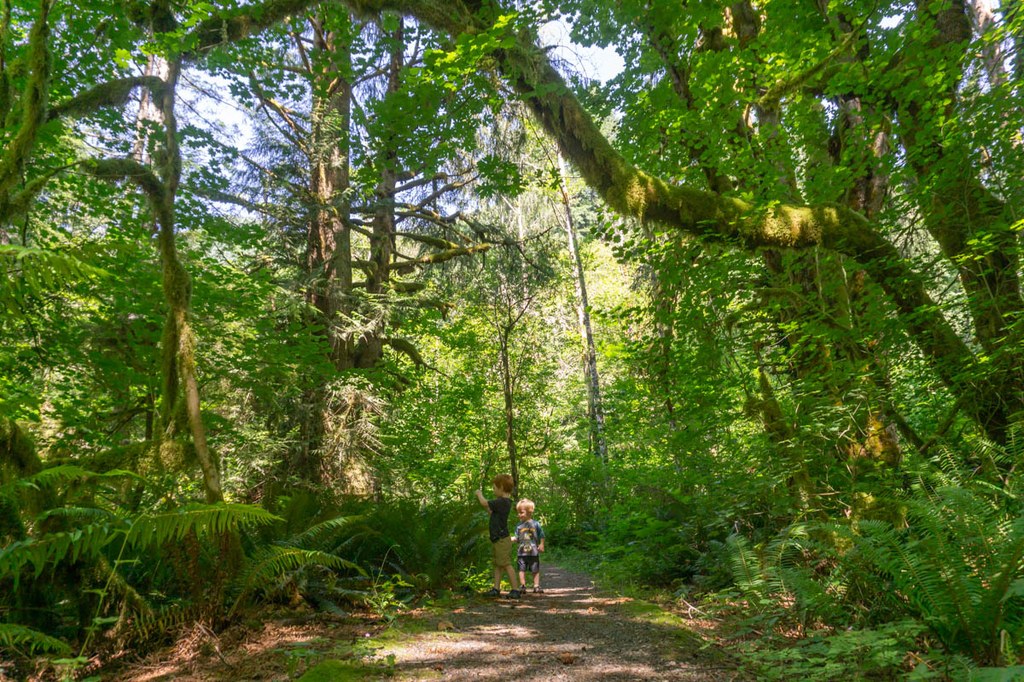
The Creek Side Loop shares a parking lot with the Mount Si Trail, which can be very busy on the weekends. Head towards the picnic area with an area map displaying the Mount Si Natural Resource area map and history. Continue past a water spigot and spot the Creek Side Loop dedication placard on the left. Turn left here, following a graveled trail lined with large ferns. Huge branches reach over the trail, wearing thick blankets of moss.

You’re about halfway when you cross the bridge over a creek. The trail soon meets the Mount Si trail. Turn right to return to the trailhead, going left will lead you up the difficult trail to the Mount Si summit. Another bridge crossing offers stairs down to the creek, an optional respite from the busy trail. Cross the bridge to return to the parking lot.

History

The Creek Side Loop is dedicated to Frances North, a long-time North Bend resident and Washington State Representative who sponsored the bill which saved Mount Si from clear cutting by establishing the Mount Si Natural Resources Conservation Area in the 1980’s.

Hike Description Written by
Jessica Wynne, WTA Correspondent

Creekside Loop

Map & Directions

Trailhead
Co-ordinates: 47.4880, -121.7231 Open in Google Maps

Before You Go

See weather forecast

Parking Pass/Entry Fee

Discover Pass

WTA Pro Tip: Save a copy of our directions before you leave! App-based driving directions aren't always accurate and data connections may be unreliable as you drive to the trailhead.

Getting There

From Seattle, take I-90 E to exit 32. Turn left onto 436th Ave SE, follow for 0.6 miles to its end, then turn left onto SE North Bend Way. Drive 0.3 miles, then turn right onto SE Mt Si Road. Follow SE Mt Si Road (later becomes 452nd Ave) for 2.5 miles, then turn left into the Mount Si Trailhead parking lot, signed for Mount Si Trail. Toilets, water, and picnic area available at trailhead. Discover Pass required to park. '

This trailhead is very popular and busy on the weekends, get there early or consider taking the Trailhead Direct bus line.

More Hike Details

Trailhead

Snoqualmie Region > North Bend Area

Creek Side Loop Trail (#), Mount Si Trail (#)

Washington State Department of Natural Resources

Guidebooks & Maps

Mount Si NRCA Trail Map (https://www.dnr.wa.gov/MountSi)

You can improve or add to this guidebook entry!

Creekside Loop

7 Trip Reports

Hiked here recently?

Submit a trip report!
 
Trip Reports