Trails for everyone, forever

Home Go Hiking Hiking Guide Mukilteo Lighthouse Park

Mukilteo Lighthouse Park

Puget Sound and Islands > Seattle-Tacoma Area
47.9477, -122.3057 Map & Directions
Length
0.6 miles, roundtrip
Elevation Gain
0 feet
Highest Point
10 feet
Calculated Difficulty About Calculated Difficulty
Easy
The eponymous lighthouse. Photo by Jennie Flaming. Full-size image
  • Coast
  • Dogs allowed on leash
  • Good for kids

Parking Pass/Entry Fee

None
Saved to My Backpack

A beautiful city beach park at an important historic location that is wheelchair-accessible (except the beach). Great place for a picnic, sunset or exploring the beach. Continue reading

Rating
2.00 out of 5

Hiking Mukilteo Lighthouse Park

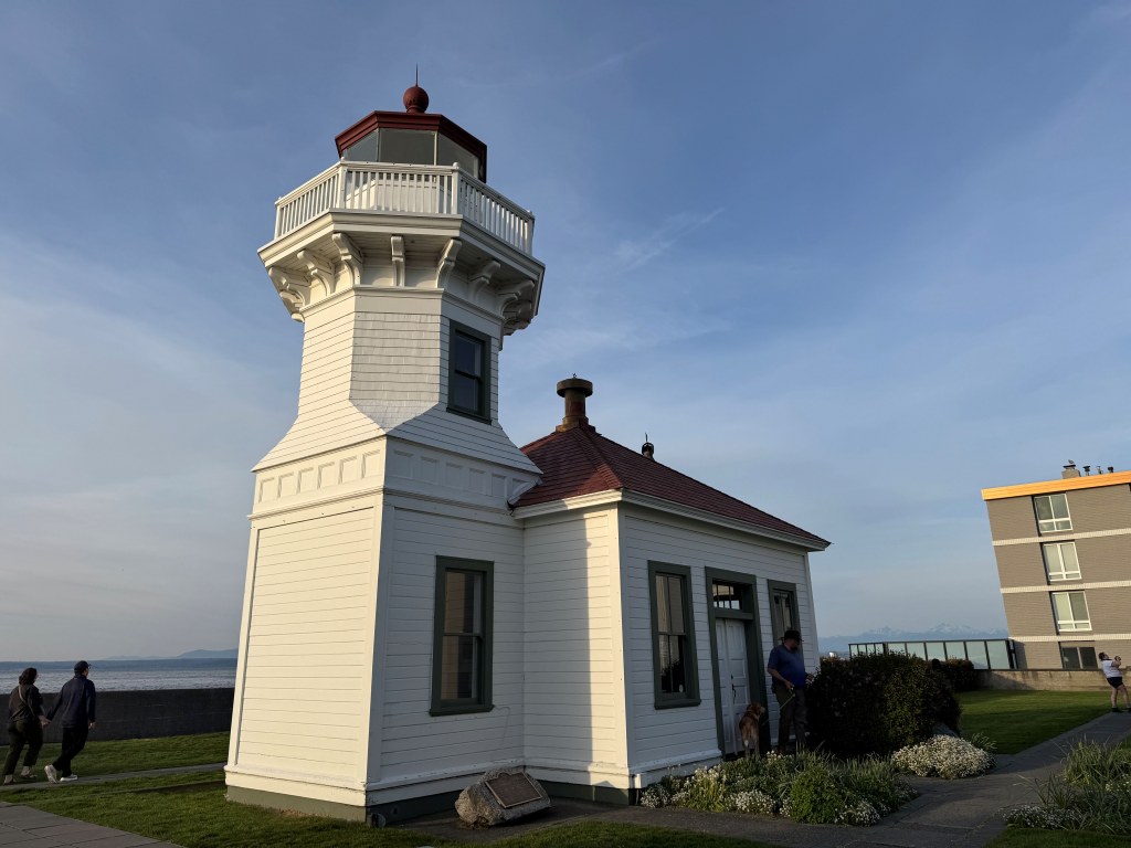
Located at Point Elliott, Mukilteo Lighthouse Park has 0.6 mile of flat, paved, wheelchair-accessible trails, including along the water and around the grounds of the historic lighthouse. 

If you do a complete loop around the park and around the historic lighthouse, it's 0.6 mile on flat, paved trails in a loop around the park. You can go down to the beach; however, that mostly involves walking over driftwood. There are a couple of narrow trails, but they are not accessible.

Before you walk the trails, grab a copy of the Mukilteo walking tour brochure outside the gate to the lighthouse area. It includes a lot more detail about the important settler and indigenous history of this location, which is significant.

The art throughout the park by James Madison (Tulalip) and Joe Gobin (Tulalip) are an important reminder of Mukilteo's 10,000-year human history.

The park is at the location of the Treaty of Point Elliott in 1855, which shaped Indigenous and Settler lands and relationships until today.

There are several first-come, first-served firepits that close at 10 p.m. Tours of the lighthouse are available. 

Toilet Information

  • Toilet at trailhead

More information about toilets

Wheelchair Accessibility

The trails around the lighthouse and along the water on the grounds are flat, paved and wheelchair-accessible. The beach is not wheelchair-accessible.

There are several ADA parking spots. There are two buildings of public restrooms (may be locked in winter) with ADA stalls; however, they do not have push-button doors.

Hike Description Written by
Jennie Flaming, WTA Correspondent

Mukilteo Lighthouse Park

Map & Directions

Trailhead
Co-ordinates: 47.9477, -122.3057 Open in Google Maps

Before You Go

See weather forecast

Parking Pass/Entry Fee

None

WTA Pro Tip: Save a copy of our directions before you leave! App-based driving directions aren't always accurate and data connections may be unreliable as you drive to the trailhead.

Getting There

From I-5 north, take WA-525 (Mukilteo Speedway) towards Mukilteo in Lynnwood. WA-525 dead ends on Front Street; the park is to your left (go past the ferry terminal where ferry traffic turns right).

From I-5 south, take WA-526 towards Paine Field until it dead ends at WA-525 (Mukilteo Speedway), turn right and follow WA-525 to the park.

The large parking area and surrounding streets in downtown Mukilteo are paid parking through a parking app.

Take Transit

Community Transit Route 117 stops at Highway 525 and 5th, about a 0.3-mile walk from the park along WA-525, which has a paved sidewalk. 

More Hike Details

Trailhead

Puget Sound and Islands > Seattle-Tacoma Area

City of Mukilteo

You can improve or add to this guidebook entry!

Mukilteo Lighthouse Park

3 Trip Reports

Hiked here recently?

Submit a trip report!
 
Trip Reports