Trails for everyone, forever

Home Go Hiking Hiking Guide Sun Lakes-Dry Falls State Park - Park Lake Side Canyon
link

Sun Lakes-Dry Falls State Park - Park Lake Side Canyon

Central Washington > Grand Coulee
47.5855, -119.3557 Map & Directions
Length
6.0 miles, roundtrip
Elevation Gain
350 feet
Highest Point
1500 feet
Calculated Difficulty About Calculated Difficulty
Moderate
  • Wildflowers/Meadows
  • Wildlife
  • Lakes

Parking Pass/Entry Fee

Discover Pass

Hike through a stunning canyon in a state park rich in history from the Ice Age Floods. Continue reading

Rating
3.50 out of 5

(4 votes) Log in to rate

Hiking Sun Lakes-Dry Falls State Park - Park Lake Side Canyon

Hike through a stunning canyon in a state park rich in history from the Ice Age Floods. 

From the parking lot at the day use area, look for a paved road that has been blocked to allow for foot or bike traffic. Walk this for one mile, then arrive at a sign that states, 'No Vehicles After This Point'. There may also be an orange sign proclaiming the Park Boundary.

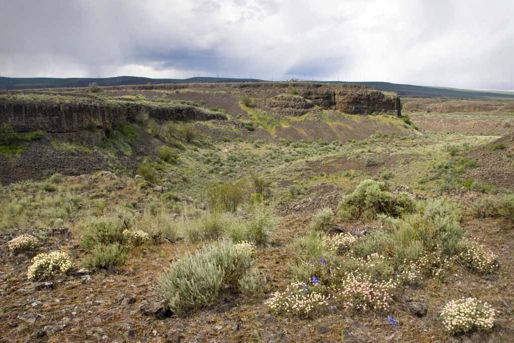
The trail is an old 2-track and is flat for the first mile past the park boundary. Past this, there's a bit of a climb -- keep your eye out and you may spot an old metal raft. Past the climb, the trail continues through a valley with high basalt cliffs on either side. The crumbly basalt and sage brush here call for gaiters at least, long pants are better. It's exposed, too -- wear sunscreen and bring lots of water. 

Meandering along the trail, you'll see a good lunch spot just past the raft, which affords visitors a view back down the canyon. Beyond this, you'll have good wildflower spotting at the head of the canyon, look for bitterroot in particular!
Wildlife in the canyon is primarily birds: you'll likely see lots of crows, robins and magpies, and maybe even an eagle. On the ground you might be lucky enough to spot a hare. 

Three miles in, the jeep track fades away. Turn around here and return the way you came.

WTA Pro Tip: Good side trips can be made to the Dry Falls Information Center, with fabulous views down into the valley, as well as stops at Banks Lake, Northrup Point, Lenore Lake Caves, and the Grand Coulee Dam.

Hike Description Written by
Multiple authors contributed to this report, WTA Community

Sun Lakes-Dry Falls State Park - Park Lake Side Canyon

Map & Directions

Trailhead
Co-ordinates: 47.5855, -119.3557 Open in Google Maps

Before You Go

See weather forecast

Parking Pass/Entry Fee

Discover Pass

WTA Pro Tip: Save a copy of our directions before you leave! App-based driving directions aren't always accurate and data connections may be unreliable as you drive to the trailhead.

Getting There

Just south of the Dry Falls Visitors Center along State Route 17 turn east at MP 92.5 into Sun Lakes State Park. Continue 1.2 miles before turning left onto the state park road toward Deep Lake. In another 0.9 miles take another left onto an unpaved road toward Perch and Dry Falls Lakes. Continue 0.4 miles before parking at the kiosk for the Umatilla Rock Trail.

More Hike Details

Trailhead

Central Washington > Grand Coulee

Washington State Parks

Guidebooks & Maps

Best Desert Hikes: Washington (Bauer & Nelson - Mountaineers Books)

Washington State Department of Natural Resources (DNR) Banks Lake

You can improve or add to this guidebook entry

Sun Lakes-Dry Falls State Park - Park Lake Side Canyon

6 Trip Reports

Hiked here recently?

Submit a trip report!
 
Trip Reports