

Hike all the way around the Phantom Lake area, nestled in between Bellevue's Weowna Park and the main section of Lake Hills Greenbelt Park. Much of the shore is taken up by homes, but you can enjoy expansive views across the lake from both the western end and eastern end. And much of the hiking path is bordered by trees that give the illusion of a more rural setting.
Our hike description begins at the small parking lot near the western end of the lake, just off 156th Ave SE. But this is a loop hike, so you could choose other starting options and adjust accordingly.
It may be helpful to download a trails map from the site parkstrails.myparksandrecreation.com/Details.aspx?pid=100
(Click on "Detailed map of the Phantom Lake Walkway," not on "Map/Directions.")
From the parking area, a path leads past the toilet and crosses a wide grassy area, heading toward the lake. A signboard proclaims "Water Flows Downhill." This may seem obvious, but the details are much more interesting. They tell how excavations by late 19th-century settlers such as Henry Thode had a major impact on lake levels and stream flows in this area.
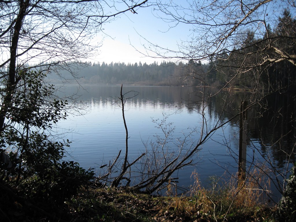
Continue on toward the lake, where the path forks. The right fork leads to a picnic table that offers a marginal view of the lake, partly obscured by cattails. The left fork leads to a pier and viewing platform that offers a great view across Phantom Lake. Pause a while and take it all in. It's a great photo-op, and you may see ducks and other waterfowl while you are here.
When you are ready, head back to the parking area and take the gravel path that leads up to the wide concrete sidewalk that borders 156th Ave SE. Ignore the traffic noise - you soon will be following less traveled streets - and continue south until you cross SE 24th St. Then turn left on the sidewalk that follows along the southern edge of that street.
If you are alert, you may catch glimpses of Cascade peaks off to the northeast beyond the treetops. Soon, the path changes from concrete to blacktop, and it weaves in and out of the trees. Remnants of a much older dirt path are visible nearby, still maintained and still in use. You may prefer the rustic feel of the dirt path, and clearly others do too.
East of 166th Ave SE the street begins to arc around to the left and it becomes 168th Ave SE. For the next half mile or so it follows the western boundary of Weowna Park. Your hiking path sometimes passes into the trees at the edge of the park and offers views down into the dark forest. (Check our Hiking Guide for information on hiking the Weowna Park trails.)
Keep an eye on the street signs at intersections where side streets come in from the west. At SE 16th St turn left and head west along that side street. There is no sign at the intersection to indicate that SE16th St offers anything more than suburban homes. But press on, and in about 0.15 miles come to its western dead end. There, tiny Robinsglen Nature Park, a green area with no facilities, provides access to the eastern shore of Phantom Lake, with fine views across the lake that are perhaps best in morning light.
When you have had your fill of this eastern shore viewpoint, return to 168th Ave SE. (Alternatively, you could turn left on 166th Ave SE and take it through to SE 14th St for a slightly shorter, but less picturesque route.) At 168th Ave SE, resume your northbound route and follow the path as it bends around to the west, becoming SE 14th St. (You soon will pass the intersection with 166th Ave SE.)
Continue west on the path along SE 14th St and, in a few blocks, pass through the rustic boundary of Lake Hills Park. You can explore the park if you like. It offers the usual picnic tables and rest rooms, and it has a large parking area that could serve as an alternative starting point for your hike.
Your route continues on through the trees as SE 14th St bends southwest and becomes SE Phantom Way. Soon, the street bends back west and becomes SE 16th St. At the intersection with 156th Ave SE, turn left and follow the path back to your trailhead at the small parking area where you began.
 Trailhead


