
The Beaver Pond trail loop offers a year-round easy hike through forests and vistas of beaver ponds. If you are lucky you may see one of the busy creatures at work. Also keep an eye out for blue heron, osprey, or eagles surveying the ponds. Active logging may affect trail access.
The trail begins as logging road 1000. Take the first right onto logging road 1100. In approximately 300 feet look for trail on right. This is the Beaver Pond trail. Follow the winding path through a dark forest with an enchanting assortment of mushrooms.
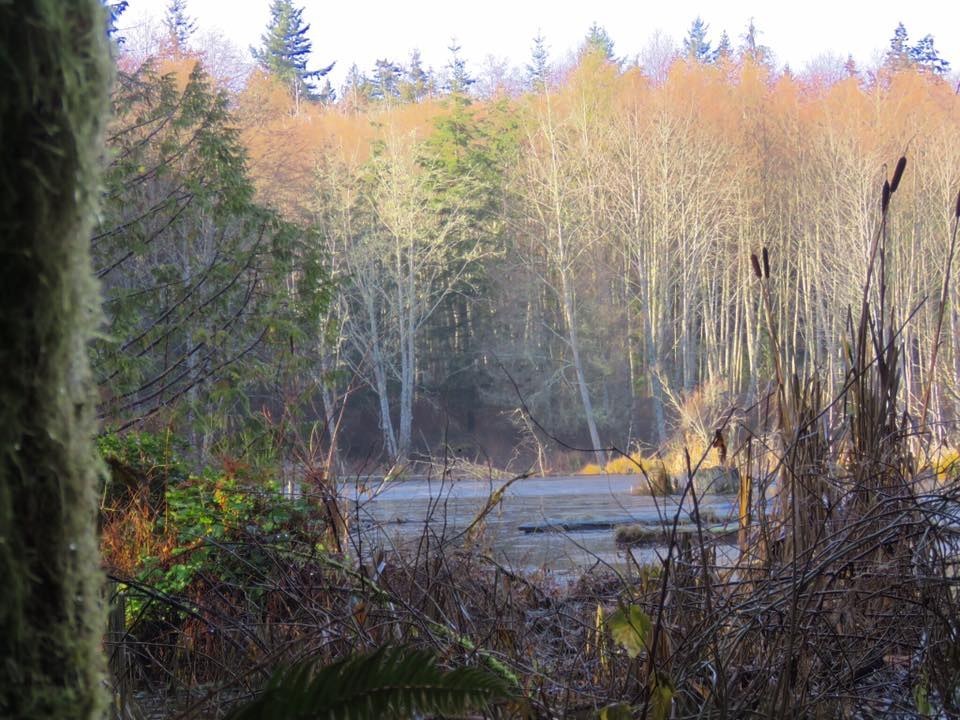
You will reach a bridge crossing the outflow of the Beaver Pond. Look upstream and you get a glimpse of one of the beaver dams. Just after the bridge a nature trail on the left offers glimpses of the ponds. This trail terminates back onto the Beaver Pond trail. You can take a right which leads you back to the bridge where you can return to trailhead along same path.
Extending Your Hike: For a longer hike you can take a left at Beaver Pond the after the nature trail and walk through an open area to the north end where you will see a barrier. Following this old road, drop down to get a beautiful view of two ponds.
Heading left at a junction will bring you through magnificent old cedars, maples and remnants of old growth with springboard notches. Continuing along trail you will see the old water supply to the timber town of Port Gamble. Continue on this old logging road (1100) back to Road 1000 and a left turn takes you back to the parking lot.
Port Gamble Forest - Beaver Pond Trail

-
 Length
- 2.0 miles, roundtrip
-
 Elevation Gain
- 207 feet
-
 Highest Point
- 151 feet
Parking Pass/Entry Fee
None
An easy, year-round hike winds through forests and offers views of beaver ponds.
Continue reading
Hiking Port Gamble Forest - Beaver Pond Trail

WTA worked here in 2020!

Port Gamble Forest - Beaver Pond Trail
Map & Directions
 Trailhead
Before You Go
Parking Pass/Entry Fee
NoneWTA Pro Tip: Save a copy of our directions before you leave! App-based driving directions aren't always accurate and data connections may be unreliable as you drive to the trailhead.


