

The Railroad Trail is the track of the Burlington Northern and Milwaukee Railroad, which ran lumber from the Bloedel Donovan Mill — which, you may have guessed, turned into today's Bloedel Donovan Park — to the shores of Bellingham Bay. The train carried lumber to and from the bay from the 1800s through 1965, and is now used by Bellinghamsters and other locals as a long trail to wander through the city.
The trail itself is wide, graveled and pretty flat throughout, save for a moderate incline as the trail crosses Alabama Street, making it a great option for wheelchairs and strollers. It starts at Bloedel-Donovan Park, heading across the field on the south side of the building along a paved path.
Soon after, come to Electric Avenue, which you took to drive into the park. Cross the road — be careful, as it can be busy! The trail on the other side of the road continues, heading into the forest. In just a few hundred feet, you'll hit a junction. Take the right to stay on the Railroad Trail — you'll know you're going in the right direction because you'll see a trail bridge.
In another few hundred feet, you can check out the trail map here, although it's not very helpful for your hike, as only a short segment of the Railroad Trail is shown and most of it goes off the map. For the next quarter-mile or so, enjoy the thick tree canopy, providing nice shade on a sunny day, because once you cross the road here, you'll be entering a residential area with significantly fewer trees. From here on out, you won't find much shade.
Walk through the residential area for about half a mile, hearing bird sounds as you weave through the neighborhood. Here, you'll cross Alabama Street on a wide bridge, where you'll get views all the way down the street to Bellingham Bay. A small lookout notch in the bridge allows you to take in the views without blocking any bikers or hikers.
The trail becomes very straight, and you'll be able to see the entire trail ahead of you for just over half a mile. As the trail begins to curve again, you can take a break on a bench next to an informational sign about the trail and this specific area: the St. Clair Detention Basin, which was built by the City of Bellingham in the 1980s to handle flooding in the area. Additionally, this area houses the Fever Creek Wildlife Pond, where many different forms of wildlife have made their home — keep an eye out and you might see some interesting creatures around here.
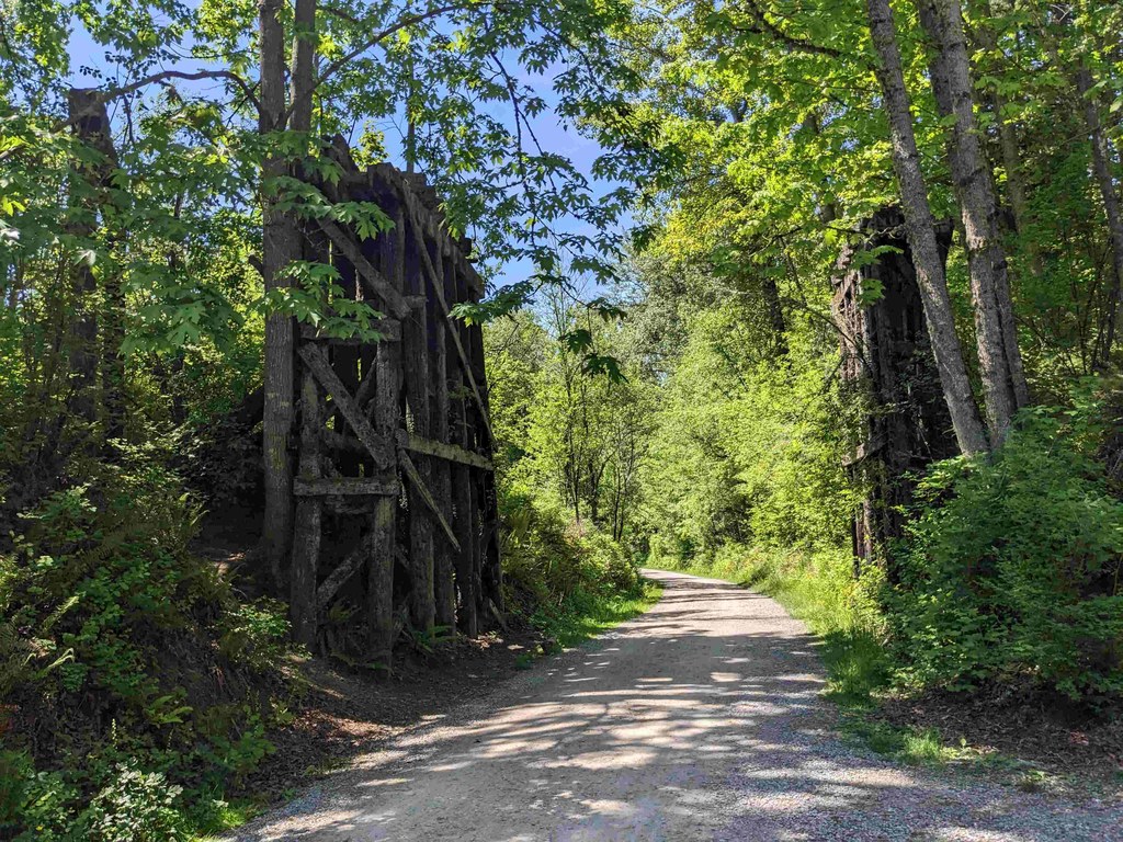
After you've taken a look at the sign, continue on and you'll see the concrete structure on the right side of the trail the sign talks about, which allowed for the dam at the basin to be controlled. In a quarter-mile, you'll walk between pieces of an old railroad trestle, an artifact from that all that old logging activity around here.
In half a mile, cross a busy street, and in another half-mile, get ready to cross several streets. The busy streets have lighted signals you can use to tell cars you're crossing, but you'll also cross a few residential streets that have far less traffic. Be sure to look to your left whenever the trail opens up to roads in that direction to see the mountains in the distance.
In just over half a mile, you'll cross I-5 on an overpass. If you want to head to Memorial Park, you can take a right on the gravel path to head straight there. If you're a completionist, head in the center-right direction at the junction instead, which ends the trail at King Street. From here, you can still go to Memorial Park — just turn right and walk halfway up the block.
Memorial Park is a small park next to Sunnyland Elementary School, with plenty of grass to sunbathe in, play lawn games or have a picnic. The park is aptly named, as it features structures that memorialize local soldiers.
 Trailhead


