

The BLM map available online shows a lollipop loop to Turtle Lake and back, and “Best Desert Hikes” shows trails making a figure 8. Unfortunately for hikers, some of the old roads and jeep tracks have been reclaimed by native grasses and are no longer visible. This description includes an out-and-back hike on a well-defined trail from Escure Ranch to Turtle Lake.
From the parking area, pass through the gate (close it behind you) and cross the bridge over Rock Creek, taking a few moments to admire the vistas. Follow the road between the ranch buildings, bearing right. Once you pass the buildings, you’ll see two gates. Pass through the one on the right. The trail is a two-track dirt road that is marked here and there with BLM trail signs. You’ll walk between basalt mesas, then through thick meadows of native rye grass as high as your shoulders.
The road heads west-northwest for about 3 miles and then turns north. About a quarter mile after the turn, look for a grass track making a sharp turn to the right. Turtle Lake is about a quarter mile along the grass track, on the left side. (If you stay on the main trail, you’ll get to Wall Lake and the Breeden Road trail… but that leads to a trailhead far from the ranch.)
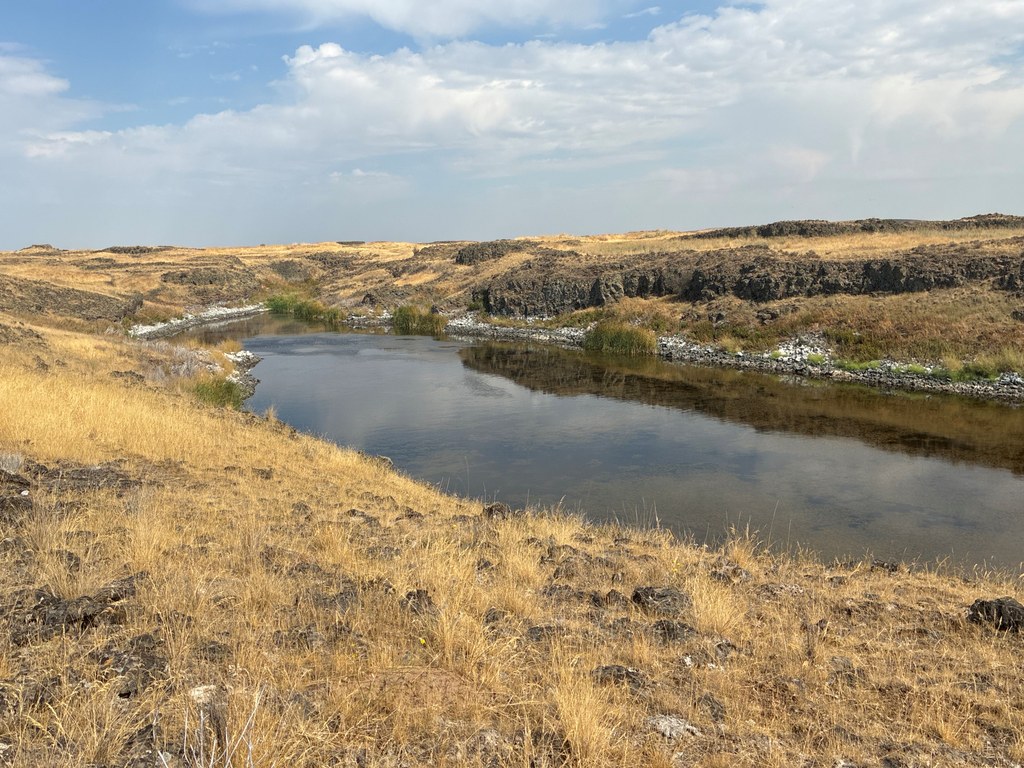
Turtle Lake, like the other lakes on Escure Ranch, is an expression of the water table in a low spot in the topography. As the water table fluctuates, so does the water level in Turtle Lake. Notice the high water mark on the basalt shoreline. Local wildlife make their home around this lake – the eponymous turtles, as well as deer, coyotes, birds and badgers.
There is supposedly a trail that continues east past Turtle Lake, and there’s at least one BLM trail sign to mark it, but it’s difficult to see. If you’re good with a map and compass and don’t mind wading through tall grass, go for it! Otherwise, turn around and return the way you came.
The arid land of Escure Ranch was formerly a sheep ranch run by Basque sheepherders and is popular today with hunters and fishermen. Other hikes in the Rock Creek Recreation Area include Escure Ranch - Towell Falls and Breeden Road - Wall Lake. There are several primitive camping sites next to the parking area, each with a picnic table. Facilities for people camping with horses are also provided. There is a spring-fed stock trough for animals, but no human-potable water.
WTA Pro Tip: There is absolutely no shade along this route, and it is best hiked in cool weather. Bring plenty of sun protection and water.
 Trailhead


