
Easy access and a gentle grade make this a great wildlife-viewing hike for all ability levels.
The Sherman Creek Wildlife Area consists of more than 9,000 acres co-managed by the Washington Department of Fish and Wildlife and the U.S. Forest Service for whitetail deer winter range. Begin the hike by crossing the old Mellenberger Bridge (misspelled Malenberger on the trail sign) in front of the parking area, with Sherman Creek cascading over the rocks far below. Once across, the hike begins on an abandoned roadbed. Trail signs, installed as part of an Eagle Scout project, lead the way to the Sherman Point Trail.
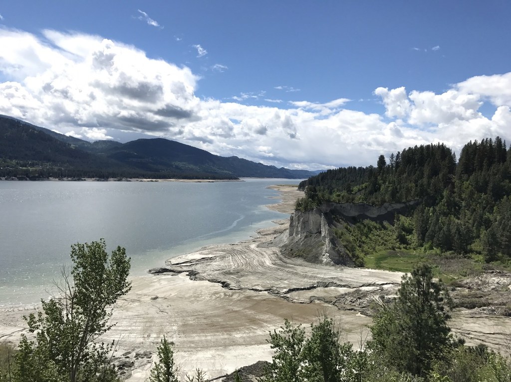
Turn left at the sign and follow the trail to several overlooks along Lake Roosevelt. Watch for weathered National Park Service markers on the trees and the sign pointing out an old ferry landing across from the mouth of the Colville River, a nice spot to pause for a picnic or try your fishing luck. Farther along the trail, a sign points out the striking Reed Slide Overlook with its sand cliffs gradually giving way to the forces of water and gravity. Whitetail deer abound, and near the water, one can sometimes glimpse bald eagles roosting in the trees or gliding over the lake. As the trail returns inland, watch for the sign pointing out the return route on the right just before reaching the irrigated fields (managed as part of the winter forage for the resident wildlife).
WTA Pro Tip: Look for whitetail deer, mule deer, bald eagles, turkeys, waterfowl and songbirds as you hike here.
Sherman Point Loop

-
 Length
- 3.0 miles, roundtrip
-
 Elevation Gain
- 200 feet
-
 Highest Point
- 1,475 feet
Easy access and a gentle grade make this a great wildlife-viewing hike for all ability levels.
Continue reading
Hiking Sherman Point Loop
Sherman Point Loop
Map & Directions
 Trailhead
Before You Go
Parking Pass/Entry Fee
Discover PassWTA Pro Tip: Save a copy of our directions before you leave! App-based driving directions aren't always accurate and data connections may be unreliable as you drive to the trailhead.


