Trails for everyone, forever

Home Go Hiking Hiking Guide South Fork Boulder Creek

Alert: On Oct. 1 the federal government began a partial shutdown that will impact National Parks, National Wildlife Refuges and U.S. Forest Service lands in Washington. Here's the latest information we have for hikers and campers


South Fork Boulder Creek

Snoqualmie Region > Salmon La Sac/Teanaway
47.4277, -121.0153 Map & Directions
Length
0.7 miles, one-way
Elevation Gain
650 feet
Highest Point
5,200 feet
Calculated Difficulty About Calculated Difficulty
Easy
Trail sign on the Paris Creek/south side of the trail. Photo by Tiffany Chou. Full-size image
  • Dogs allowed on leash

Parking Pass/Entry Fee

Northwest Forest Pass
Saved to My Backpack

This short trail connects the Boulder De Roux and Paris Creek trails, and provides hikers a method to link together a much longer hike. Continue reading

Rating
0.00 out of 5

(0 votes) Log in to rate

Hiking South Fork Boulder Creek

The above stats reflect the hike as done from the Boulder De Roux trail to the Paris Creek trail, the uphill direction. There is very little climbing in the opposite direction — it is all downhill.

You won't get much in the way of views on this trail, but it does allow you to connect the two aforementioned trails, offering hikers the opportunity to create longer hiking routes. 

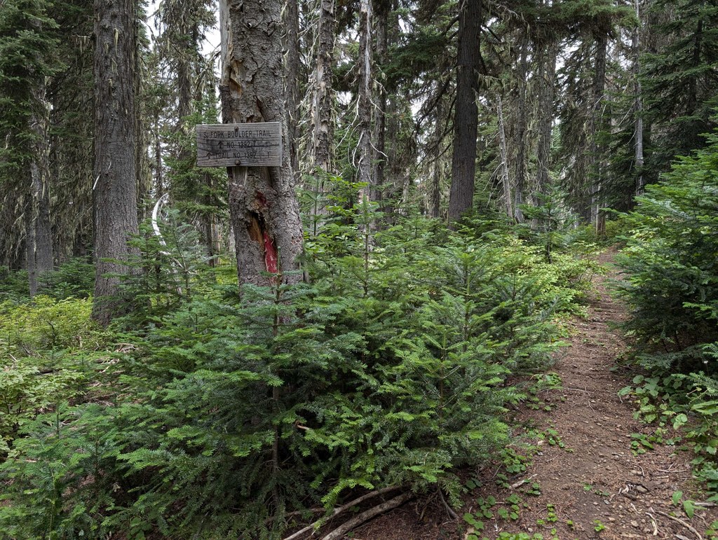
Starting on the rocky Boulder De Roux trail, head south on the South Fork Boulder Creek trail, the junction marked with a sign. To reach the junction, hike about 2.3 miles on the Boulder De Roux trail, gaining around 1,300 feet. 

You'll start making a relatively steady climb up to the Paris Creek trail, wandering through the forest. The trail levels out at the end when you reach the Paris Creek trail, a relatively seamless transition to the Paris Creek trail — you might not even notice you've crossed onto another trail! This junction is also signed. 

At this junction, head straight toward the Paris Creek trailhead, or head left to take the Paris Creek trail toward the Elsnor Mine or Middle Fork Teanaway trails. 

If you wish to start from the Paris Creek trail instead, plan for a longer (and steeper!) hike; hike a little over 4.7 miles, climbing nearly 3,000 feet, to reach the junction with the South Fork Boulder Creek trail. 

Toilet Information

  • No toilet at trailhead

More information about toilets

Hike Description Written by
Tiffany Chou, WTA Staff

South Fork Boulder Creek

Map & Directions

Trailhead
Co-ordinates: 47.4277, -121.0153 Open in Google Maps

Before You Go

See weather forecast

Parking Pass/Entry Fee

Northwest Forest Pass

WTA Pro Tip: Save a copy of our directions before you leave! App-based driving directions aren't always accurate and data connections may be unreliable as you drive to the trailhead.

Getting There

This trail can be reached via the Paris Creek/Davis Peak trailhead or the Boulder De Roux western trailhead. 

Heading east on I-90, take exit 80 to Bullfrog Rd. Follow Bullfrog Rd for 3 miles and continue straight onto WA-903 N at the traffic circle. Follow Highway 903 N (Salmon La Sac Road) for 16.5 miles and veer right onto Cle Elum Valley Rd/NF-4330. Continue on to the trailhead you're heading to:

PARIS CREEK/DAVIS PEAK TRAILHEAD

Drive on FR 4330 for about 1.6 miles to the Paris Creek/Davis Peak trailhead parking lot on the left. This established trailhead has about a dozen spaces in the parking area.

BOULDER DE ROUX TRAILHEAD

Drive on FR 4330 for about 5.5 miles, then turn right. At the fork ahead, turn right again. You will reach the Boulder De Roux trailhead in about 0.5 mile.

More Hike Details

Trailhead

Snoqualmie Region > Salmon La Sac/Teanaway

South Fork Boulder Creek (#1392.7)

Okanogan-Wenatchee National Forest, Cle Elum Ranger District

You can improve or add to this guidebook entry!

South Fork Boulder Creek

1 Trip Report

Hiked here recently?

Submit a trip report!
 
Trip Reports