Trails for everyone, forever

Home Go Hiking Hiking Guide South Fork County Park
WTA is a nonprofit that needs you

We're just as excited as you to get the summer hiking season started. We're psyched our website, app and work for trails help you get outside.

But we're a nonprofit that runs on donations from regular people. If everyone who visited this site this holiday weekend donated $9/month, it would fully fund our work for the next 2 years. Time spent outdoors is priceless, but every donation large or small helps us support those experiences for everyone. Thank you and happy hiking!


Please take 2 minS to chip in $9

link

South Fork County Park

Puget Sound and Islands > Bellingham Area
48.7181, -122.1857 Map & Directions
Length
1.5 miles, roundtrip
Elevation Gain
22 feet
Highest Point
317 feet
Calculated Difficulty About Calculated Difficulty
Easy
  • Wildflowers/Meadows
  • Mountain views
  • Wildlife
  • Good for kids
  • Dogs allowed on leash

Parking Pass/Entry Fee

Discover Pass
Saved to My Backpack

Walk along a quiet flat grassy trail with plenty of space to take picnic breaks in some quiet, not far from the city. Continue reading

Rating
0.00 out of 5

(0 votes) Log in to rate

Hiking South Fork County Park

Walk along a quiet flat grassy trail with plenty of space to take picnic breaks, not far from the city.

The trail starts on the eastern side of the parking lot, next to an information board. The board contains a map of the trail and park rules. It also has information about the wildlife of the South Fork area (salmon, trout, elk, cougar, black bears, eagles, and more) and some history of the area as well. 

The first part of the trail is exclusively for hikers and bikers, and is a dirt trail surrounded by ferns and mossy trees. Enjoy this short nature walk in the forest, as the view will soon change.

In 0.2 miles, the hiker/biker trail ends and merges with the equestrian trail and becomes a wide grassy trail that hugs the edge of a large field. The trail also opens up completely, with expansive views of the nearby peaks on a clear day. 

Continue forward toward the opening in the fence ahead where there’s a “0.25 mile” trail marker; taking the right brings you to the equestrian trailhead parking lot, visible from the trail. Trail markers show up every 0.25 miles along the trail. 

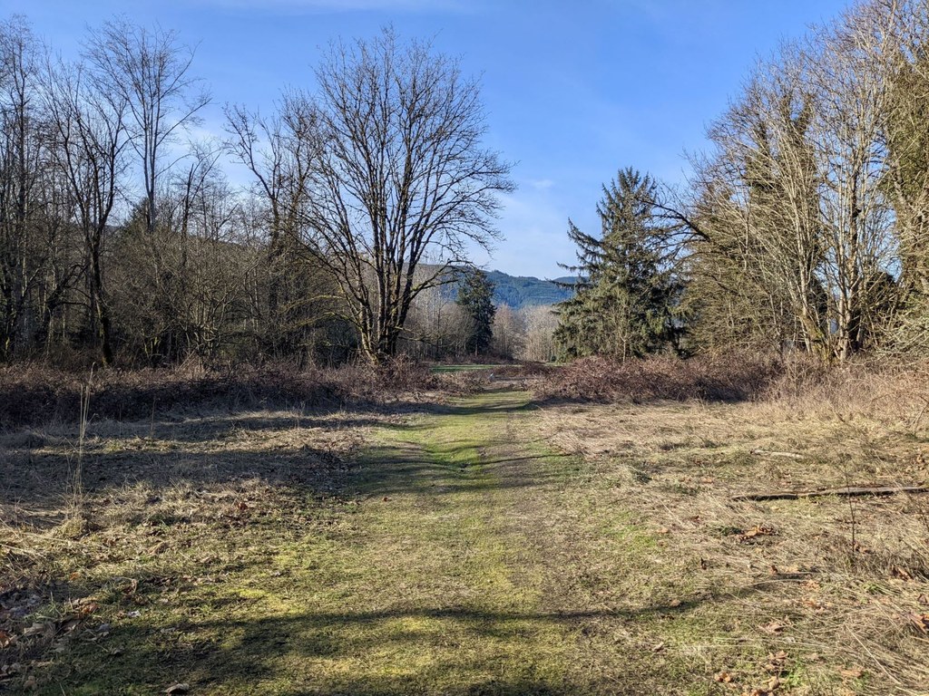
At the “0.5 mile” trail marker, the trail becomes flanked by bushes and vegetation for a while, leaving behind the large field and feeling more remote. 

In about 0.15 miles, follow the sign to stay on the trail by turning right at the junction. In another few hundred feet, follow the sign to turn left at the next junction. Very shortly after, follow the sign to turn right at the final junction, next to the “0.75 mile” trail marker. 

A plaque details some history of the Galbraith Homestead in another few hundred feet off the right side of the trail. The trail opens up again as well, returning to the edge of the field. Soon, the trailhead parking lot will come back into view, and in about 0.35 miles, the trail goes past the parking lot. Continue on the trail to complete the loop.

You’ll soon come to the “1.25 mile” trail marker and the trail will start bending back toward the parking lot. When the trail hits the wooden fence next to the parking lot, follow the trail sign and turn right to walk along the fence toward the “Trail Crossing” sign. There is an opening here back into the parking lot. 

History Note

The entry into South Fork County Park is on Galbraith Farm, one of the first pieces of land purchased in the area. The farm was established in 1886, and its original purchase is commemorated by the Galbraith Homestead plaque seen on the trail. Only some remnants of the buildings still exist on the farmland. 

Hike Description Written by
Tiffany Chou, WTA Correspondent

South Fork County Park

Map & Directions

Trailhead
Co-ordinates: 48.7181, -122.1857 Open in Google Maps

Before You Go

See weather forecast

Parking Pass/Entry Fee

Discover Pass

WTA Pro Tip: Save a copy of our directions before you leave! App-based driving directions aren't always accurate and data connections may be unreliable as you drive to the trailhead.

Getting There

From Bellingham, take Highway 542 east. Continue until the Highway 9 south roundabout and take the first exit onto Highway 9 south. In 7 miles, turn left onto Mosquito Lake Road. Continue for 0.1 miles until you see a South Fork Park sign on the right marking the paved parking lot. 

There are 20 total parking spaces, including one accessible space. There are also 2 vault toilets, a bike rack, and an information board that includes a map of the park and some history of the area. The park is open from sunrise to sunset. 

More Hike Details

Trailhead

Puget Sound and Islands > Bellingham Area

Whatcom County Parks and Recreation

Guidebooks & Maps

https://www.whatcomcounty.us/DocumentCenter/View/6973/South-Fork-Park-Map

You can improve or add to this guidebook entry!

South Fork County Park

1 Trip Report

Hiked here recently?

Submit a trip report!
 
Trip Reports