

Beginning on an old logging road, the trail winds through forest so old that you're under a dense canopy and the forest floor is littered with downed trees, branches and understory. Flora abounds here, including avalanche lilies.
The tread is passable, though this trail hasn't seen maintenance in a while. While some of the drainages have been cleared, as of summer 2016, there were 18 trees down across the trail. A spring awaits hikers at about 4,600 feet of elevation, but it is an unreliable source of water, so be sure to carry all you need.
The logging road turns into a trail after a couple of miles, and enters a meadow. It then enters a forest of moss-draped silver fir, the forest floor is smooth and clean; covered in green leafy understory.
At the spring, look for a 9-foot-wide Douglas fir. It survived a fire that burned through here early in the 20th century. As you take it in, think about how many of the pines below exist thanks to the cones and seeds from this one giant.
Past the spring, arrive at a small rock garden, then a few meadows at 4,800 feet of elevation before going back into high elevation forest. Soon, pop out to a saddle, a good place to rest or stop your hike if you don't wish to huff up the remaining 300 feet to the hot summit. There are nice views here of the surrounding peaks, without having to head to the top. Climb up to the ridge, and then the point, where the lookout once sat.
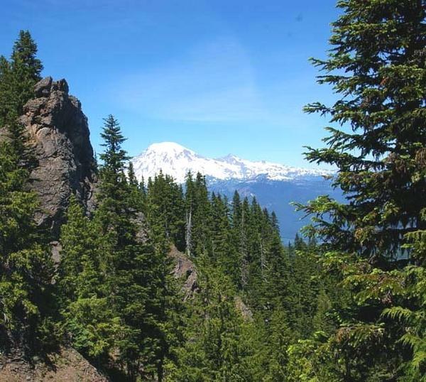
If you do choose to continue to the top, it's possible to see volcanoes galore — Mount Adams, Mount Hood, Mount St. Helens to the south, Mount Rainier close to the north, and to the east, Goat Rocks right in your face. Glacier Lake is seen far, far below your feet. The Tatoosh look small, maybe because Rainier looks so big.
Lower in elevation, but no less stunning, look for Whalehead and Purcell Peaks to the northwest, and take in the pastoral views of the Big Bottom of the Cowlitz. Like most lookouts, the climb is trying, but the views are rewarding. Be sure it's clear the first time you visit South Point Lookout.
Note: Some old hiking guidebooks mention a trail heading south from the lookout point. It intersects where the main trail almost touches the ridge, on your left, several hundred feet below the top. It is recommended only for those with cross-country and navigational experience.
 Trailhead


