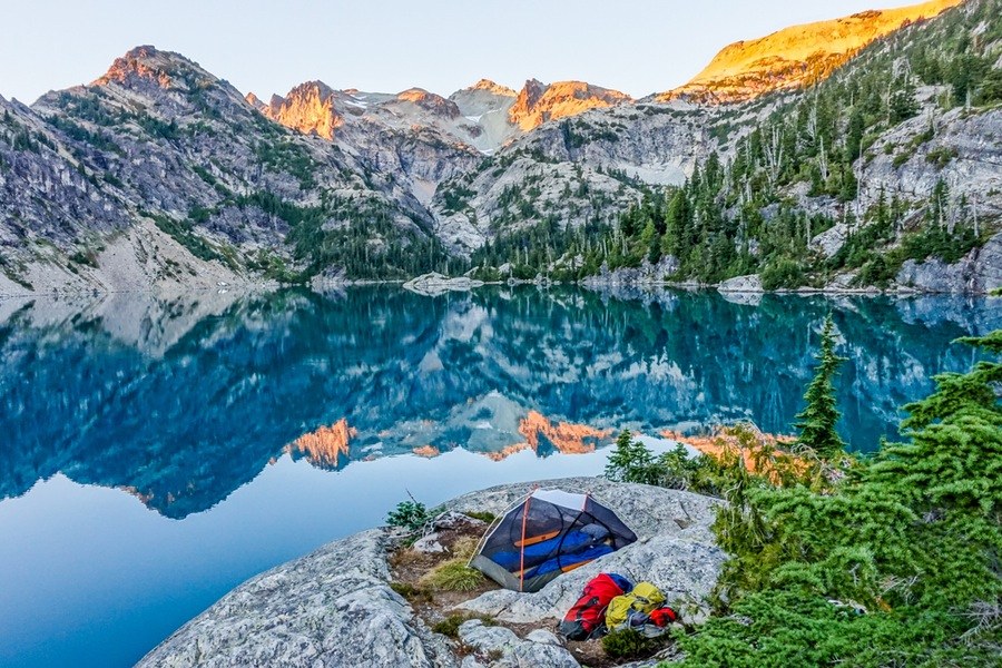

Spade Lake is a lovely, lonesome lake nestled in a rocky cirque high on Mount Daniel. Because it's a hefty hike to access, it is one of the most remote lakes in the Alpine Lakes Wilderness.
From the Waptus River Trail, just above Waptus Lake, the trail to Spade Lake heads straight uphill through old-growth forest. Past its junction with the Pacific Crest Trail, the trail becomes fairly steep.
The grade lessens 1.25 miles from the turnoff from Waptus, as the trail heads northwest along the mountainside and passes through several meadows and belts of smaller trees. It then enters a relatively open area with good views of the surrounding mountains and Spade Creek far below.
As it approaches the lake, the trail crosses some talus slopes and passes over small bluffs before entering scattered trees and meadows. Near the lakeshore, the trail splits, with a user-built section heading off to the left to some scattered campsites on the bluffs.
The main trail heads to the right and goes up and down some steep bluffs as it skirts the east shore of Spade Lake. It soon becomes narrower and fades out into a network of user paths to the shore and various old camping spots.
WTA Pro Tip: Due to the fragility of this high altitude area, remember to camp away from the lake and avoid meadows and other sensitive areas. Water is available at a couple of small streams and at the lake. Campfires are prohibited in this and all areas above 5000 feet elevation in the Alpine Lakes Wilderness.
Spade Lake

-
 Length
- 25.6 miles, roundtrip
-
 Elevation Gain
- 5,200 feet
-
 Highest Point
- 5,400 feet
Spade Lake is a lovely, lonesome lake nestled in a rocky cirque high on Mount Daniel. It is one of the most remote lakes in the Alpine Lakes Wilderness.
Continue reading
Hiking Spade Lake
Map & Directions
 Trailhead
Before You Go
Parking Pass/Entry Fee
Northwest Forest PassWTA Pro Tip: Save a copy of our directions before you leave! App-based driving directions aren't always accurate and data connections may be unreliable as you drive to the trailhead.
Getting There
Spade Lake Trail begins from the northern shore of Waptus Lake. To arrive at the Waptus Lake trailhead, Drive I-90 to Roslyn/Salmon la Sac exit 80. From the exit, drive north 2.8 miles on Bullfrog Road to the State Route 903 junction. Turn left and follow SR 903 past Roslyn, Ronald, and Cle Elum Lake. 16.5 miles to the pavement's end just past the Salmon la Sac guard station. The road forks here; take the left fork and follow across the river, then turn right onto spur road 111 and follow 0.6 mile to the trailhead loop.


