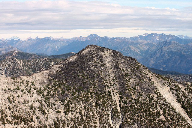

Continuously, steadily steep on all sides, Voodoo Peak requires climbing experience to summit. This mountain is notable for its striking profile, appearing uniformly steep and sharply peaked from all sides.
Class 4 and 5 climbing is required depending on the approach used.
Voodoo Peak

-
 Highest Point
- 5,198 feet
A striking peak off the Mountain Loop Highway that requires climbing experience to summit successfully.
Continue reading
Hiking Voodoo Peak
Voodoo Peak
Map & Directions
 Trailhead
Before You Go
Parking Pass/Entry Fee
NoneWTA Pro Tip: Save a copy of our directions before you leave! App-based driving directions aren't always accurate and data connections may be unreliable as you drive to the trailhead.
Getting There
From Darrington: Follow Highway 20 south for three miles, and make a right hand turn on to FR 2060. Follow this road approximately 5 miles to a fork. Make a left turn to cross the Clear Creek bridge, and continue just under half a mile miles past the bridge.
The side road on which the route begins is very difficult to see from FR2060, as the first few hundred feet is covered in brush, but it is marked with two pieces of pink survey tape.