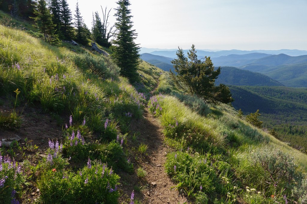

Spectacular rolling hills, far-off views and a flower explosion make this little-known gem a destination to explore and roam. It's one of the few places hikers can see sagebrush growing side-by-side with sub-alpine larch.
Don’t let the lower portion fool you – the monotonous lodgepole pine forest gives way to huge open spaces up above, with a tremendous flower explosion in early summer. Thunderstorms march across the landscape – the dark lodgepole forest growls with the sound of far-off thunder. Up above, thunderstorms in the distance create a spectacular cloudscape – lighting, rainbows, clouds swirling with many colors - white, black, blue and green. Rolling hills as far as the eye can see. The trail connects with the Kettle Crest Trail, so roaming can be done for a dayhike or a backpack. Regarding thunderstorms - know when to turn back. Chances are, in order to get to Wapaloosie from Sherman Pass, you had to drive through 20,000 acres of burned forest from the 1988 White Mountain, fire that was caused by lightning!
Wapaloosie Mountain

-
 Length
- 5.0 miles, roundtrip
-
 Elevation Gain
- 1,850 feet
-
 Highest Point
- 6,850 feet
Spectacular rolling hills, far off views and a flower explosion make this little-known gem a destination to explore and roam through. It's one of the few places hikers can see sagebrush growing side-by-side with sub-alpine larch.
Continue reading
Hiking Wapaloosie Mountain
Wapaloosie Mountain
Map & Directions
 Trailhead
Before You Go
WTA Pro Tip: Save a copy of our directions before you leave! App-based driving directions aren't always accurate and data connections may be unreliable as you drive to the trailhead.


