
This trail offers vistas of the Okanogan River and Pasayten Wilderness as well as wildlife viewing potential for hikers of all experience levels.
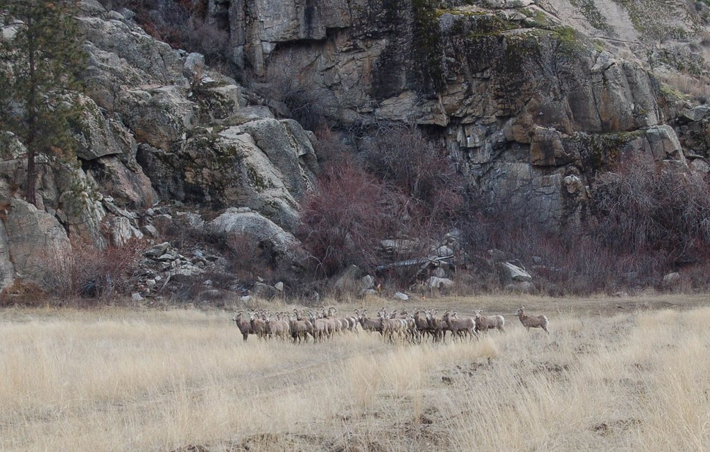
This hike is actually a completed portion of the Pacific Northwest Trail. It climbs quickly at first, and features great views of Okanogan Valley, and if you climb high enough, the North Cascades. It also has terrific wildlife viewing possibilities. Hikers commonly report seeing bighorn sheep on rock faces above the trail. Mule deer, bear, marmot, and wild turkey have often been sighted here as well.
The trail has something to offer everyone: it is excellent for hikers and equestrian riders and even has some challenging areas for rock climbers.
Like the rest of the region, it is often pretty dry, with lots of sun exposure, so come prepared. You can do a day hike out and back (actually up, then back down) from the trailhead on Highway 97, roundtrip up to 24 miles.
Two good side trip options are available from the 97 trailhead. The first is the Frog Pond Trail, which leaves Whistler Canyon Trail at 0.32 miles and is 1.6 miles total out to the pond and back to the trail. All in all, a great little hike if you only have a few hours to spare. The second is a half-day side loop called the Black Diamond Trail. It leaves Whistler Canyon Trail at 2.2 miles, makes a 2.5 mile loop past Black Diamond Lake, and rejoins the Whistler Canyon Trail at 4.1 miles.
Alternatively, you can do a one hour roundtrip car shuttle and hike 12 miles from top to bottom using the Wildhorse Trail cutoff to the Wilcox Mountain Trailhead.
The Wildhorse cutoff is shorter, and has better views, than sticking with Whistler Canyon all the way to Wilcox.
Whistler Canyon Trail

-
 Length
- 24.0 miles, roundtrip
-
 Elevation Gain
- 3,000 feet
-
 Highest Point
- 3,930 feet
This trail offers vistas of the Okanogan River and Pasayten Wilderness as well as wildlife viewing potential for hikers of all experience levels.
Continue reading
Hiking Whistler Canyon Trail
Whistler Canyon Trail
Map & Directions
 Trailhead
Before You Go
Parking Pass/Entry Fee
NoneWTA Pro Tip: Save a copy of our directions before you leave! App-based driving directions aren't always accurate and data connections may be unreliable as you drive to the trailhead.


