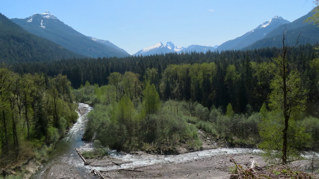

The White Chuck Bench trail is a beautiful, 5.8 mile walk in the woods along the White Chuck River.
The trail originally followed the railroad grade left by the Sauk River Logging Company. The trail has been cleared by hardworking WTA crews after the 2003 floods rendered it nearly inaccessible. Thanks to numerous work parties, the trail now takes hikers on good, winding tread through a pleasant forest of tall trees. Skirt the ledge above the White Chuck River, cross a sturdy wood bridge, and continue upstream, looking for peek-a-boo views of Mount Pugh and the surrounding summits. The trail doesn’t reach the river until near the eastern end, but there are numerous stream crossings and small waterfalls.
Don't miss the trees for the forest -- take time to look at individual Western redcedars, Western hemlock and Douglas fir. There are a few silver firs here, too. The trees in the area are second-growth, sprung up from former logging operations shut down about 80 years ago. It's amazing how large they can get in less than a century. Admire the massive old-growth stumps with their springboard notches; ghosts of the giants that formed the Forest Primeval.
The forest floor offers a wealth of life as well. Blanketed by moss, Oregon grape, false lily of the valley, and innumerable other wildflowers, watch where you step to ensure you don't disturb the life underfoot.
Turn around at any point if you don’t have the time or energy for the full roundtrip hike; any portion of this trail is well worth a visit!

 Trailhead