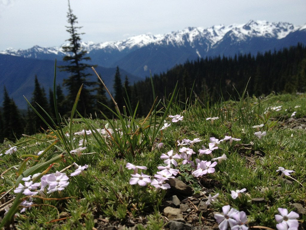

The Wolf Creek trail departs Hurricane Ridge and plunges 8 miles downhill to Whiskey Bend in the Elwha River Valley. It's a lovely route that gets little use along its entire length, though many people wander a couple miles down its length before heading back up.
Access to the Wolf Creek trail is off of the Whiskey Bend Road in the Elwha Valley, or just off the Hurricane Hill Nature Trail, near the Hurricane Ridge Visitors Center.
Coming from the Hurricane Hill junction, the way switchbacks down a gentle grade, allowing hikers plenty of opportunities to take in Alaska cedars which give way to madrones as you descend. There are several wet areas that can be soggy in the shoulder seasons, but for the most trail is a good one.
Salal covers the area near the bottom, which provides a lovely green carpet, but can be a bit wet after a rain. Look out for animal tracks as you hike; this area is a great spot to see wildlife!
When you've had your fill, head back the way you came, or consider making this a thru-hike by parking cars at either end.
WTA Pro Tip: There's more than one way to access Hurricane Hill from the Elwha River Valley. The Elwha to Hurricane Hill trail is at the beginning of the Whiskey Bend Road, but it's a much shorter and steeper trail than Wolf Creek.
Wolf Creek

-
 Length
- 16.2 miles, roundtrip
-
 Elevation Gain
- 3,800 feet
-
 Highest Point
- 5,100 feet
The Wolf Creek trail departs Hurricane Ridge and plunges eight miles downhill to Whiskey Bend in the Elwha River Valley. It's a lovely route that gets little use along its entire length, though many people wander a couple miles down its length before heading back up.
Continue reading
Hiking Wolf Creek
Map & Directions
 Trailhead
Before You Go
Parking Pass/Entry Fee
National Park PassWTA Pro Tip: Save a copy of our directions before you leave! App-based driving directions aren't always accurate and data connections may be unreliable as you drive to the trailhead.
Getting There
To access the Wolf Creek Trail from Hurricane Hill, follow Race Street south in Port Angeles for 1.2 miles to Hurricane Ridge Road, past the Olympic Wilderness Information Center. Continue to the Hurricane Ridge Visitors Center, 17.7 miles in, and continue past the Visitors Center another mile and a half to the Hurricane Hill picnic area. Park here, then walk the road back about a half mile to a trail that heads downhill on the righthand side of the road.


