I decided to go a bit insanity mode (by accident), ignoring my previous plans to go up the winter route (theoretical route referenced), I went up the summer route with some amendments, feeling out snow conditions, avoiding visible hazards (cornices), trying and be efficient with snow travel by using the ridges/forestry roads, and being careful when making the traverse over the ridge line. I tacked on a bit of meandering down the winter route, but also poked around Sasse Ridge a bit (for future potential trips with others).
I got really confused with the directions and set Google Maps to find a route to Wish Poosh Campground (silly midnight decisions). Obviously the campground is closed, but panicking about not being able to park along Salmon la Sac Rd and seeing the Sasse Mountain Trail sign, I decided to park at the Last Resort parking lot along with oodles of other folks (who turns out were snowmobiling), checked in with the folks at the store to make sure it was ok (buying some items both before and after as a token of appreciation for my parking there), then started walking towards NF-4305 on foot along the side of the groomed snowmobile trail (I figured that snowmobiles had the right of way, so I should keep to the side).
I zig zagged up NF-4305 hoping to find helpful signage, but couldn't find any (it's not present/missing, damaged by snowmobilers, or buried under the snow :/..). Thankfully I had a topo map downloaded, so I could feel out a route.
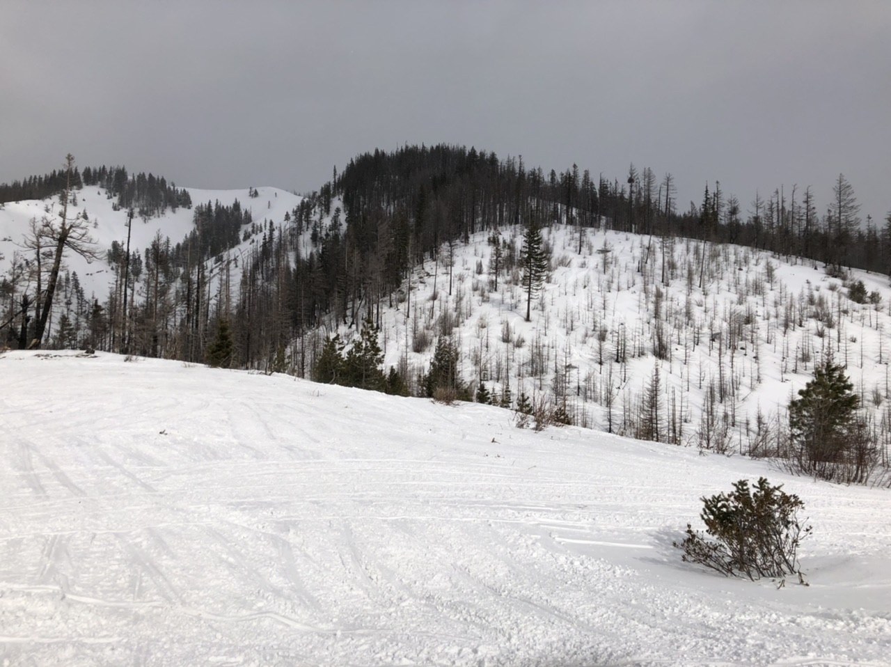
I went up a ridge between the trees, since there wasn't a clear path to the Sasse Mountain (summer route), following what I thought was an old boot path/snowmobile path. Eventually I caught up with a small snowmobile track, pushed up the groomed forestry road some more, then pushed up the ridge for efficiency/what I thought was for safety reasons [1].
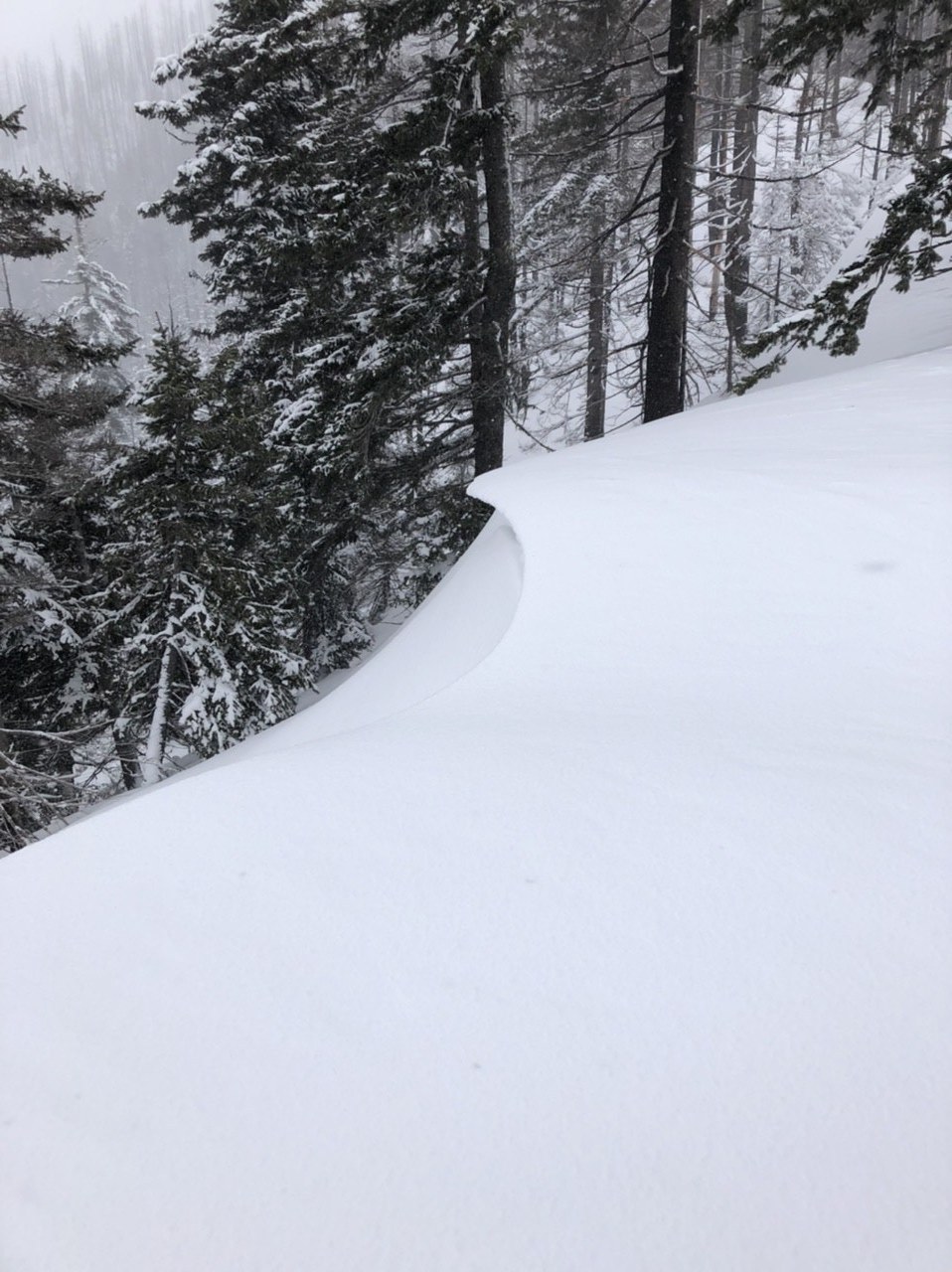
After crossing a creek and pushing up the entire lower ridge, I got to the last 250'~300' and paused to observe the surroundings. I noticed along the way that there had been a some wind loading on the northwest side of the trees, so the southeast side was probably the side to be aware of on the way up. Given that there were small cornices on the lower (south) peak, I approached them a bit cautiously (even though there was a boot path that plowed through the southeastern end of the cornice >.<...).
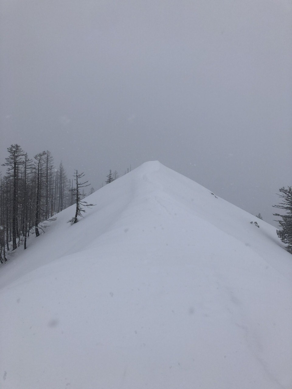
Once up to the ridge, I decided to chance it and push for the real (north) summit. This was probably the riskiest part of the hike, given that there was a fair amount of wind loading on the south side of the ridge and it was a planar drop off of at least 35 degrees on both sides with no clear runout area, so one misstep could have resulted in me getting buried. The part that made the south/west side so risky compared to the north/east side is that it appeared stable, when in reality it wasn't: I tested out the stability with my trekking poles and they sunk in at least 1' deeper than I thought they should have when I planted them (pro-tip: always bring trekking poles in the winter, even if it's not steep for this reason ;)..!). Once I got to a wider more stable section, I walked up the remaining 25' to the real summit with relative ease. There was a small cornice on the east end of the summit, so I stayed away from the edge.
Poking around, I noticed a bootpath down the northwest side of the ridge -- turns out it was the winter route. I went down it because I wanted to check out the traverse over to Howson Peak and Sasse Mountain. I went about a quarter mile and turned around because there was a steep undisturbed section (it was at least 35 degrees), and I didn't want to wander out there by myself. I did also observe an older broken crown on the east side of the ridge, which reinforced the fact that I should be careful and return another day.
I wandered back over the ridge; the gusts had increased and the visibility had decreased greatly. Not wanting to get caught in changing conditions (originally the concern was wind slabs; it felt like it might change to storm slab concerns), I moved briskly back to the trail I took before. One thing that I did a bit different on the way down is that I tried to take the summer trail and it was surprisingly different from what I expected; it's basically following a small (stream) drainage back to the marsh where the trailhead started.
Walking down I ran into less snowmobilers than I did going up. I did however run into the cat involved with grooming the roads (kinda caught me by surprise).
The way down wasn't bad, but it was a bit tricky since I had transitioned out of my snowshoes to boots and the snow consistency after a point was like corn snow (it was easy getting up in the morning; a bit more of a challenge getting down since I couldn't do my boot ski trick). Would have been nice to have a pair of rock skis/snowboard to ride down (there are some exposed muddy/rocky areas along NF-4305)..
I did about 11 miles today and a little over 3k' I think (my Fitbit isn't 100% accurate with the elevation gain piece). All in all a very good day in the Salmon la Sac area with a new summit seen along with some awesome short distance views of the Teanaway/Stuart range (I wish it had been clearer :'(..).
1. Turns out the snow pack was super forgiving today (this might not be the case other days), but the groomed road would have been relatively safe given conditions.


Comments