
Update to directions: At the Stillwater Store on highway 203, the road is “Stillwater Hill Rd”, this becomes Kelly Rd. Stossel Creek Rd is a slight right at a “Y”.
The WA Discover pass is required in the Marckworth State Forest.
When I arrived a pick up truck was driving up the gated road, and unlocked the gate and drove through. As stated, the road appears well used, so avoid blocking access to the gated roads when parking.
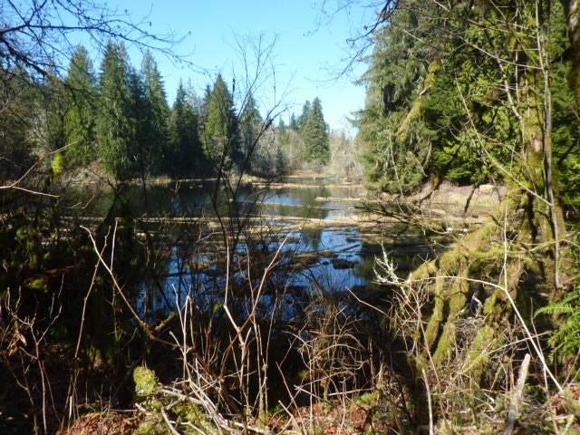
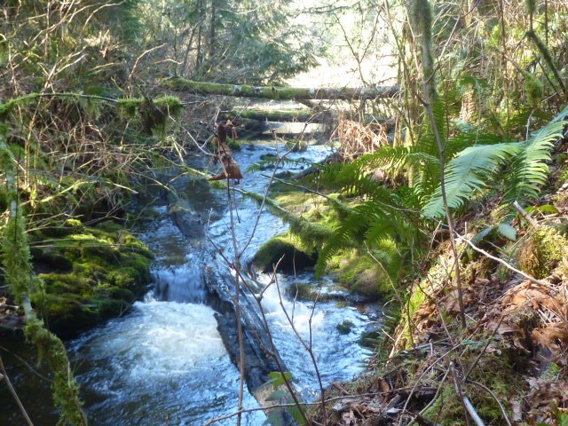
The trail into the forested marshes is easily discovered. There is a small sign “0.5” (probably mile marker). This may be a different trail than described in the guide description, this trail does not seem to have been a road. The trail skirts Swan Lake with several access points to the water. Not sure if this is a fishing area? the short trails to the shore are reminiscent of fishing holes. The trail crosses the creek outflow from the lake. This day there was a rushing stream, too wide to jump, and too deep to cross without waders, but a downed tree of good size over the creek worked as a bridge. After crossing the creek the trail did look like an abandoned road. The creek widened to marsh, from the road/trail there were occasional peaks at the marsh but no visible water. Soon the trail connected with a paved road. Two walkers informed me the road is access to a water reservoir and is gated. The road exits at Kelly Road, and is a popular bicycling destination. Walked up the hill on the grassy shoulders, and passed an area of croaking frogs filling the air with their music. Next some kind of facility, probably water related, with a sign that due to the corona virus no visitors or tours were allowed. The walkers had informed me the road is gated with no access for anyone shortly, so turned back, looking for any possible trails continuing along the wetlands. There was a dirt road, appeared well used and not particularly peaceful, so returned to the same trail. From this direction, before crossing the stream, there was a road/trail that might be the trail to Swan Lake in the trail description, but decided to stay on the same trail.
Returned several days later for more exploration. This time found a trail into a logged area on the left side. A short, well used trail cut the switchback on a deteriorating logging road. This area is being re-planted and there are boxes of sticks and yellow netting used to protect the small trees along the route. There are at least 3 different trees being planted: cedars, Doug Fir, and some kind of pine with long needles. The varieties are grouped together,so one area has cedars, another fir, and another pine. It would be interesting to know if this is being replanted for commercial purposes (it seems then it would be all Doug fir or hemlocks) or re-forested for recreation. The road/trail became increasingly overgrown and eventually un-passable. Next time I’ll head up the road past the trails at the valley crossing. There is also a gated road on the left of the parking spot. When returning to the parking area saw a couple off road motorcycles and some pick up trucks returning from further up the road. Where I was hiking is very quiet (other than frogs!) so if there is an ORV area, it is far from this hiking area. The gated roads have signage prohibiting motorized vehicles, but hikers, dogs and horses are permitted.

Comments