Nerd Alert. This report is all about Geology.
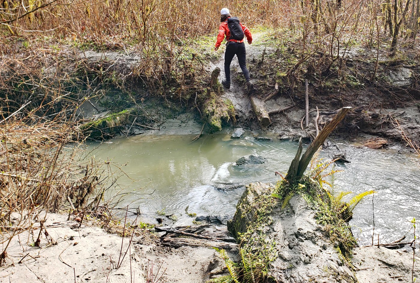
The Sitka Spruce trail is in the Mid Fork Snoqualmie River valley. It is an unmarked and muddy path that takes you through ground zero of the Mid Fork Claylands. Not a great trail per se but the complex geology that gave rise to the Claylands is facinating.
First you have to go back to the last ice age (13,000-18,000 years ago). All of Canada was covered in a massive ice sheet that was 2 miles thick. The Puget Lobe of the Cordilleran Ice Sheet was an extension off of the southern margin of this greater ice mass. The Puget Lobe filled the entire Puget sound area from North Bend to the Olympics with Ice that was 1/2 mile thick (1 mile thick at the Canadian border). At its maximum, the Puget Lobe extended all the way down to Olympia. All of the land features in Puget Sound were carved out by this massive glacier.
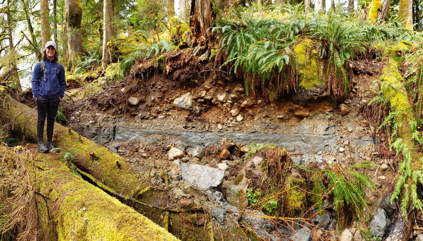
The Puget Lobe pushed through North Bend and in the process shaved off the steep face of Mt Si. It continued up to the mouth of the Mid Fork Snoqualmie river and deposited massive amounts of rock debris in the form of a lateral moraine. This big flat topped ridge can be beautifully appreciated from Rattlesnake Ledge. This resulted in a very unusual situation where the valley was dammed up from below and created a large lake in the Mid Fork Valley. Over hundreds of years, silt eroded down from the surrounding mountains and settled in the lake bottom, creating thick layers of grey mucky clay called "Varves". Eventually the lake spilled over the top of the moraine and then carved a V-shaped gap in the moraine (near Mailbox TH) that allowed the ancient lake to drain out.
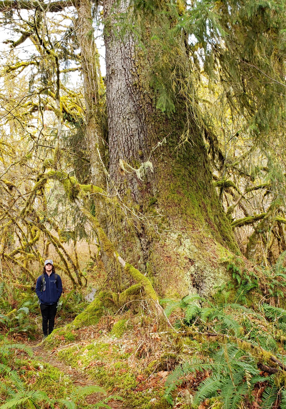
The clay has a profound effect on the types of plants that can grow in this portion of the Mid Fork. Only trees that can tolerate the constant wetness of clay soil can survive. Sitka Spruce which is relatively uncommon in the Cascades thrives here. Western Hemlock, Big Leaf Maple and Cedar also grow well here. Douglas Fir, which needs well drained soil is a rare as hens teeth in the Claylands. Just go a few hundred feet above the valley floor and above the clay and Doug Fir becomes the dominant species as it is in most of the Cascade lowlands.
Awesome Video on Geology of the Puget lobe. I would watch the whole thing but the part pertinent to the Mid Fork is 8:30-11:00: https://youtu.be/ip8nTokv_k0
Greenway Article on the Claylands: https://mtsgreenway.org/blog/goopy-gems-the-claylands-of-the-middle-fork-snoqualmie/


Comments
ptaylor on Sitka Spruce Trail
Not sure if you realized but ... "The trailhead on SE Middle Fork Rd just past the concrete bridge at 840 ft and the "Sitka Spruce" trail are closed to protect the roots of the eponymous stand of Sitka Spruce trees." Details @ https://www.mountaineers.org/activities/routes-places/green-mountain-north-bend-winter
Posted by:
ricola on Mar 25, 2020 04:21 PM
Maddy on Sitka Spruce Trail
Thanks and good to know. I thought they closed it because the trail is muddy and unstable.
Posted by:
Maddy on Mar 25, 2020 06:00 PM
fourteen410 on Sitka Spruce Trail
I'm not sure that closure is correct. I've seen this link to the Mountaineers page before, but no one has been able to provide anything from the forest service confirming this.
Posted by:
fourteen410 on Mar 26, 2020 12:11 AM
Maddy on Sitka Spruce Trail
The land here is in the Mt Si and Middle Fork NRCA (Natural Resouce Conservation Area). This is WA State DNR land managed in a fashion similar to a National Forest Wilderness Area. The USFS would have no jursidiction here. USFS land starts in the upper valley and beyond.
https://www.dnr.wa.gov/Publications/amp_na_midfork_snoq_boundary_map.pdf
Posted by:
Maddy on Mar 26, 2020 08:47 AM
fourteen410 on Sitka Spruce Trail
Has the DNR published anything indicating that there is a closure? (Notwithstanding the current virus-related closure).
Posted by:
fourteen410 on Mar 26, 2020 10:23 AM
thebrink on Sitka Spruce Trail
Thanks for the geologic and botanical information. It makes getting out and hiking all the more interesting.
Posted by:
thebrink on Mar 26, 2020 09:49 AM
Nordique on Sitka Spruce Trail
Thanks, Maddy, I too enjoy exploring and learning more about the Middle Fork and the claylands. I included a link to that article about the claylands and it's been viewed over a 1,000 times:
https://www.flickr.com/photos/nordique/49358122351/in/photolist-2icBhav
Posted by:
Nordique on Mar 26, 2020 04:52 PM
mato on Sitka Spruce Trail
"New Trip Report", eh? Your link was also an interesting read, but left me wondering - at what age does second-growth become old-growth? Presently, old-growth means "never cut", but as more of our previously logged forests are protected and mature, would they not at some point in the future be considered "old-growth"?
Posted by:
mato on Mar 31, 2020 10:05 AM
Nordique on Sitka Spruce Trail
I'm not a forester so I've no answer to your question!
Posted by:
Nordique on Mar 31, 2020 01:27 PM
Maddy on Sitka Spruce Trail
That title "New Trip Report" just appeared spontaneously. It was originally titles "Sitka Spruce Trail".
The definition of Old Growth is not standardized. Most people consider Old Growth to be a natural forest that has not been significantly altered by man. It has trees of various ages and sizes with standing dead trees (snags) and a varied canopy. In the northwest, the older trees have to be 200-250 years old. This would preclude a forest that has been clearcut. In the northwest at least since white man style clearcut logging only started here in the 1850's. Not yet long enough for the second growth trees to be old enough to meet the definition either.
A Virgin Forest is a different definition. This would be a forest that has not been molested by man but could be a younger forest if say the trees regenerated after a fire or avalanche that occurred less than 200 years ago.
Posted by:
Maddy on Mar 31, 2020 03:01 PM
Nordique on Sitka Spruce Trail
Thanks, Maddy! I learn a lot from your contributions!
Posted by:
Nordique on Mar 31, 2020 03:54 PM
Abam on Sitka Spruce Trail
Maddy: great photograph of the 'mud-layer.' I wonder if I might get permission to use the photo in a book about the Natural History of the Cascades that I am working on (Abam). I am a retired faculty person from School of Environmental and Forest Sciences at UW. Tom (hinckley@uw.edu)
Posted by:
Abam on Apr 06, 2020 10:34 AM
Zipster on Sitka Spruce Trail
Here is the 11/21/2023 DNR response, copied from an email to me when I enquired about Stika Spruce trail:
I received your question about the Sitka Spruce trail, and I would be happy to clarify the situation there.
The trail was never an official trail created by the DNR. It is a user-build, non-designated trail that is not sanctioned by the DNR. As such, it is not marked or maintained and there is also no parking area associated with it.
After discussion with multiple stakeholder groups in the North Bend area, the DNR has decided to decommission the trail. The specific concerns cited by the groups include:
•Damage to shallow root systems of the trees by compaction of the soil. Had the trail been constructed according to established guidelines, they trail would have avoided the sensitive root systems.
•The trail also travels through sensitive wetland and riparian environments
•Disturbance of wildlife in an intermittently used area
•The clay-rich environment of the area degrades easily, and without proper construction and maintenance, the impacts to the landscape are greater.
The DNR conducted what is called a State Environmental Protection Act (SEPA) assessment of the area for decommissioning in 2021. The SEPA is a publicly available document, and I have attached the final determination write up to this email. This SEPA includes not just the Sitka spruce trail, but other areas as well. The section relevant to the Sitka spruce trail is at the top of the second page, and called out on the map on the third page. Several of the comments refer to this trail as well.
(Link to SEPA document → https://apps.ecology.wa.gov/separ/Main/SEPA/Record.aspx?SEPANumber=202103700)
Please let me know if I can clarify further.
Stacey Fuchs (she/her)
Natural Areas Manager (Acting)
North Bend office
253-736-4830
Stacey.fuchs@dnr.wa.gov
Work days Mon-Tues (part time until further notice)
Posted by:
Zipster on Nov 22, 2023 12:48 PM