Uh... Wow, this trip report is incredibly late! I can't believe I'm writing it now when it's such old news. Truth is, we didn't do the backpack in March 2020. But, we did do it!
I'd intended to write a trip report at the time but other things intruded and I lost momentum. Very recently, I was looking through old hiking photos and thought this might be a good time to share recollections of that trip.
Actually, it was back in 2006 (I did say this trip report is late... ) when my hiking buddy Marin and I backpacked in to Colchuck Lake. The next morning we did a day hike up over Aasgard Pass to explore some of the high Enchantment Lakes. We returned to our camp later the same day, then moved back the following day to camp for two more nights along the west side of Colchuck Lake. We explored more there before heading out.
On September 10 we had driven to Leavenworth and spent a night at River's Edge Lodge. The next morning, very early, we took Icicle Creek Road and FR 7601 to the Stuart Lake Trailhead. The road seemed rather dusty, and there were a few other cars parked there.
The route began gently enough, then after a mile and a half it offered our first significant uphill. Much more uphill was in store once we turned onto Trail 1599 and began our ascent toward Colchuck Lake, some 4 miles from our trailhead and 2300 feet higher.
It had been a while since we had carried full overnight backpacks, and on the uphill sections of trail they did seem a bit heavy, around 44-49 pounds. (This was 2006. Today's gear would be lighter.)
The route was very rocky and often required some big steps up. We were glad to have brought the treking poles for balance.
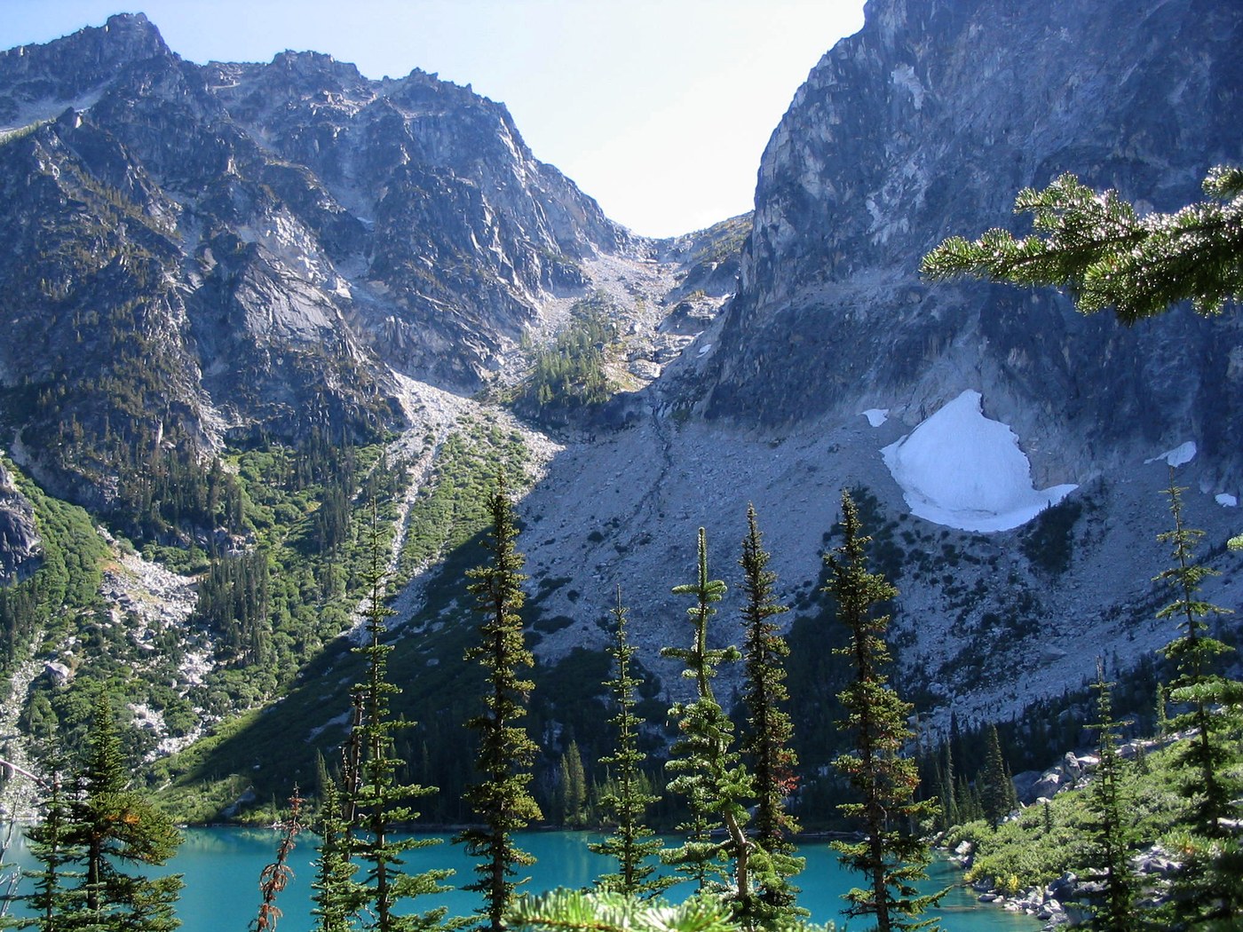
Colchuck Lake, with its intense blue, came into view quite abruptly, with Dragontail Peak rising beyond.
We continued south on the minimal trail paralleling the western edge of the lake, with Aasgard Pass - our route for the next day - now clearly visible, an imposing 2200 feet higher.
At the south end of the lake the trail became an unmarked route across a major boulder field. At least it was level. I ventured to cross a few feet inland from the shore but discovered that I actually had picked a more difficult route. For our return Marin suggested we stay closer to the water, and that did turn out to be easier.
Once across the boulder field we left the ongoing main trail and took the side trail toward the lake shore where we expected to find a few camp sites. We were successful, and initially seemed to have the whole area to ourselves.
Early the next morning, with light day packs and minimal gear, we headed for Aasgard Pass. At first the route was fairly easy, but steepness increased greatly and the route became much more minimal. Brief sections seemed more like a rock climb, with hands required for secure balance. We were glad not to be toting our heavy backpacks here.
The pass, at 7800 feet, was the highest point of our trip. A drop of only a few feet brought us to tiny Tranquil Lake, and soon other lakes became visible including the much larger Isolation Lake and many small tarns.
We saw little in the way of wildlife or flora up here. No close-up sightings of goats. (There was an occasional grasshopper.) A few gentians were in bloom, and a larch showed its golden color.
We enjoyed a leisurely exploration of the upper lake basin then, in late afternoon, began our descent back to our camp at Colchuck Lake.
So far the weather had been great, but the following morning brought change. Clouds formed rapidly and soon a few snowflakes were in the air. We had visions of crossing a slippery boulder field if snow were to accumulate, so decided to break camp immediately and cross back to the west side of Colchuck Lake and seek a different camp site. This we did without difficulty.
In the end the snow did not last very long and the slight accumulation soon melted off. We resumed our explorations along the west side of Colchuck Lake, and noted the helipad at the far northern end.
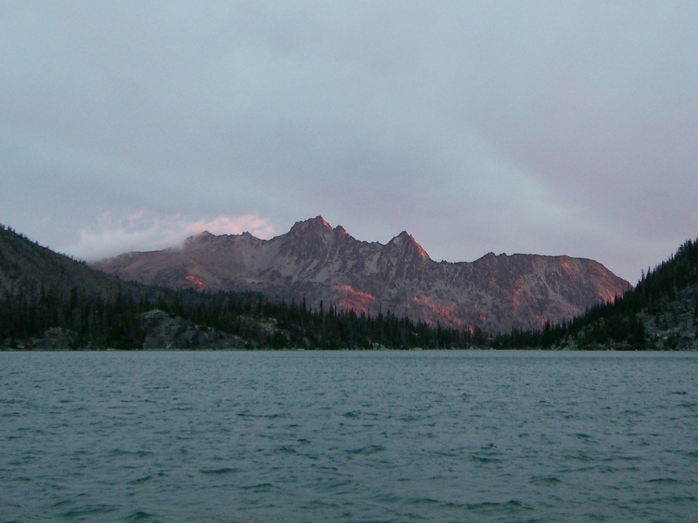
We enjoyed relaxing and taking in the views to the east and south of the lake as the light varied throughout the day.
Our hike out to the trailhead went smoothly. Then it was time to head home, check our photos and reflect on our wonderful trip.


Comments