
Thought I'd give folks an option I discovered early season during coronavirus limitations.
Map: USGS South Huckleberry Mountain, WA 2020 lists the trail to the top as "S.Huck2" but it is also 2014060
Est. Distance, 10.5 miles RT
Est. Elevation Gain: ~2000 ft in, ~400 ft back
Notes: Requires high clearance to go all the way to the TH, low clearance cars will have to park ~1/3+ mile farther back and walk the difference.
Notes: Mostly a decommissioned road walk.
Directions to TH: From the Lake Ellen Campground at the East end of Lake Ellen, continue west for 2 miles until you reach a junction. Go right on the road signed "Barnaby Creek" "2014", enter Colville National Forest shortly thereafter. Go ~3 miles, heading right on unsigned road 2014085 which swings back east to cross Doukhobor Creek. This road is mostly good but becomes rough after awhile. Drive to the end if you have high clearance, roughly a mile, and park here.
Trail Description:
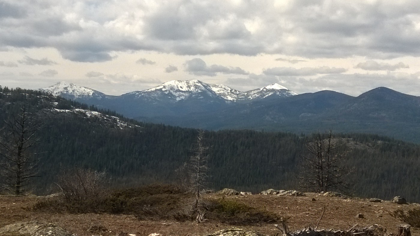
The trail lies over the huge mound of dirt and continues the same way the road did. Follow the trail as it traverses the hillside, gently up and down. Cross a small, shallow but wide stream in 3/4 mile. Continuing on the other side, reach a T intersection with 2014028 in less than 1/2 mile. Head left. The way is flat for 1/4 mile then begins to climb. You may see a couple faint paths to the right 1/2 mile later but keep the main road. About one mile from the T you will reach a Y intersection where the left fork goes sharply up to the left and doubles back, and the right path stays level and straight. The left path steeply climbs to valley views but our path is to take the right fork - this is 2014060 - to even better views. In just under 1/4 mile there is a road that heads left signed "2014" (small print) "065" (larger print) on a brown marker. Stay right to remain on 2014060. In 1/4 mile there is a developed spring next to the trail. More climbing! At one point the road dips down to the right and there is a significant blowdown, but notice a faint trail way back before the road goes down and it will save you having to negotiate the giant blowdown. About 1/3 mile past the spring the road heads southeast to skirt around a large rock outcropping on the left of the trail. Views of Lake Roosevelt start appearing, and the flowers here are abundant, glacier lillies, shooting stars, western springbeauty. This would be a suitable destination or place for lunch. ...to continue to better views, continue onward and upward. In less than 1/2 mile pass a second spring, this one ~50 feet off trail uphill. Eventually you reach a high point and as you transition to the northeast flank of South Huckleberry Mountain, the trail begins to descend and the vegetation changes to include Cedars, Western White Pine, and Tamarack. As you follow the track northward, it becomes indistinct in the saddle but it follows the eastern side of the saddle and your way lies to the north so it is easy to regain. Finally, ascend to the summit after false summits come and go. From there you will be rewarded with good views of Lake Roosevelt to the East with Selkirks and Huckleberry Ranges to the East and Southeast, Canadian selkirks to the Northeast, the southern peaks of the Kettle Range to the West, and Huckleberry Mountain to the south. It is a broad summit with a few scattered trees and some rocks to the East the beckon exploration.
Bugs: No mosquitoes. Butterflies were out.
Snow: There was a section with patches of 1.5 ft snow, on the northeast flank of S Huckleberry -- but only a couple hundred yards total. This was a low snow year.
Flowers: Glacier lillies, Western Springbeauty, even saw a few Shooting Stars and a paintbrush!

Comments