
I did not see another car on FS26 on my way to the TH and did not see another person all day. FS26 has rough sections that are hard to see forcing a slow drive in spite of the road being paved 99% of the 12 miles. I started hiking at 12:45pm.
The first two miles are snow free. It is approximately 1,600 ft of elevation climb in the first two miles.
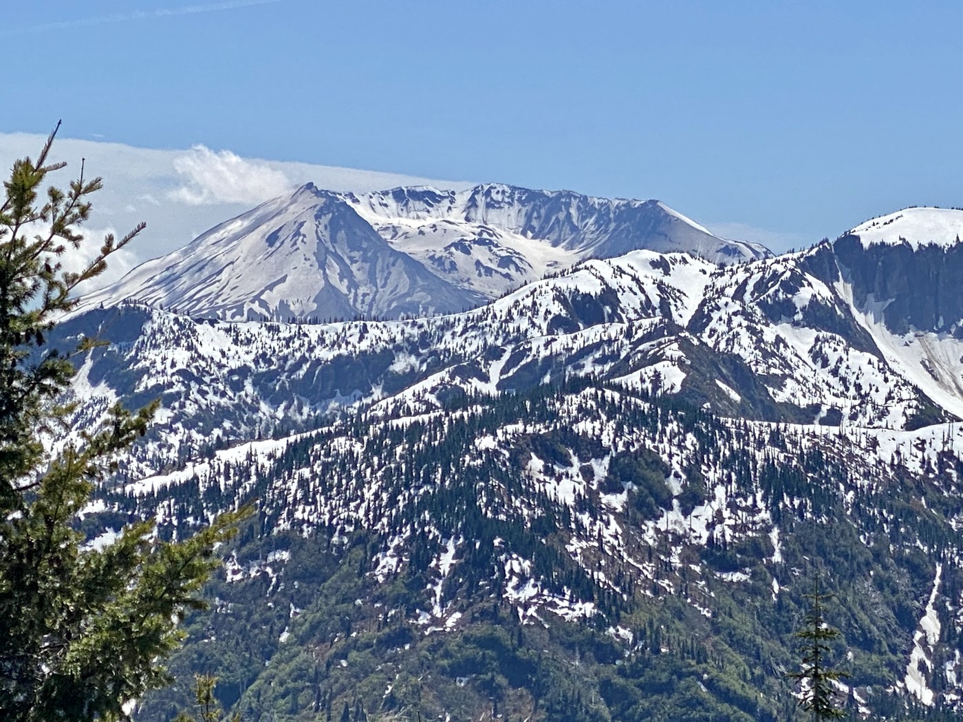
At two miles, there is snow covering the trail for the next .5 mile. Route finding skills or GPS tracker is required to get through this section. There was not a boot path to follow. Once on the ridge, the trail is visible again and snow is intermittent along the trail. The third mile is filled with views of Mt Rainier, Mt Adams, Mt St Helens, Mt Hood and Mt Jefferson in the distance.
Trilliums are just starting to bloom.
Due to time constraints, I only went 3 miles before I turned around. 6 miles in 2hrs and 30 mins.
The gate on FS26 is now open to Ryan Lake.


Comments