

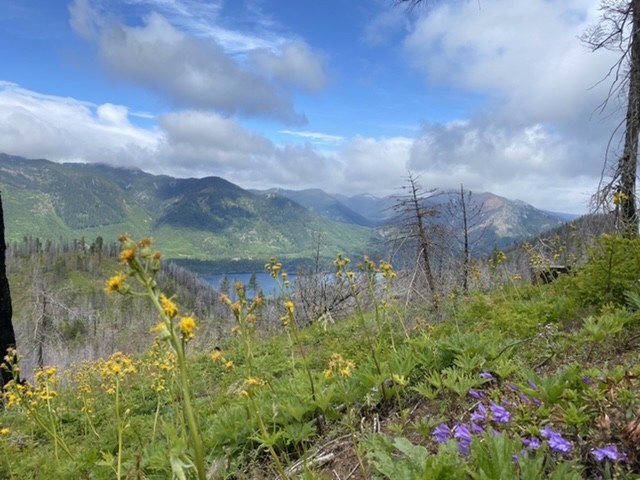
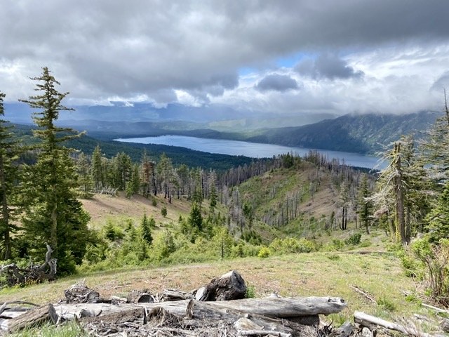
Arrived at the trailhead a little before 9am. As previous trip reports mention, don’t follow the directions link on the WTA website. The direction description is correct. There were about 6 cars at the trailhead. Once hiking, the first right turn came sooner than expected, so we did accidentally go left for a while, but not too long before we self-corrected. Someone did mark the trail with an arrow of sticks, but easy to walk by. This turn wasn’t an obvious fork or change in the road. The next intersection is more obvious. Bring a GPS or good map. The hike is steep at times, so a good workout. Windy today but way better views than expected for a cloudy day. We ate lunch in the forest just before the summit, as it was protected and wind-free.
For the route down, we decided to take the other ridge to make it a loop. It started out fine. We did run into some motor bikers, so beware that this section is a multi-use trail. We thought we were on track until we weren’t and there was no obvious indication of how we missed the trail we were supposed to take. We stayed east of the creek too long. We started debating different options, including bushwhacking down the ridge to the creek, but we were unsuccessful. So we stayed on the trail we were on and found a better place to cross the creek and made it back to the main trail eventually. As everyone else mentioned, this trail requires some navigation and the multitude of turnoffs make it tricky. However, overall it was a good hike and recommended.
We got back to the trailhead a little before 2pm. There were about 25 cars there, including a few parked on the road.

Comments