
Started at the unmarked trailhead at 47°18'08.0"N 121°03'42.5"W. Road is rough but suitable for most vehicles. Monday was light rain on and off all day. Getting up Hex is steep but short. Continuing along the ridge requires going straight down the west side of hex peak, but the trail quickly becomes visible.
Sasse Ridge was rough in places, with no sign of trail in areas. GPS was helpful here, but basically just always stay as high as possible and you will find the trail. Sasse peak is underwhelming. Eventually you'll hit snow, some very deep patches but mostly you can walk along side it. The trail is easier to follow here until you head into the valley.
The signs at the junction of Teanaway, Jolly, and Sasse are still readable. I skipped the 1-mile detour to Jolly because it was foggy and freezing rain. Heading down into the valley to meet the river was really hard to keep track of the trail, but there is no undergrowth so just watch your GPS and don't go far from the river.
It was a couple of miles before I found a place flat enough to set up camp, so plan on this. About 13.5 miles from the trailhead for the first day.
Day 2 was better weather, which was fortuitous, given that I had to ford the Teanaway about 5 times. There's no way to get across in boots right now, but with water shoes and poles the crossings were not difficult. They just slowed me down a LOT while I dried off before putting my socks and boots back on.
At the end of the West Fork Teanaway River trail, there is a logging road. I use AllTrails and here the roads do not match with what is on the map. With a little trial and error, this is the way back:
Keep right on FS4305-115 for a little while until it looks like there is a turnoff to the right. On the map it says there is a road. There is no road, but you walk over the giant dirt piles and go down and go straight across the river. You can see a dirt bike trail going up the bank on the other side. Walk up this path and at the top turn LEFT. It loops all the way around and eventually becomes a "normal" logging road and matches the map again (still 4305-115). If you stay on this without turning, it will eventually meet back up with FS4305 and it's easy to get back to the trail head.
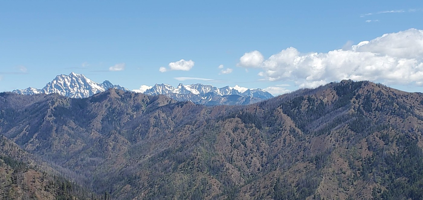
Wednesday was sunny and warm, so I headed back up Hex to get a few photos before returning to my car and heading back to Seattle.
Loop was about 27 or 28 miles (not counting second ascent of Hex). I had mixed feelings about utilizing the logging roads rather than actual trails, but the flat ground was a welcome change after two strenuous days - and the roads are remote. I didn't see anyone until I made it back to the trailhead.

Comments