My partner and I spent three nights at Ipsut Creek Campground (backcounty/wilderness camping permits are required) starting on Monday June 22nd. We biked out from Seattle (~80mi) on June 22nd and hiked the Green Lake trail on the way in. We did day hikes out of Ipsut Creek CG on July 23 and 24 to Yellowstone Cliffs/Windy Gap (Day 2), Carbon Glacier, and Ipsut Falls (Day 3). We biked back down the Carbon River Trail and onwards to Seattle on July 25th.
The ride into Ipsut Creek is as described in other recent reports. Just before the trailhead for the dirt Carbon River trail (the now-closed-to-cars former road) begin, the road is washed out spectacularly so only pedestrians and bikers can get through. Since we weren't parking, we weren't affected. Most folks drive and are parking alongside the road before the washout so this doesn't seem to be a major impediment. It is definitely going to be a big project for the NPS.
The trail to the Green Lake trailhead has a few tress down but is in great shape. The Green Lake trailhead itself is is good condition. We headed up late afternoon and there were several larger groups with boom boxes coming down. No masks at all. It was late afternoon so there was nobody at the lake.
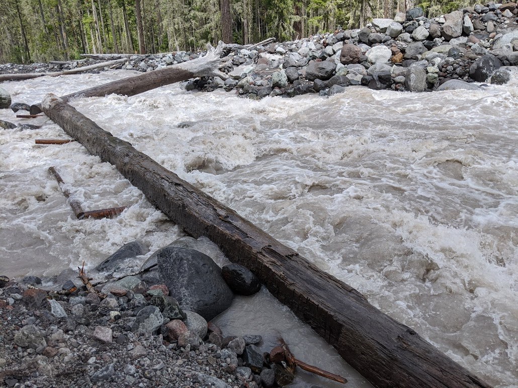
Just past the Green Lake trailhead, there is another big washout on the Carbon River trail where a few offshoots from the Carbon River have completely eaten away the trail/road. People have piled together logs and sticks in such a way that it looks possible for a hiker to get across a series of rock "islands" without having to actually go through water. That said, if you've got a heavy bike that you can't lift up and cary across some makeshift log bridges or something like a bike trailer, you're likely going to have go through the water. There are two main streams you need to cross to get back onto the trail. Both were 6-12 inches deep but not moving too fast.
It's not so hard to cross these streams even with loaded bikes but the water is painfully cold. We changed out of our bike shoes to aquasocks/sandals before crossing. Remember to keep your bikes upstream when crossing!
We were there during the week so the Ipsut Creek campground was not very crowded (1-3 other groups over the days we were there). The campground has fallen trees all over the place but it's otherwise in great shape. The restroom (there are two but one is closed) was very well maintained on a daily basis. We used the bear boxes to store foods, sunscreen, chapstick, and so on. One thing to keep in mind that the river water has enough silt in it that by Day 3, our Sawyer water filter was getting a little clogged.
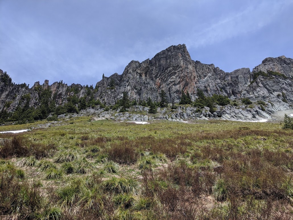
On Day 2, we hiked up the Northern Loop trail towards Yellowstone Cliffs/Windy Gap. Getting from Iput creek to the "low bridge" crossing on the Carbon River is easy enough. Some parts of the trails were eroding but the trail and there was bear scat on the trail in several places but the trail was otherwise is good shape.
The major challenge with almost any hike out of Ipsut Creek Campground (other than up to Ipsut Pass) is definitely the Carbon River crossing. The NPS lists the bridge as "OUT" but as others have said it's not completely out. The first half of the bridge is turned 90° on its side so there is no flat surface or handrails but the log is still vaguely in place. The logs themselves are stable. Before we went, we saw another trip report which showed a picture of dry logs which looked challenging and scary but likely within our ability/comfort zone. By the time we got there, the water level had gotten high enough that much of the first log and about a third of the second log were very wet. There was no water going over the logs.
The stream was moving fast but we decided to butt scoot across the river. It was not possible to do this without getting our legs (up to mid-shin) submerged. The water was cold but our adrenaline is high enough that you mostly didn't notice. One of us tried crawling the last bit of the second log because the log widens a bit and she's small but this is probably less stable and safe than butt scooting. Obviously, folks should take a look and know their own limits, abilities, and comfort zones when deciding. From what we saw, most people were turning back at this point. We also talked to people who tried/started and then decided against going forward.
We hiked up and up towards Windy Gap and started hitting snow at 4500ft. There were probably a dozen trees over the path on the way up but nothing that was difficult to cross.
When we sat down for lunch near Windy Gap. We were covered in wood ticks but there were no mosquitoes.
It was a very warm sunny day so when we returned to the Carbon River crossing, we realized that the water level on the Carbon River had gone up substantially since our morning crossing (perhaps 5 inches) and the logs were much more wet than when we crossed in the morning. We butt scooted/crawled across the logs again and dried our feet on the other side of the river.
We didn't see anybody else on the trail on the the other side of the Carbon River on Day 2. On Day 3, we spoke with another hiker who had come from the other side of Windy Gap and reported that the snow was quite deep beyond Yellowstone Cliffs. He had full winter gear including crampons and an ice axe and suggested it was a difficult to move across this area even with this gear. The Northern Loop is definitely going to be snowed in for at least a few more weeks.
On Day 3, we set out to see Carbon Glacier. We made it as far as Dick Creek. We crossed Carbon River on the logs again to head towards Carbon Glacier. The water level was about the same as late afternoon on the day before. This time, we changed out of our hiking boots to aquasocks/sandals before butt scooting/crawling across the logs to save ourself wet feet for the whole day. The first log was quite wet and our hands slipped a few times as we moved forward. The water is cold and fast although butt scooting felt stable enough for us given our abilities and risk tolerance. Again, there was no water over the logs. It was definitely scary and many hikers will mot want to do this.
We hiked up to Carbon Glacier and crossed the suspension bridge. Again, there are some large trees over the trail but otherwise trail is in good shape and easy to follow.
We hiked up to Dick Creek Campground. The "new" higher crossing of Dick Creek (before the rope assisted climb) looks to be about half-out and the logs to cross the stream seemed to be missing or mostly submerged under the water. The stream was moving fast, so we decided to turn around there. It looked crossable if you were willing to get wet but we had nowhere in particular we wanted to be above Dick Creek so we took a lunch break at a spot along the trail with a great Carbon Glacier viewpoint before heading back. A pika came and joined us during lunch.
We still had some time before dinner, so we head up to Ipsut Pass. The Ipsut Pass trail is very well maintained and mostly in good shape. We saw some bear droppings but no bear. There were several very large trees across the path including one that has created a shortish reroute of the trail. The reroute is not completely obvious but we set up several cairns to point them out. We started seeing snow at about 3800ft. Days had been hot and snow had melted a bit more than the last trip report we saw before we began our trip. The pass itself looks doable although microspokes are probably a good idea and the trail will not be visible for at least some of the upper parts.
There is a ton of water on the trail after things open up at after 3800ft right before the switchbacks up to the pass. At the very least bring waterproof boots and extra pairs of wool socks if you want to try to make it to the top of the pass!


Comments
They fixed the Lower Carbon River crossing on Monday July 13, 2020. The road from Carbon River Ranger Station to Ipsut Creek Campground currently has only dry crossings and is easy for any level of mountain biking.
Posted by:
trillium on Jul 16, 2020 12:01 AM
Hooray! To be clear, they fixed both (a) the washout on the Carbon River Trail right after the Green River Trail trailhead and also (b) the lower bridge on the Carbon River that was turned onto its side and is in the final picture?
In either case (and especially in both!) that's great news!
Posted by:
makoshark on Jul 16, 2020 09:22 AM
I don't think they "fixed" anything on the Carbon River Road/Trail. I think the water level dropped. In any case, on 7/12/20 there was no water covering any of the road/trail. There were some real bumpy spots over rocks on a couple of dry washouts. Might want to walk a bike here.
The lower bridge on the Carbon River is reportedly fixed. I don't know exactly how well. From the description of the work I got from someone who saw them working firsthand, I gather they flattened the tops of the logs and added a handrail. Falling in the river here would still be deadly. But the hikers I talked to said it was a fine crossing now.
Posted by:
trillium on Jul 16, 2020 10:35 AM