My girlfriend and I hiked on Tuesday, July 28th. and the trip totalled 18 miles over 10.5 hours with spray falls and a small detour on a trail heading south from the highest point. Perfectly clear day and this trail really highlighted all of the beauty of Mt. Rainier and it's ecosystem.
Arrived at Mowich lake by 7:30am, plenty of spots left. There are trash cans and restrooms that are open. We hiked clockwise to save the views of Mt. Rainier for last. Also had the benefit of the snow softening up. Microspikes were not needed, but there is a lot of snow heading up from Seattle Park to Spray Park. I wouldn't do it without poles. The trail was mostly covered in this section for several miles, but there were cairns in place and other peoples' boot tracks were reliable. I don't expect the snow to be completely gone for several more weeks, but it was beautiful with the snow! Only passed a handful of people in the first half, a bit more near Spray Park but no more than a couple dozen all day. Everyone had masks and were courteous.
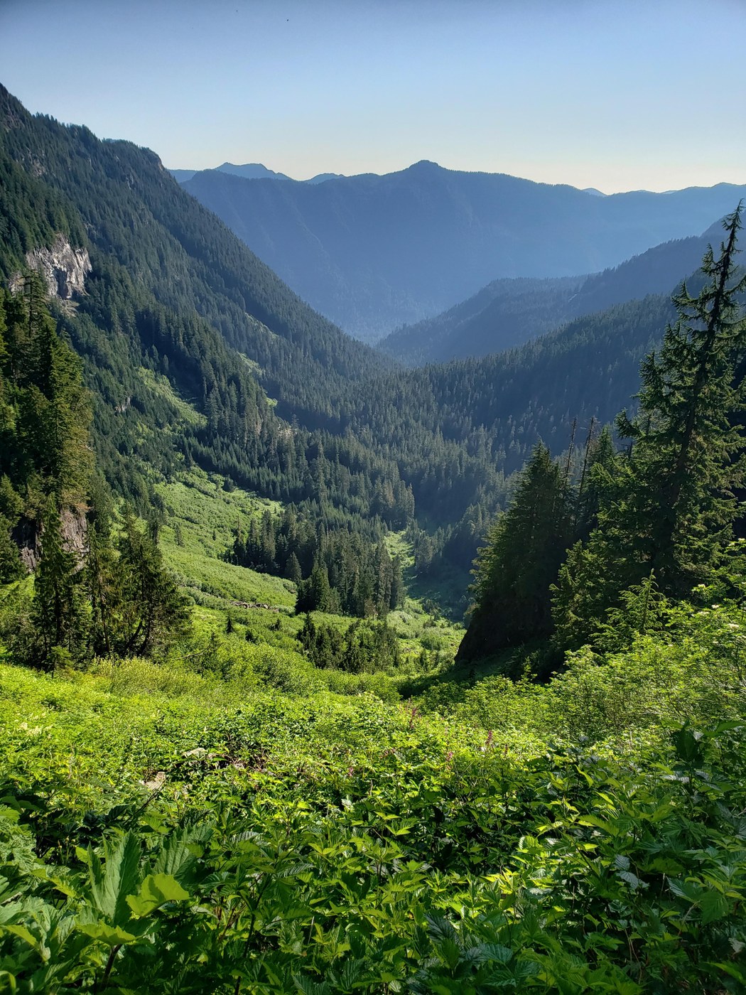
There was some snow on the trail near Mowich lake, but it went away within a half a mile. The view from ipsut pass was beautiful in the morning. Heading down the pass, we saw a LOT of fresh (and some dry) bear scat on the trail. This section of the trail descends a thousand feet or so in a mile, and it's very tight with tall greenery rubbing on both sides in places. Virtually nowhere to go but the trail and you can't see very far in advance. Not where I'd want to be caught with a bear, but thankfully we didn't see one (yet).
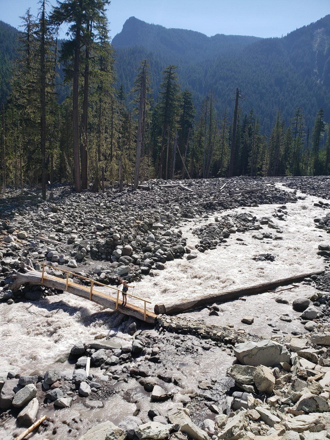
Descending to the Carbon river we saw many small waterfalls and crossed many streams that had nice log bridges with a handrail, there were surely over a dozen of these along the trail! The Carbon river was flowing fast. Had to cross it once on one of the log bridges which was neat, but definitely would not have wanted to slip and fall in. From here, the trail isn't quite as clear, but you can follow cairns NE across the river bed. The trail switchbacks up a couple times before getting to the fork of the Northern Loop trail, we were worried for a while we missed the turn for the wonderland trail and was switchbacking up a different trail!
We crossed paths with a couple that warned about a bear ahead, they didn't see it, but someone else told them about it. Within a half a mile of the suspension bridge we ran into the bear, a mama and two very small cubs. They were probably 15 yards away off the trail about 10 o'clock, moving in my direction. I got out the bear spray, started making some noise and talking, and it continued to move towards the trail. It surely knew we were there, but didn't seem to acknowledge us, or care. So we calmly continued up the trail passing the bears and it proceeded on North. The bear was probably within 15 feet at the closest point, much closer than I'd like to be with a mom and cubs :)
The suspension bridge was really neat, pretty wobbly! The hike heads straight up at this point, not much excitement for a while, but the legs start to get tired. With the exception of a mile at ipsut pass, everything had been pretty well shaded. Things open up at Seattle Park and it's exposed for the next several miles. Beautiful flowers, streams, birds, and greenery here. Also, a fair share of mosquitos here and near most streams.
Once we get up high enough, we start to get beautiful views of mother mountain, and other peaks/ranges in the distance. The snow also becomes a factor at this point, but like I mentioned above, it's easy enough to follow other people's tracks and cairns (at least since it was clear). It's relatively steep in some places, and with the soft snow there was some "one step forward half step backward" going on, but overall it was okay. This was the most tiring section. Some snow fields stretched for over a couple hundred feet before the trail was exposed again for a short stint.
From the highest point on Spray Park trail, we saw another trail that was cleared going south uphill towards Mt. Rainier. We went up and sat on a rock and had a second lunch while looking at a beautifully clear Mt. Rainier. We had the whole mountain to ourselves! From that point I had 13.5 miles on my watch, and thought it was 3 miles back from there. (Spoiler, it ended up being another 4.5 miles. We weren't happy when we hit the 2 miles left to Mowich lake sign).
The walk downhill was much easier in the snow, it was slushy, a bit slick, but it made for fun sliding on your feet. Spray falls was beautiful. You have to walk on the rocks upstream a bit to get a full view of the falls, and you'll get a bit sprayed ;) Eagle cliff viewpoint also had a beautiful view of the mountain, worth the short trip down even when you're exhausted.
It was a relief once we finally got back to the lake after 18 miles. It was a long day, but a beautiful journey, seeing just about everything the mountain could show us :) Highly recommend if you have the stamina!


Comments