
I have a love/hate relationship with this trail. The main complaint is that — after Discovery Lake and venturing on to Discovery Peak — it's often hard to follow. All is forgiven, however, as you reach the area near the top and then the summit itself.
The trail starts off on old roadbed. Mother Nature is doing her thing, but it's still quite obvious that you're on an old road. It's open, though, so you get constant views down the Wynoochee Valley and of Capitol Peak, Three Peaks, Chapel Peak, etc.
It's probably 1.75 miles to the lake, and after 2/3 of that, just before you reach the Discovery Lake sign, the trail turns off the old roadbed, becomes a real forest trail and gets a little steeper.
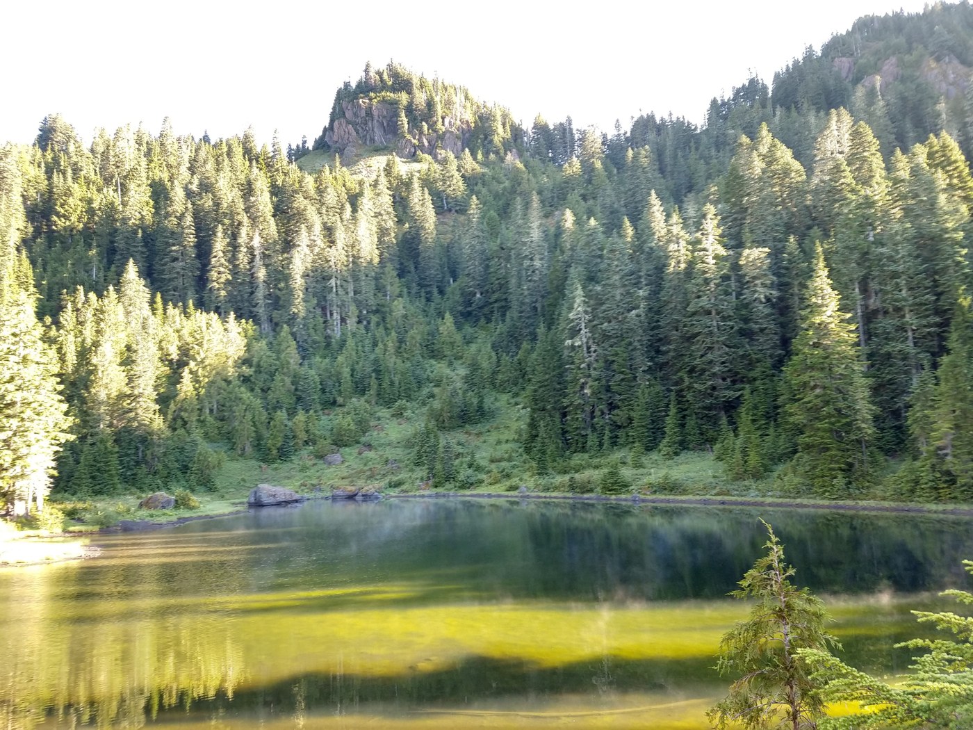
Soon you're at the lake. It's a sweet little lake in a beautiful setting, and it feels quite remote for the short hike it takes. (No doubt that's because you took a long drive on rough Forest Service roads, so it *is* pretty remote!)
After the lake, the trail gets difficult. (You want the trail that starts off counterclockwise around the lake.) Primitive would be a charitable description. It winds its way up the slope behind the lake for a while. This part isn't so hard to follow, with a good boot path and regular flagging.
The trouble starts when you begin traversing across the deforested hillsides. (Discovery Peak is not the rocky outcropping looming over the lake; it's out of sight from the lake, around to the right, hence all the traversing to be done up above.)
The trail is really hard to follow up here, and hard to distinguish from random animal tracks. Someone's GPS route I downloaded was invaluable. It took me 1.5 hours from the lake to the peak, but I bet you could do it in close to half that, if you knew where you were going.
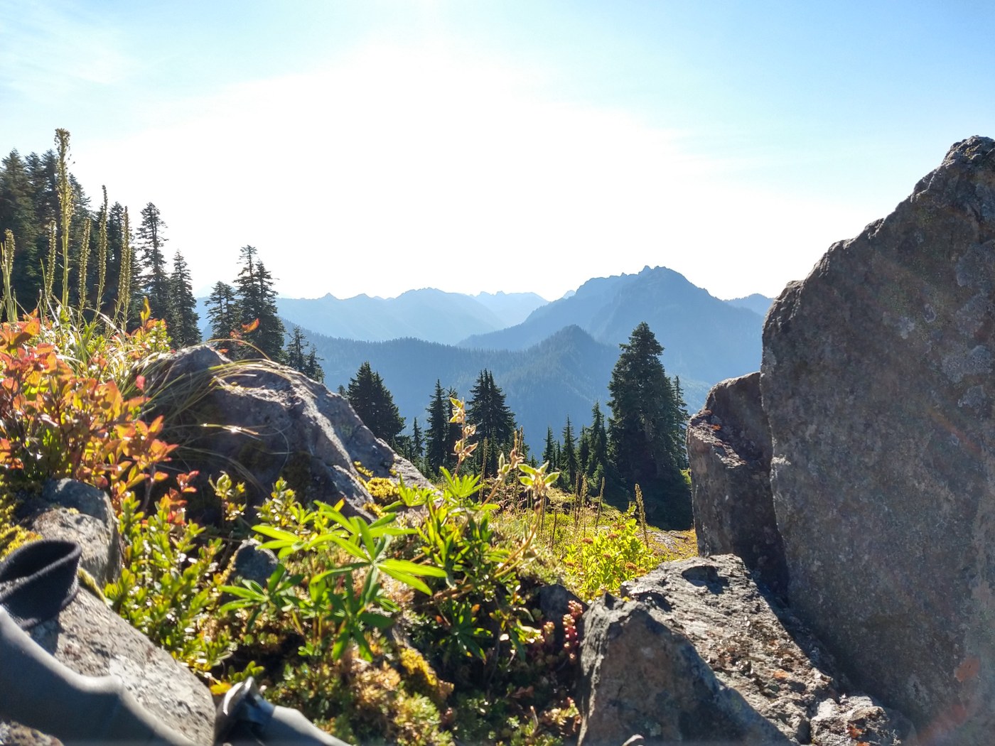
The traverse again has great views of the valley and surrounding mountains. And you encounter some beautiful meadows as you reach a ridgeline and swing left to get to the peak.
The peak itself -- wow! Full 360° views, from Mount Hoquiam, Colonel Bob and the ocean beyond, to St. Helens, Ellinor and Washington, Stone, Constance, and north to Olympus and friends (although that direction had the most cloud cover today).
It's a large-rock scramble to get to the true summit, but it's not bad. The register is slightly below, in a gravelly redoubt with equally good views. Although it was in an OtterBox, the register was soggy, so I let it dry in the sun while I soaked up the views.
Keeping on the trail is just as challenging on the way down. It's often a half-decent bootpath, and you wonder why you keep losing it, but you do.
This trip had the remote solitude I'm seeking in this age of social distancing: I encountered only two people, both bear hunters, the whole time, and neither was going where I was from the lake. One told me he saw, from afar, a bear traversing the mountainside not long after me, but I never saw a bear, just scat.
Directions: Drive like you're going to the Wynoochee Pass Trailhead, but instead of turning right onto the final spur -400, stay left, continue winding around on this road for a while and park at approximately 47.499964 N, -123.580917 W.
In short: Discovery Peak -- well worth discovering.


Comments