As it's now our tradition, my beautiful daughter and I do a multi-night backpacking trip for 6 days/5 nights to honor the life of her beloved brother/my beloved son, who was born on a July 17 and died on a July 22. This is our ritual for the second anniversary. Finding You There, 2020. Finding you there beloved Diego. Your soul never left us.
Due to COVID-19 and many of its consequences, we couldn't plan a multi-night trip that covered the six days, so we broke it into two sections: from July 17 to July 20 (4 days/3 nights) in Trapper Creek Wilderness, and from July 20 to July 22 (2 days/2 nights) in Panther Creek, just 7 miles from Trapper Creek. The latter hike can be found in a separate report (Panther Creek - Pacific Crest Trail Southbound).
From Trapper Creek Trailhead: if your goal is just to go to Observation Peak, we recommend you to do the out-and-back on trail #132. If you want more challenging conditions, do the loop, counterclockwise (out on #132, back on #192 - this is what we did). If you want more challenges do the loop clockwise (out on #192, back on #132 - #192 has a lot of switchbacks and it's steeper and longer than #132). If you want a full challenge, do the out and back on #192.
Day 1 – Fri Jul 17, 2020 - After the birthday cake, we hit the road for a short drive (1hr+) to Trapper Creek Trailhead. We started our hike at 1430 hours. After a one-mile hike, twenty-five minutes from the trailhead, we got to the intersection of Observation Trail #132 and Trapper Creek Trail #192. Though Romano recommends doing this loop clockwise, we followed WTA member Wallycake’s suggestion: counterclockwise, ascending on #132 to the peak, and descending on #192. Wallycake was not the only one that said “the switchbacks on #192 are gnarly”. Cwaterfalls, also a member of WTA, reported “grueling is a better adjective” for the steep and long ascent on #192. Happy to have done that investigation, the ascent along #132 to the creekside camps was a piece of cake. The trail was in excellent trail conditions, and we found not a soul. Beautiful nature took us, after a total of 3.2 miles, to a perfect camping spot next to Trapper creek. We reached it at 1600 hours for a one-and-a-half-hour hike. We set up camp, collected water, had dinner, a cup of coffee with dessert, and spent time just doing what we love to do. Talk. We removed the rain-fly so we could see the amazing top of the trees from our tent, calling it: “The view from down here.” We talked about what life is, what we believe in, the current sad situation of the country, and what direction it may take us. At about 2130 we fell asleep like a log.
Day 2 – Sat Jul 18, 2020 - We woke up about 0730, moving quickly to go to the “bathroom” and prepare breakfast. The average time for these activities is 1.5 hours because once we get coffee, we go back to the tent to just enjoy the view of the trees all over us. Our goal is always to enjoy every second, dictating a pace of calm and mindfulness. There is no hurry for us. Then, we collected and filtered more water, picked up camp (another 1.5 hours), reassembled backpacks, and hit the road. It was 1030. The plan for the day was a hike of 3.4 miles to Observation Peak and camp there, or in Berry Camp. Trail #132 was easy, and we rated its difficulty two out of five, though the difficulty could have been 1/5, the backpack weight cannot be dismissed. We noted there were no creeks along the ascent, making us think that we could lack water in our second campsite.
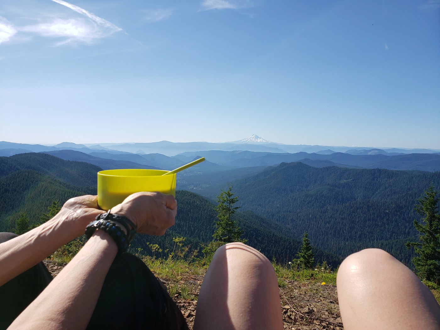
We got to the fork for Observation Peak to the left, and Berry Camp to the right. The first choice was to check the peak and camp there if there was space. If not, we would come back to Berry Camp. The last ascent to the peak from the junction is 0.8 miles. When we arrived at the top, around 1300, we could not believe our eyes. On the North and clockwise, there they were: Mount St. Helens, Mount Rainier, North Cascades, Mount Adams, Mount Hood, and Mount Jefferson. All clear and for us to absorb for as long as we wanted. There were a couple of people admiring the view, and nobody had set camp at the peak. Though the area is large, the terrain has a lot of small, medium-size rocks that would not make a comfortable bed ground. We chose the best clear spot with no rocks. The next step was to search for water. We checked our map and it seemed to be a creek on trail #192 at about a mile from the junction. After walking for a while, we found the creek completely dried. After a walk of fifty-five minutes, we found water. Filled the three-liter camelback and two one-liter bottles. Back to camp, now uphill, which it took us another hour. We learned later that Berry Camp, which is closer, had water, but heck, it's a hiking trip, right?
Only a couple of guys had set camp at the peak. Nobody else, most people coming to the peak were camping at Berry Camp. Comet NEOWISE was going to be visible (was closest to Earth on July 23), but we were so tired and the wind was so brutal (gusts were approximately between 35 and 40 knots) that after dinner we retired to our tent with the rain-fly partly open to see the sunset, and if we were awake at dark, then the stars. The wind and flapping of the rainfly did not let us sleep. At 2230 hours we decided to have a pee session, and observe the comet, with its magic tail of released gases located below Merak and Dubhe, two of the seven stars of Big Deeper, in the Ursa Majoris constellation. It was a nice experience. After four hours trying to find the right direction inside the tent due to the strong winds, we finally fell asleep at 0230. It was a short night.
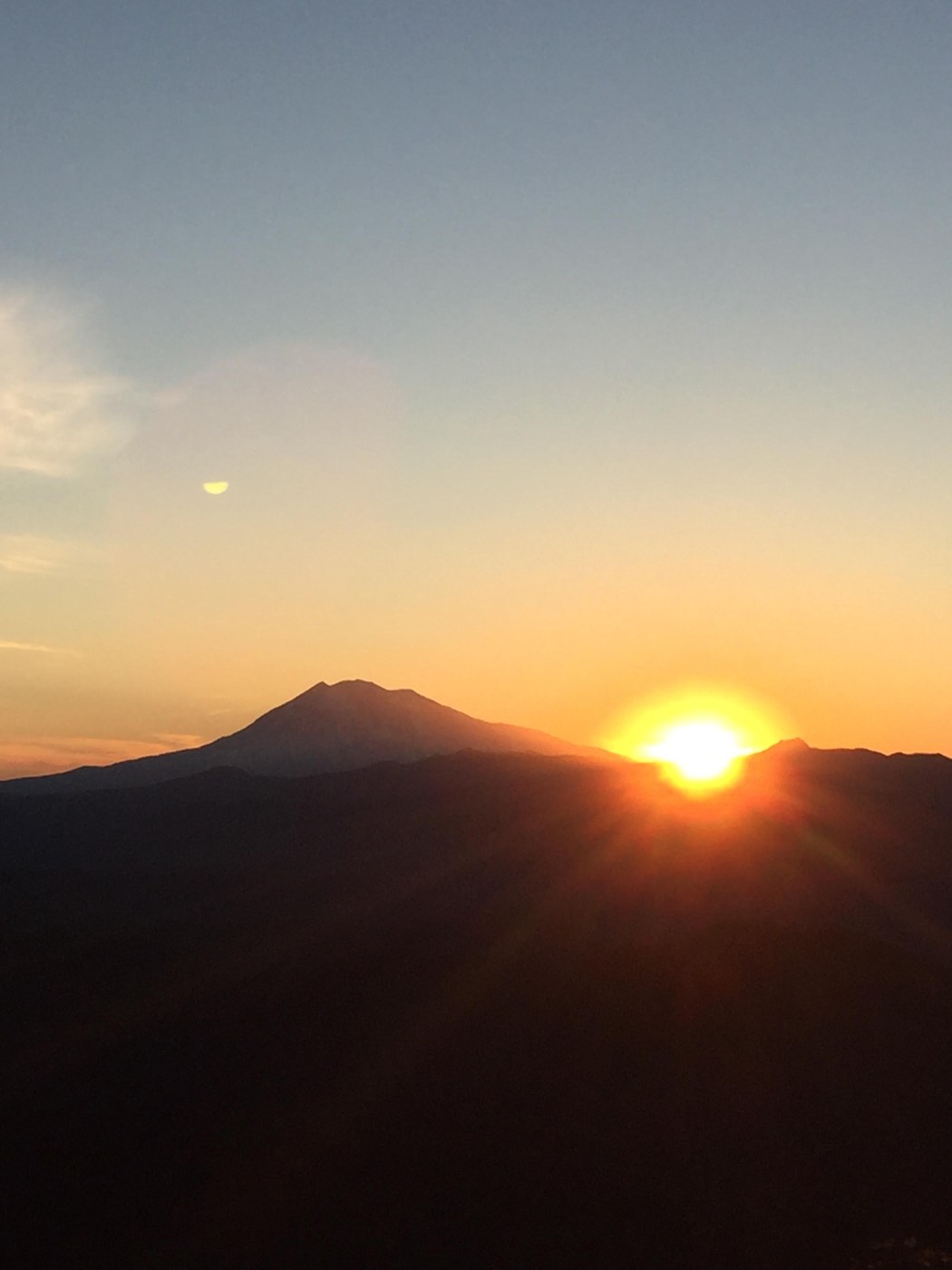
Day 3 – Sun Jul 19, 2020 – At 0530 we were up. The wind has died down. We peaked from a little opening of the tent and saw the sunlight on the horizon. The sunrise promised to be beautiful as we had clear and beautiful Mount Adams, east of us. We got out of our tent and a stunning picture of an already up observer was shot for the memories of this trip. Covered with our sleeping bags on top of the peak, we saw our star little by little, peaking, and rising from the south side of the mountain. We made then coffee and came back to our tent to enjoy it. We left camp at 1030 calculating that we would arrive at Creekside camps by 1330. The trail was friendly at the beginning but became narrow and concerning. A lot of switchbacks confirming that doing this loop clockwise is not the best idea. There was a moment when we were desperate, having to make several stops. We were hot and tired. The descent looked forever. After four hours, including one hour for the various stops, we arrived in an area by the creek with several camping spots. We threw the backpacks on the ground and submerged our heads in the cold water. We thought that we have hiked for so long that this camping site must have been the second going down according to Romano, but then, how did we miss the fork to #198 and #195? Though we wanted to believe that we were at the lower campsite, not having passed the two trails just mentioned, was like a truth on our face. We were at the first campsite, and probably halfway. The conclusion at that point was that the switchbacks fooled us with the distance.
Important to notice that during this hike we did not see one single soul, neither going up or down, what makes this hike a good selection if looking for solitude. After setting up camp at 1600, we hopped a bunch of rocks and sat in the middle of the creek to admire the water and its wonderful sound while running west. Due to our proximity to the water, there were a lot of bugs, no mosquitos, but all those sorts of things, big size, that want to get into your tent. While looking them crawling outside our tent we fell asleep having a delicious one-hour nap. At 1800 we were back up for dinner, and to our surprise, all the bugs, ALL, were gone for the day. Closed dinner with a cuppa that we brought back to the tent, to continue talking. Suddenly, the sound of high-pitched whistles, long in duration, and without rhythmic patterns, let us static. We held hands very tightly and wondered if it was someone in distress blowing a whistle. Or is it an animal? A bird? Sasquatch? Should we close the rainfly so we do not see if someone or something approaches? Or keep it open to be alert? Should we have our knives handy? (Spoiler alert: Elk!!!)
Day 4 – Mon Jul 20, 2020 – A lazy start occurred around 0700 when nature asked us to leave the tent. Coffee followed and we went back to the tent to enjoy beautiful tree-tops from inside. Eventually, we got out, prepared breakfast, and picked up camp. It was noon thirty when we left camp to finalize Part I of the backpacking trip. We saw only 2 people in the whole descent. The descent never ended... seemed like it...We continued being confused with the length of the #192 trail. Per Romano, it was 7.2 miles from the trailhead to the intersection to Berry Camp, Observation Peak, and Trail #132. Several reports indicate that the hike is much longer than what the book said. It is about 9.2 miles, including the word of a park ranger.
From the trailhead, we drove seven miles to Panther Creek to camp there for two nights and do some PCT hike. Thanks for reading!!!


Comments
What a beautiful tribute to your son. Thank you for sharing it.
Posted by:
Lenore on Nov 06, 2021 04:04 PM
Such a helpful trip report! Thank you so much for writing it up.
Posted by:
Lmcg86 on Jun 15, 2022 07:00 AM
Such a helpful trip report! Thank you so much for writing it up.
Posted by:
Lmcg86 on Jun 15, 2022 07:00 AM