
GETTING THERE:
Google Ira Spring Trailhead. Take 90 East towards Spokane for about 36 miles off of 405. Take exit 45 to access USFS Road 9030 and then buckle up for a bumpy ride. The Road is about 3.8 miles to the trailhead, about 3 miles of which is like driving through a mine field where every single mine has been detonated.
THE TRAIL:
The trailhead is clearly marked and there is a toilet to use before starting your journey. Please keep in mind that every mileage / step / altitude tracker has slight variations. I'm using Under Armor's Map My Run app, but open to suggestions for a better one. The first 1.5 miles is pretty steady uphill, pretty smooth, mostly covered and beautiful. Then the trail veers slightly left and much more UP. The increased uphill continues and at 2.28 miles, you'll encounter a series of 5 switchbacks. And you also get to content with some boulders, some rock fields, some tree roots as you continue your ascent.
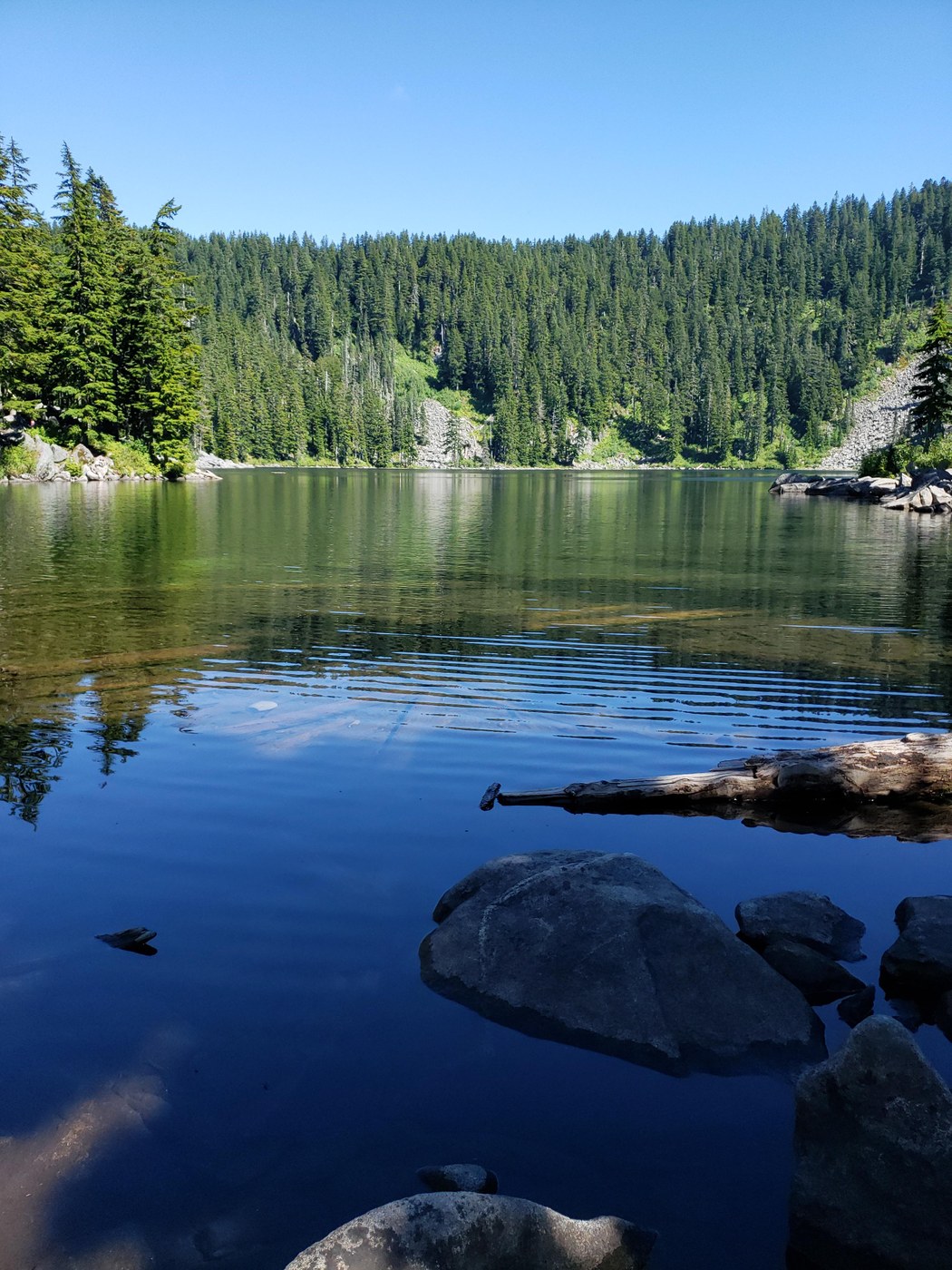
At 2.78 miles, you'll come to a split. To your right is Bandera Mountain. We went left to Mason Lake and Mt Defiance. At just over 3 miles, you'll finish your initial ascent and begin a nearly half mile 200 foot drop to arrive at Mason Lake. Gorgeous lake, but be careful sitting too long as mosquitoes and horseflies like snacking on you.
As you follow the trail along the lake, you'll see a series of wooden signs bolted to trees indicated where the Main Trail goes. There are a couple of forks without a sign, but it's not terribly difficult to pick out the main trail. Do this for about a quarter mile and you'll come across a T-intersection with a sign. To your right is Pratt Lake and Island Lake. To the left is Mt Defiance. This is a pretty minor incline with a pretty smooth trail, but it doesn't last very long.
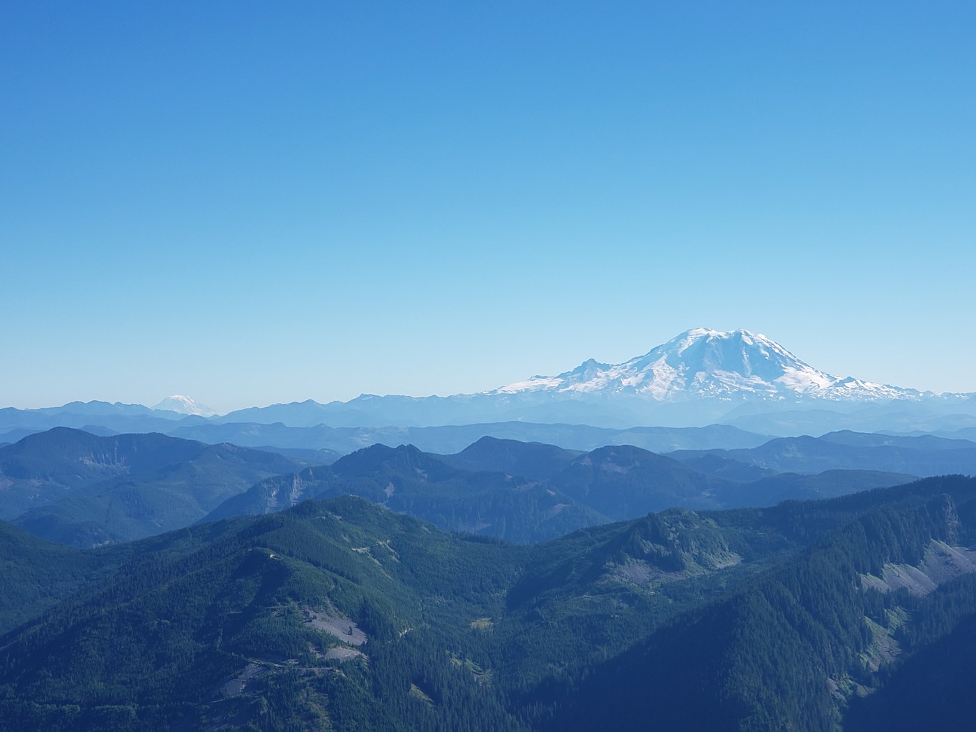
Right around 4 miles in, you start more incline. You are rewarded with a couple of plateau breaks, so enjoy them while you can. You are also completely in the thick of the woods for about 3/4 of a mile. Then you finally get a clearing with a gorgeous view of the Diva Mt Rainier to your left. This opens up and you cross a rock pile and then through a brief nearly flat meadow-like path with lots of wildflowers blooming. Enjoy this last little break because the last half mile or so to the top is going to be a nonstop, uphill, toes-only, assault. We were actually warned by all 3 couples we encountered on the way down that it's a pretty tough one. But we made it and the views are spectacular. To the West, you can actually barely make out downtown Seattle. To the South, Mount Rainier. To the East of Mount Rainier, we saw either Mt. Adams or Mt. Hood.
My app said it took us 5.4 miles to get up there. It's 11 miles round trip, so that's not too far off. It's an elevation gain of 3584 feet to get you up to 5584 feet at the peak.
GEAR USED:
My right knee has been bothering me, especially on the descent of bigger altitude hikes. So I bought a PRO Orthopedic Knee Brace. My knee hurt slightly, but I was able to make it down the mountain without a problem. The leg is still mobile with the brace on. The day after, both my legs are a reasonable amount of sore after an 11-mile, nearly 3600 foot hike. The only downside is a large 2-inch scrape / blister from one of the buckles. Perhaps I cinched it too tight, but the knee feels fine.
CONSUMED:
2.5 L water
Chomps brand turkey stick from Trader Joe's
Field Trip brand meat stick from Grocery Outlet
Nature's Bakery brand Apple Cinnamon flavored Fig Bar
Clif Bar brand Spiced Pumpkin Pie flavor
Clif Bar brand Apricot flavor


Comments