

Summary
We did the thru-hike from the Colchuck/Stuart TH to the Snow Lakes TH. According to my GPS that added up to 18.2 miles, 5280 feet of elevation gain and 7360 feet of elevation loss. The only side trip we did from the main trail was climbing up to a knoll above Sprite Lake. The trip took us 12h45m.
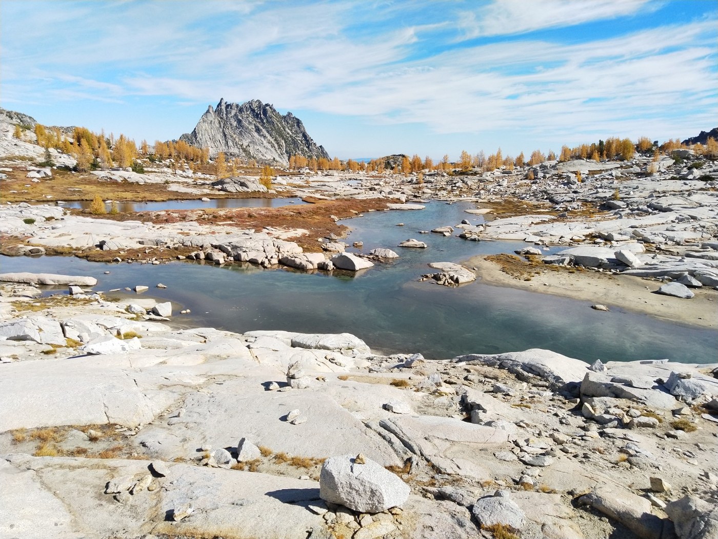
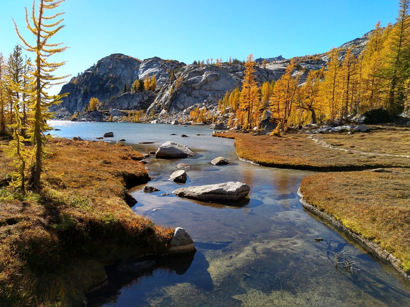
The larches are at or just past peak in the core zone. Right now, the best larch displays start about half a mile before Inspiration Lake and continue up to Sprite Lake, with the biggest concentrations being around the shores of Inspiration and Perfection.
Road/Trailhead
We reach the Snow Lakes TH at 6:25am to drop off one car - the trailhead was nearly full by then. We then reached the Colchuck/Stuart TH at about 6:40 and the day parking there was about half full, maybe a bit less. Privies at both trailheads are open.
The road up from Icicle Creek to the Colchuck/Stuart TH is in decent shape. There's nothing that I would categorize as a pothole, but there are some sections of pronounced ridges across the road and a few sections with large rocks embedded in the soil. The road is easily doable in a sedan if taken slow.
Trail
Couple of things worth knowing up front:
- This is long and strenuous hike. Do not attempt if you haven't been hiking regularly. Keep in mind that your speed from other hikes may not extrapolate well to this one. For perspective, the 2000+ foot climb up to Aasgard pass is about 2.5 times as steep as Tiger Mountain's Cable Line trail of similar elevation gain and it lies at higher elevation - I do the Cable Line's 1.8 miles in under 50 minutes with water weight, while Aasgard less than 3/4 of a mile took me about 2 hours from where the slope really starts to the top.
- There is a lot of rough terrain. Bring your A-game in terms of shoe/sock setup. For the descent, trekking poles are a huge help as you'll be stepping down from stone to stone for long sections.
- There are a bunch of rock slab sections, some with a bit of exposure. Doing this hike in the wet or in snow would be... quite a bit more exciting.
- The route finding is not difficult in daylight hours with good weather. From Colchuck/Stuart trailhead to the boulders below Aasgard and then again from below Snow Lake to the Snow Lakes trailhead the trail is fairly obvious with a headlamp. Further up, navigating in the dark or in thick cloud or a whiteout may be a challenge. See first point about estimating your time.
The trail from the Colchuck/Stuart TH to the lake is mostly a superhighway with only a few roughish sections. Keep an eye out for the Colchuck/Stuart split as the Stuart trail is much more prominent and the Colchuck fork is easy to miss if moving at speed and/or in the dark.
After rounding the first part of the lake, there's a section of giant boulders to traverse before rounding the rest of the lake to the base of Aasgard pass. There's obvious cairns throughout, so this section is more a matter of gymnastics than route finding.
Once heading up Aasgard the trail starts climbing diagonally up towards the left and then mostly hugs the left side for the middle section of the climb. If you take the time to scan ahead for cairns, the route finding here should be straightforward. Shortly after passing under Spineless Prow, the main trail takes a broad swing to the right through a copse of larches, crosses the stream and proceeds to follow the stream up for a ways before drifting further to the right again to pass under a big rocky section. The cairns here are less frequent, but there's still enough to follow. Note that there is no scrambling anywhere on the main Aasgard climb - if you find yourself needing to use your hands, you are probably off-trail if attempting to follow the main path.
Once up and over Aasgard, there's a little more rock hopping and then the streams and tarns start. This section is wide open with only a scattering of trees, easy to navigate with obvious trail the whole way. There are a bunch of logs embedded in cairns to make long-distance navigation easier. This easy trail continues until just above Inspiration Lake, where there's a short section of almost-scrambly descent, and then continues on again until the crossing of Lake Viviane's outlet.
After Viviane, the descent starts in earnest. There's a few sections of rock slab, some with a bit of exposure. One section has a bunch of steel traction rungs drilled into it and another has some side-slope steps chiseled out of it, but for the most part you'll be counting on the friction of your boots on the granite for a few of these sections. Once past these sections, there's a steep descent down to Snow Lakes with a bunch of switchbacks on both rocky and rooty trail. The trail then contours around Snow Lakes, crossing the small damn between the upper & lower lake and then begins descending again to Nada. The navigation here is mostly obvious expect for one section through the campsites after the dam where the continuation of the trail could be non-obvious in the dark.
There's more sometimes-rocky switchbacks along the way to Nada and more below Nada, and then some longer section of trail that are sandy and easy going. Once into the old burn zone by the Snow Creek Wall, the trail is pretty easy for the remainder of the descent. Immediately after crossing the big bridge over Icicle Creek, take a hard left and head up the rocky trail - this comes out at the trailhead parking shortly thereafter.
Our timing:
- Colchuck/Stuart TH departure - 6:58am
- Boulders below Aasgard - 9:24am
- Top of Aasgard - 11:40am
- Inspiration Lake - 1:35pm
- Sprite Lake lunch stop - 2:40pm
- Begin descent from Sprite Lake - 3:15pm
- Bridge at Upper Snow Lake inlet - 4:45pm
- Snow creek crossing below Nada Lake - 6:05pm
- Snow Lakes TH - 7:45pm
There was much photo taking between the top of Aasgard and Sprite lake - that section is easily doable in half that time even at a leisurely hiking pace if not documenting every larch.

Comments