
Visited Thursday 12/24/2020.
Trailhead; I was the first vehicle in the lot at 6am and other vehicles showed up close to 7am. The roads on the way to the TH were in good condition even though the temps were below freezing for road ways, at the TH there was snow around the edges. Parking enough for 50+ vehicles, parking spaces are pull in only. I was relieved to see that my vehicle was not damaged when I returned back at the TH. Picnic table with fire ring/grill behind bathrooms. Bathroom's are closed, due to covid-19.Be sure to have a Northwest forrest pass ($30) or America the beautiful pass ($80) or pre purchase a day pass($5), as there is no fee pay box for parking area, you can purchase passes online. Beautiful views from the parking lot. From highway 2 , Mount Index road to the TH is gravel and short, just watch out for the potholes if you have a low clearance vehicle. Be aware highway 2 is known for bad traffic in the afternoons, I sat in traffic for over an hour on highway 2 alone on my way out. Would not recommend any of these trails for young children as there are creek crossings and the terrain to the falls and lake is steep (this time of year, December, snowy and icy trails as well). These trails are not paved, nor handicap accessible. Always remember to pack it in, pack it out. Leave no trace and leave the trails better than you found them. We packed out three ziplock gallon bags of items left in various places on the trails.
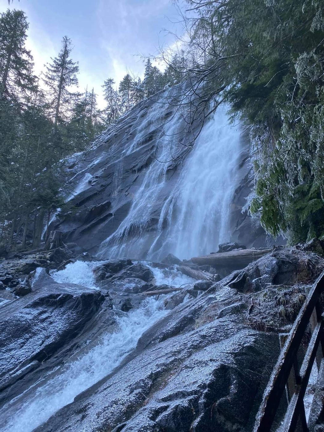
Bridal Veil Falls; The majority of elevation gain is on the Bridal Veil trail turnoff. This time of year it is icy and snowy on the trail (make sure to have microspikes for added comfort on your descent). If doing both trails, the falls is an extra mile with an extra 427 feet elevation gain (the majority of this is in .5 miles). There are lots of stairs and several stream crossings, but the view is worth it. Close to the falls is wet and icy so bring rain gear if you want to get close. Would not recommend for young children as it is steep and the above reasons.
Lake Serene; The majority of elevation gain is before the lake in 2 miles and in the middle of the hike. The last 2 miles of trail to the lake is narrow. There are several creeks to cross without bridges, although I thought the worst one was up on the ridge. Lots of stairs and rocky. the first 2 miles is nice and steady elevation gain. There is snow and ice on the trail this time of year (make sure you have microspikes, the descent will be much more easy, trekking poles are helpful as well). The snowy views of Index Mountain from the lake are well worth the journey, even if the lake is frozen over. We did the falls and then the lake, 7.93 miles with 2427 feet elevation gain.
Comments