

Summary: This trip report covers both Ashland Lakes and Twin Falls Lake beyond. If you want to escape the crowds of Mtn Loop and have a little adventure, check out this trail!
I wanted to do an "easy" hike because I hurt my back earlier this week, but it turned it to more of a scramble/bushwhack than I'd anticipated!
First of all, note that the road is awful—easily the worst I've seen in Washington. Definitely need a Jeep or similar rig to navigate. And it's slow going!
Also, make sure to bring your Discover Pass. I didn't realize this trailhead was owned by DNR! Sort of confusing to remember a separate pass but whatever.
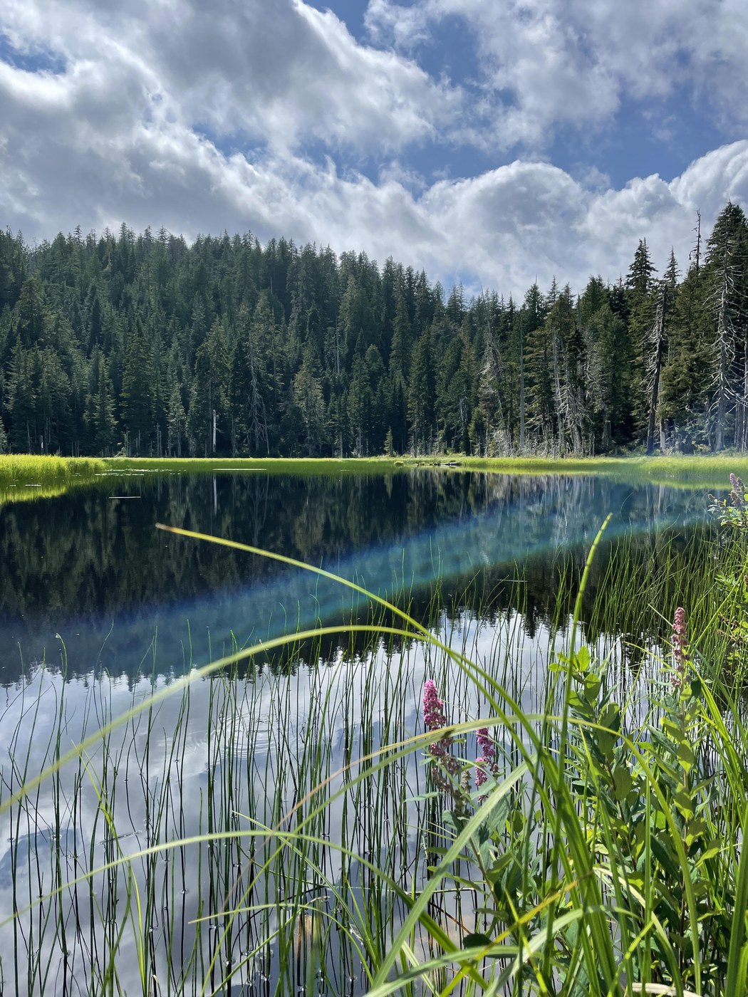
The trail to Ashland Lakes and Beaver Plant Lake is in good condition. Lots of nice boardwalks prevent your feet from getting wet. The lakes are quaint and quiet, with very dark mysterious water.
We had read a comment on another trip report mentioning that an unmaintained trail continues beyond Lower Ashland Lake for another mile or so to another lake with some really neat waterfalls. Thought this sounded like a doable way to make the trail a little more interesting. If you are looking for more of an adventure than just the main lakes, this is a great option that offers LOTS of solitude compared to the rest of mountain loop highway! We only saw one other party on the main trail to Ashland Lakes, and once we got beyond the end of that trail we saw no one else all day.
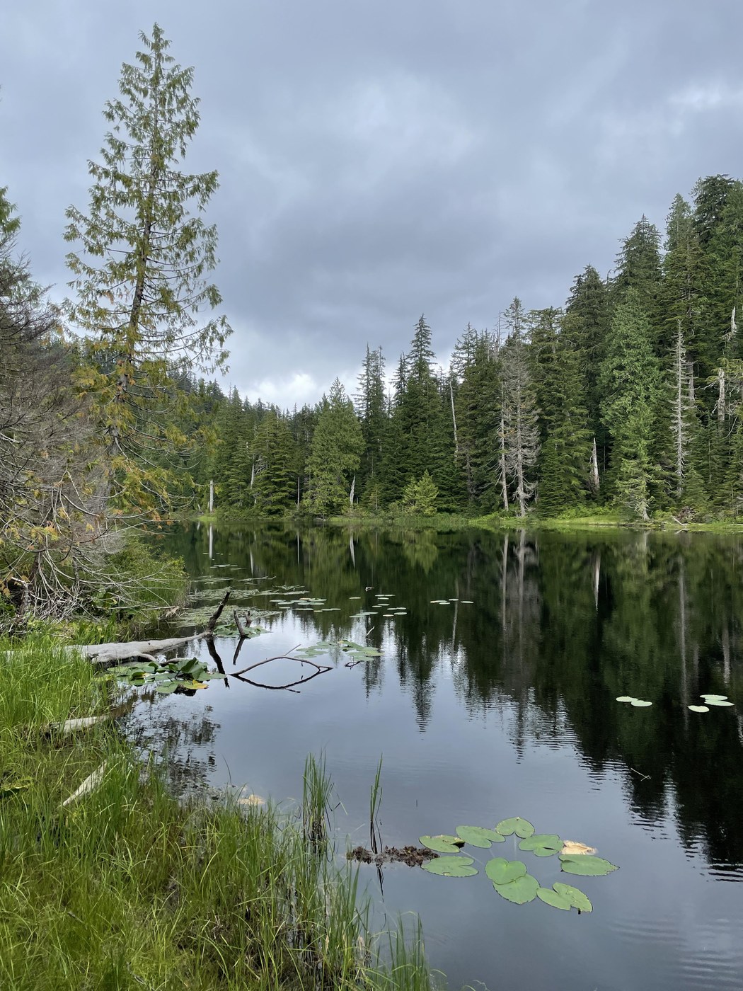
The boardwalk from Lower Ashland Lake continues on and begins to descend a bit into another draw. You'll cross a creek over a large (and slippery) log after a couple minutes, and at this point the boardwalk planks start to peter out. If you plan to try and reach the falls, please make sure to have a topographic map of the area so you can orient yourself. Though the trail is fairly obvious in most spots, it can be quite overgrown and is not maintained. There are several blowdowns that cause the trail to divert which is where you may get confused. There is quite a bit of flagging to mark such spots which is very helpful. It can be steep in some spots, and very rocky, so be prepared for rugged conditions. According to CalTopo Twin Falls Lake is another mile from Lower Ashland, and according to Craig Romano's Day Hike NOCA it's an additional 1.5 miles, though it feels longer than either of these because of the difficult nature of the trail. It's slow going. Though eventually you'll reach a signed creek near a cliff edge, marker "Twin Falls Lake campground". Turn right here to reach a nice rock slab to sit on for lunch and enjoy the view of the falls. The Lake and falls felt a bit creepy to me, having a bit of that abandoned ghost town vibe. It's a really neat spot though and worth exploring! I'm not sure why this section of trail is no longer maintained.

Comments
Don Gerald on Ashland Lakes
Thanks for the info on Twin Falls Lake! Its good just to see a picture of it again. I used to come here when both road and trail were in far better condition, and I always felt that Twin Falls Lake was the only really good reason to do this hike. In its current condition, it should only be attempted by experienced hikers who are not easily disoriented.
Posted by:
Don Gerald on Aug 21, 2021 07:50 AM
tinyhousebigwoods on Ashland Lakes
Absolutely, anyone who ventures here should be prepared with map and compass. We were able to stay on trail the whole way without using our compass but I can imagine someone losing the trail fairly easily if they weren't paying attention.
Posted by:
tinyhousebigwoods on Aug 21, 2021 09:32 AM