Overview:
A buddy scored a Stuart Zone permit so a group of us spent two nights at Lake Stuart. On the middle day we day hiked up to Colchuck Lake and into the Core Zone of The Enchantments via Aasgard Pass.
23 miles total (Day 1: 5 miles, Day 2: 13 miles, Day 3: 5 miles)
6200' ascent
GPS route below
Road In/Parking:
The road into the Lake Stuart TH is not too bad. A little washboarding and some potholes, but nothing too crazy. Most cars could make it no problem in dry conditions. There is some exposure at the edge of the road, so drive carefully. We arrived around 8:45 am on a weekday and found many spots open in the lot, but filling up quick. We snagged an "overnight pass only" spot. I believe new this year, they have opened up climber's right side of the road in to parking, so parking shouldn't be too much of an issue except on the busiest weekends in Summer.
Trip Notes:
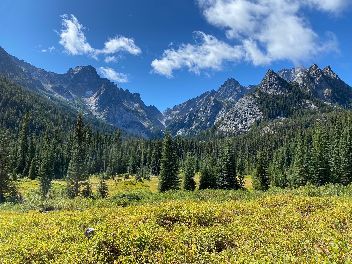
The climb up to Lake Stuart from the TH is in two equal length, but distinct sections, before and after the split to Colchuck Lake. The first half is pretty smooth and not too steep until after the bridge across Mountaineer Creek. It then climbs up relatively steeply to the turnoff to Colchuck. This first section is a relative highway compared to the next. After the split, the crowds decrease significantly and the trail smooths. About halfway to the lake from the split, you cross an amazing meadow with a great view of the whole Stuart cirque (pictured) of Mount Stuart, Sherpa Peak (look for the Sherpa balanced rock), Argonaut Peak, and Colchuck Peak. Mountaineer Ridge also is prominent here underneath Mount Stuart. There was a ton of avalanche destruction on the way up to Lake Stuart. Three distinct sections of pulverized trees, clearly a couple large avys ripped down the South slope of Axis Peak, North of Lake Stuart. These were not here when I did this hike June 2020. There was a very pretty birch or aspen groove that got 90% destroyed. Very sad to see. In one section the avy ripped easily 100 ft past the trail, so think twice about doing this hike as a snowshoe in dangerous avy conditions. No snow debris left from the avys however.
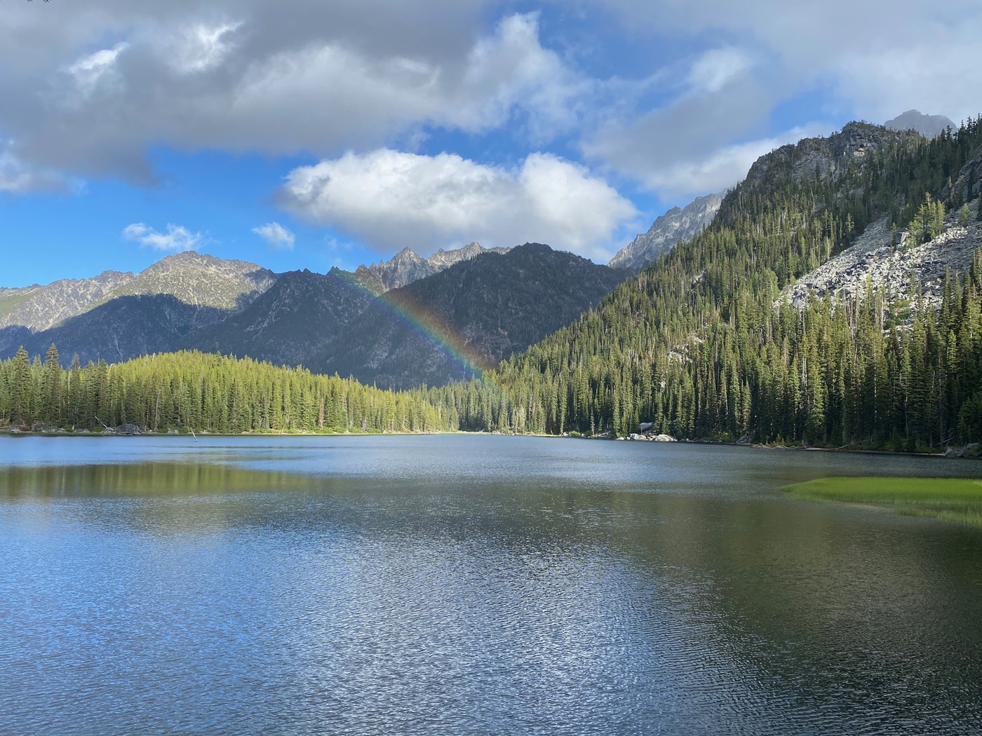
We hiked to the far side of the lake where there is a large rock that sticks into the lake and camped here. There is a lot of space at this site, probably space for 6+ tents. Our group's 4 tents fit just fine. Lots of fish here and they were biting, but mostly <1'. We saw otters and deer came into our camp! The deer and (many) chipmunks all were very acclimated to humans unfortunately. Not too many chipmunks at this site, but many on the trail up and all standing on their hind-legs begging for a hand out - please Leave No Trace and do not feed the wildlife. Pretty much no bugs. I saw two the whole trip, zero bites. We did not venture further up the trail to Horseshoe Lake, but saw some people coming from and they said it was an "obstacle course" of blowdowns.
In the morning we left our camp and headed toward Colchuck Lake. After the turnoff to Colchuck lake you immediately have to cross a creek via bridge then (somewhat exposed) rock hop. Easy to do, but a fall would hurt. Kind of surprising for such a popular hike. In comparison to the very smooth and well graded Lake Stuart trail, the Colchuck Lake trail is very rooty and rocky. Much steeper too as you climb to the lake. Throughout the hike up you are presented with many overlooks of the Mountaineer Creek drainage, looking both towards Lake Stuart and towards the TH. Arriving at Colchuck Lake you are presented with an amazing view of the lake, Dragontail Peak, and Aasgard Pass. We stopped here for a snack and then continued around the lake toward the pass. There are many beautiful campsites along this shore and it would be a pleasure to camp here. Eventually you come to a boulder field to the SW of the lake you must cross. Rock hopping here is a little sketchy and, honestly, I felt more dangerous than climbing Aasgard Pass. Also, unexpectedly slow going. At the South end of the lake there is a beautiful white sand beach. Here we left some of our group as the remainder began the ascent of the pass. At first it is not too difficult, rock stepping through talus. Eventually the slope transitions to scree and dirt. There are many cairns to show the right way, but there are many braids to the trail so it is somewhat "choose your own adventure," with some trials more optimal than others. Looking up at the pass there is a tree band in the center. Aim for the climber's left side of this tree band. Arriving at the base of the tree band is about 40% of the way up. The slope here quickly steepens and you transition from class 1 to class 2 scrambling. I stowed my trekking poles at this point and started using my hands more. Gloves would help. We saw two goats in the tree band as we passed. At the top of the tree band you are about 60% of the way up and you begin to go through a cliff band. There are two streams/waterfalls here. Cross the leftmost stream but do not cross the rightmost. Staying between the streams will give you the easiest way up. Going on the outside of either you will have to climb (class 4/5) cliffs. Staying in the middle of the streams it stays class 2 and 3. There are some trees in this section too. This section is where the scrambling gets most difficult. Going up there were two areas where class 3 moves were necessary. However, upon getting up and looking back I noticed that I could have bypassed these cruxes by a trail braid I did not see earlier (I took this option when headings down). Soon the gradient begins to smooth an you come to the top of the pass. From base of pass to the top it took us 1.5-1.75 hours. We then continued into the core zone which is flat/rolling hills and many gorgeous lakes. We saw only one other person up here and many open spots. It is a beautiful moonscape up here with many hanging glaciers and calm lakes. We could definitely feel the elevation in our lungs. We passed Isolation Lake and stopped on the next hill for a snack. It was past 5 pm at this point and we started heading back. Heading down the pass was nearly as tough as going up and quite slow. It took us 1-1.25 hours to descend to the lake. We saw more goats, pikas, and marmots on the way down. We picked up the remainder of our group and began our hike around the lake, down the trail to the split, and back up to Lake Stuart. We planned poorly and darkness set in on us halfway down from Colchuck to the split. Only 3/5 of our group had headlamps on them so going was slow. The long hike in the dark back to Lake Stuart was definitely an experience. Fortunately no one was hurt and we saw no cougars. At the meadow on the way up to Lake Stuart, we stopped and turned out our lights for a bit and looked at the stars. Amazing. It was a moonless night and the Milky Way was very deep and colorful. Returning to camp we were so tired we went to bed without dinner. It took about 12 hours round trip to go about 13 miles with ample breaks thrown in.
Waking up the next morning quite sore we packed up camp and hiked back to the TH. We saw a ranger at the split who was checking permits. He had been on fire duty for the past month, sounds like very tough work. Much appreciated! Many people heading up as we headed down. The rest of the descent was uneventful. Overall, an amazing trip and would love to snag a Core Zone permit one of these years (who wouldn't) or thru-hike the whole Enchantments in a day next summer.


Comments
Just a hiker on Lake Stuart, Colchuck Lake, The Enchantments
Terrific trip report. Looks like you had excellent weather for excellent photos.
Posted by:
Just a hiker on Sep 05, 2021 11:04 AM
Rhabbie on Lake Stuart, Colchuck Lake, The Enchantments
Thanks! Weather was great!
Posted by:
Rhabbie on Sep 05, 2021 02:54 PM
seattlenativemike on Lake Stuart, Colchuck Lake, The Enchantments
Great shot of the Dragontail alpenglow
Posted by:
seattlenativemike on Sep 05, 2021 11:07 AM
Rhabbie on Lake Stuart, Colchuck Lake, The Enchantments
Thank you!
Posted by:
Rhabbie on Sep 05, 2021 02:55 PM