This is a trail best when the avalanche risk isn't too bad but with enough snow to cover all the loose rock, and cold enough that it doesn't entail too much trail-wading. Unfortunately we'll need more snow to achieve those conditions.
The snow is spotty to a bit past the intersection with the Great Wall trail. I put on spikes shortly after the stream crossing as a previous trip report suggested, but took them off again shortly after as the snow had mostly melted away. I didn't try putting them on again until perhaps 0.25mi past the intersection with the Olallie trail/pond (~3600'). Shortly after that I left the Mt Washington trail, traveling slightly east of due south, aiming for the south ridge of Change Peak. This worked perfectly - a nice even grade on firm snow, though the last few hundred feet was steep enough that I was glad to have my ice ax. The clouds were just starting to thin.
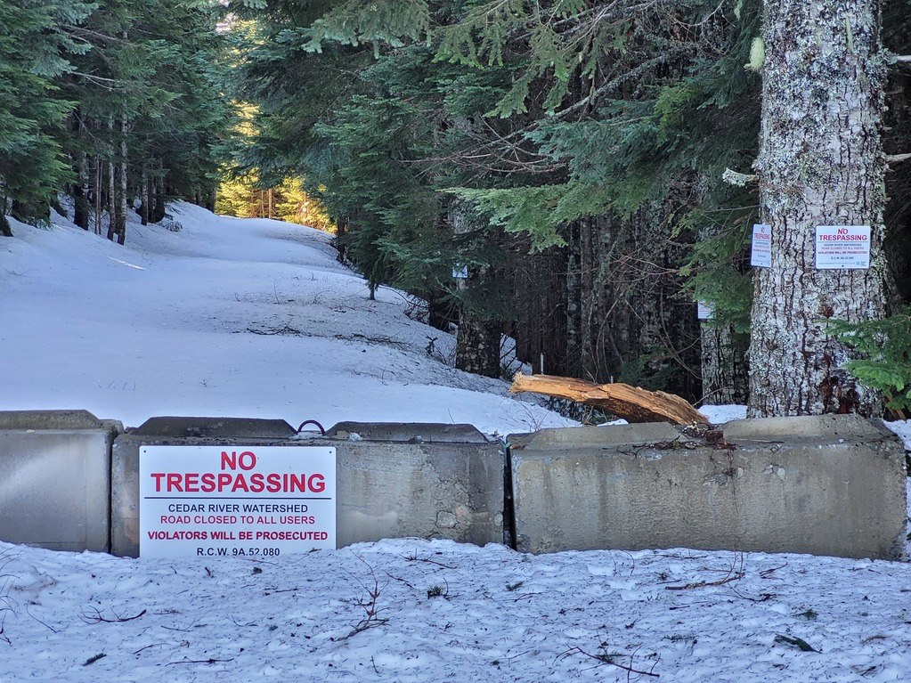
I put on my snowshoes, planning on taking the roadway to Greenway. Most previous trip reports for Greenway don't mention it, but this road travels through the Watershed. So while Greenway itself is not in the Watershed, it seems that nearly a mile of the roadway to it is. Disappointed, I turned back to Washington.
The snowshoes didn't really help all that much. In fact, there were stretches of Washington's south ridge that were thin or even completely bare of snow. The summit itself has several feet of snow. And views were getting better with the minute. There was a modest breeze.
The descent from Washington down its east face was on a narrow hard track that made me grateful for my spikes. On the 4th switchback, rather than continuing down the trail I investigated going down the NE ridge. There is a dotted track shown on Caltopo, and I had heard of an old trail supposedly following this ridge. However it seemed far steeper than I expected from the topo maps. Worse, there are numerous rocks faces/cliffs along the way that made it quite challenging, at least towards the upper end. Eventually I found what seemed to be a channel through the tangled brush and trees that worked almost to the Olallie trail. The final part was once again quite steep, forcing me to back down the slope. This whole stretch would have been impossible to do safely without my ice ax. It was much more difficult than the route I'd taken getting up to the Change Peak ridge.
The Olallie trail quickly led to the main Washington trail, so the remainder was simply a matter of careful footwork on the loose rock, wading the trailbed streams, and getting over/under/around the downed trees {most of which are near the trail start point - they become less frequent with altitude}.


Comments
kidz won't hike on Greenway Mountain, Mount Washington
Those concrete blocks are new, as they were not there last winter. That is a huge bummer as it was a nice snowshoe over to Greenway and you could even make a loop of it. Before you could walk the road as all of the watershed signs were on the right hand side of the road going over there.
Posted by:
kidz won't hike on Feb 11, 2022 07:42 PM
Alex's Dad on Greenway Mountain, Mount Washington
My photo cuts off the leftward view - there were many signs on the left/upward side of the roadway beyond the blocks :(
Posted by:
Alex's Dad on Feb 12, 2022 09:42 AM
Dream Delay on Greenway Mountain, Mount Washington
Thanks for the update as I was headed there today. Plan B.
Posted by:
Dream Delay on Feb 12, 2022 07:15 AM