
Highway 123 is now open, so I decided to head into the mountains for a Memorial Day hike. I wanted big trees without the hassle of snow - the MRNP ranger said that the snow level is around 4000ft, so I decided to hike the Eastside Trail. For the most part, it was exactly what I needed!
Quick details:
- I only went to Ohanapecosh Falls, so I do not know conditions beyond that.
- Grove of the Patriarchs Trail is still CLOSED (bridge damaged)
- Trail is 90% snow-free, only the last 1/4-mile before Ohanapecosh Falls had some patches, nothing dangerous
- Several blowdowns along the way, only 2 were a big hassle
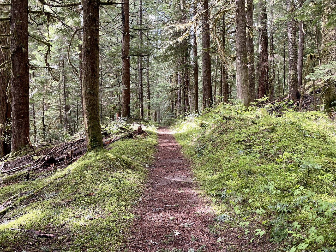
This is such a great trail - you can go as far as you want, it's a slow incline so good for all ages and abilities, it has some variety (including several stream crossings and waterfalls), and it's usually in pretty good shape.
I drove over White Pass, then onto Highway 123, past Ohanapecosh CG, turning onto Stevens Canyon Rd. The road is closed, but you can go through the gate and park at the trailhead. The nice bathrooms are still closed, but the pit toilets are open and stocked. There are several signs reminding people that the Grove of the Patriarchs Trail is still CLOSED due to the bridge damaged last November. But the Eastside Trail is open.
I started at 6:50am, it was 50 degrees and misty/drizzle. Most of the hike I was in short sleeves and a hat. Warmer layers were nice when I stopped for breaks. You could easily trail run this as well, but I liked having sturdy boots and poles. It rained some along the way, but I stayed relatively dry in the trees. Some sunshine on the way back, which was a nice bonus.
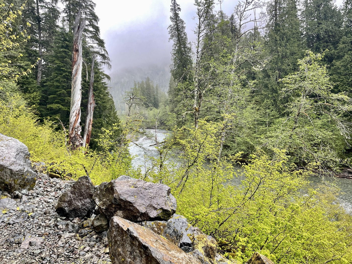
At the turnoff for the Grove, there's a big sign blocking the trail saying YOU SHALL NOT PASS (my translation). I stayed left on the open Eastside Trail, meandering through big trees, the river my constant companion. This trail parallels the highway, but I only heard cars once or twice, it was never a distraction.
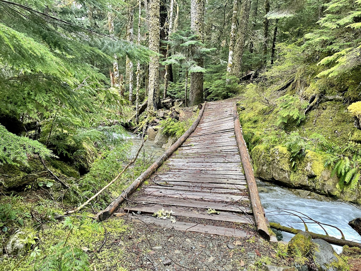
There are some fun bridges to cross - they were a little slippery, so be careful. One bridge was definitely in need of help, it was sloping to one side and had no railings. You can see this in the photo - but it slopes down more than the photo lets on. If it had been a little more slippery, I would have felt uncomfortable crossing it, especially the middle part. Again, poles and boots helped here.
About a mile from the TH, there's a giant tree blocking the trail. I made the mistake of going right (downhill from the trail) - I could easily step onto the log that way, but on the other side, I jumped down to what I thought was solid ground, but turned out to be a snag of branches, and one leg punched through to past my knee. It could have been a lot worse, I was lucky. On the way back, I went around the tree on the uphill side - that was better, but still required some finesse. Except for that one tree, the rest of the trail is in pretty good shape - solid underfoot, often covered with pine needles or leaves, not too many roots.
The last 1/4-mile before Ohanapecosh Falls was where conditions were more challenging. Some mud, some patches of snow on the trail - I never felt in danger, but it was a hassle punching through crust to the trail six inches below. There was another blowdown that was a giant mass of branches - if you follow the left (uphill) edge of the pile, you will eventually return to the trail. Again, at times you are walking on some branches, so be careful with each step.
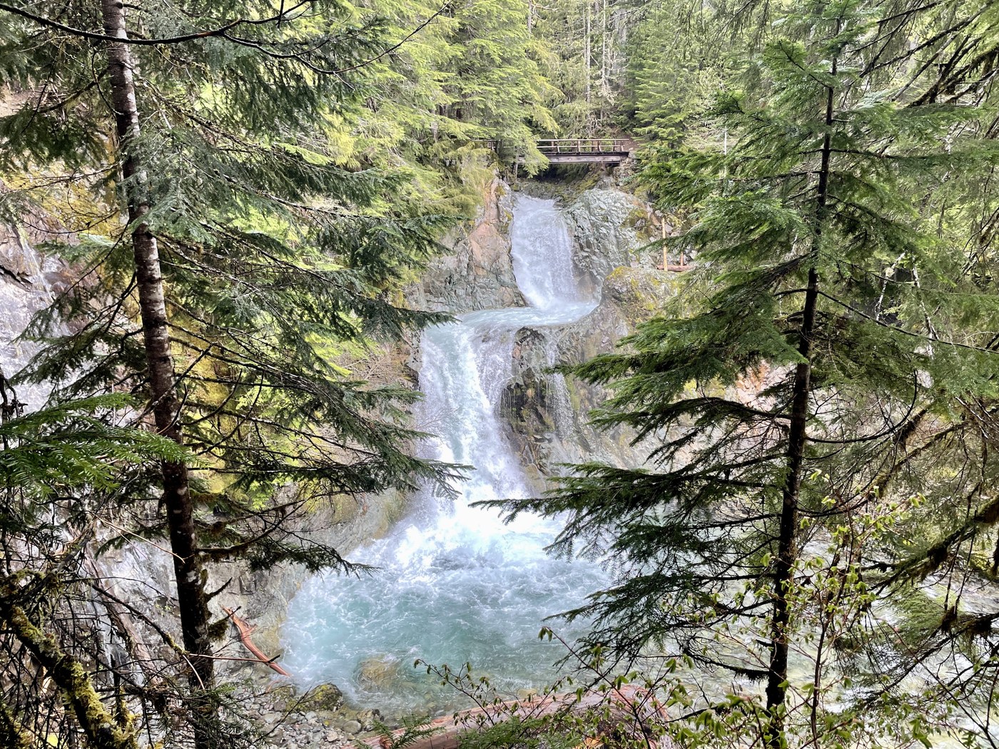
Eventually I made it to Ohanapecosh Falls - sat for awhile on a log, resting and enjoying the view. After 20 minutes, I headed back. I was going to go another mile further to Stafford Falls, but I didn't want to deal with more snow or blowdowns, so back I went.
I only saw people near the trailhead, the rest of the time I was alone with the birds and squirrels. Total of 7.8mi round trip, 670ft elevation gain. Started at 6:50am, back to the car at 10:20am. Even leaving that early, I still got stuck in a loooooong caravan of RVs heading back over the pass - oh well, it was still worth it 100%. Grateful to be in the big trees today.
Comments
Love this trail! Plan to head over there this week; thanks for the intel!
Posted by:
glucas on May 31, 2022 01:09 PM
Thanks All, for your fine report. This is the perfect trail for this time of year. Blowdown situation doesn’t sound quite as bad as it does some years.
Posted by:
Paul At Rainier on Jun 06, 2022 11:24 AM