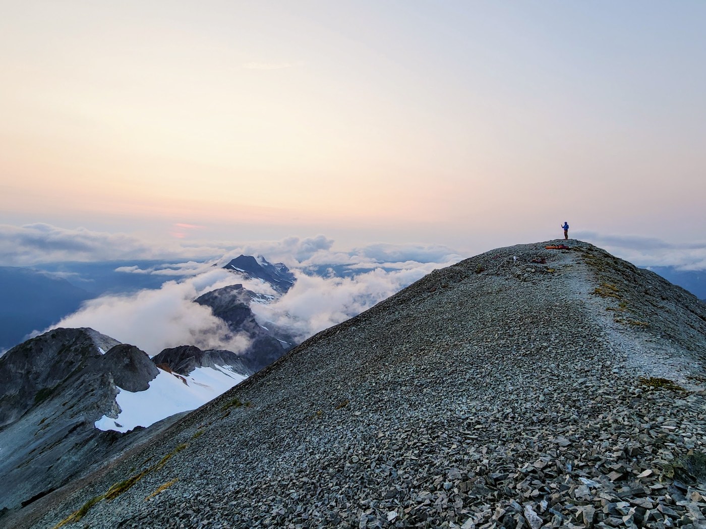
Overnight climb of Ruth Mountain and Icy Peak, with summit bivy on Ruth.
RED TAPE: The summit of Ruth Mt lies within the North Cascades National Park and a permit is required for overnight stays. I was able to pick up a permit for the Icy Cross Country Zone the day prior to our climb in the Glacier ranger station. $10/person + $6 fee.
ROAD/TRAILHEAD: Lots of surprisingly deep potholes, but passable with care. A bit of clearance will make life easier, of course. The parking lot was surprisingly busy even at 6 a.m. on a Saturday! There was an outhouse a short way down the trail - there was TP available when we exited on Sunday. Blue bags were also available at the trailhead, as you need to pack out your poop from the alpine!
HANNEGAN PASS: This section of trail was in good shape, fairly mellow and had several easy water crossings. We topped up water at the stream near Hannegan Camp as the ranger had told us it was the last reliable water source.
RUTH MOUNTAIN: From the pass, we headed right on the trail towards Ruth Arm and Ruth Mountain. We went up and over a bump, before beginning a rough climb up a slippery, loose rock and root gully that involved some scramble moves and veggie belays. Fun!
We topped out of the gully where there was a small meltwater pool - the last liquid we'd see for a while - and began an easy traverse along a picturesque trail along Ruth Arm. The boot path eventually turned into rock-hopping, and we picked our way to the edge of the snow to get on the glacier.
There were several campsites along the Arm which would eliminate the hassle of getting a permit, but no running water or easy snow access (until closer to the glacier).
The Ruth glacier was in good shape - we saw just one small crack near the boot path. Our journey up was uneventful, and we soon topped out on the rocky summit where we claimed the bivy sites.
We spent the afternoon setting up camp, scoping the route to Icy and melting snow for water. Clouds rolled in and out, making for whiteouts at times, moody, dramatic PNW views at others, and a very soggy overnight bivy situation!
ICY PEAK: We left camp at around 6 a.m. and dropped down the loose, rocky boot path into the basin below. From there, we traversed over snow towards the top of what we had heard referred to as the "Death Gully". We down-scrambled the gully and didn't find it too bad, as there were solid holds in between the loose stuff. Just don't kick said loose stuff on anyone you care about!
Rumor has it that there is a bit of a boot path on the left that avoids the gully scramble though, should you prefer to do that.
Once we got to the bottom, the route became mostly a pick-your-own adventure scenario through some very time-consuming rocks and boulders, for the most part. I imagine this goes a lot faster when snow-covered! We rock-hopped slowly and painfully to the edge of the glacier to gear up.
This glacier was also in great shape with no visible cracks or crevasses anywhere near the route. We hugged the ridge to ascend before doing a rising traverse to the saddle, where we dropped some gear. There was still some snow to cross on the backside, and we headed up some scree and steep-ish snow to the base of Icy's NW summit block.
The class 3+ gully scramble went fairly smoothly - there was one cruxy section midway that was a bit slabby underfoot, but we all eventually made it through after some initial hesitation. From there it was straightforward to the top (yes, I know it's not the true/highest summit of Icy but that's ok...)!
We ended up sharing the summit with another group of 5, so we amazingly had 10 people sitting on top of a sheer rocky peak for a while. Clouds rolled in and out, but sadly never cleared completely to give us a good view.
RAPPEL STATION: There was a rappel station set up at the top of the gully with multiple pieces of webbing and rap rings. We used a 40m rope, with all except one of us doing a full, single-rope rappel. Our most experienced climber then did a double-rope rappel so he could pull the rope. This got him just past the crux section, and he down-climbed the rest.
From there, we headed back the way we had come, trying to stay on snow longer on the descent to avoid as much rock-hopping as possible. Re-gaining all the elevation we had lost dropping down from Ruth was definitely rough on the legs, but we made it back to camp and out to the trailhead without any issue.
We did cross several running water sources from snowmelt on the return from Icy towards Ruth.
WANT MORE PHOTOS? Follow along on instagram @thenomadicartist :)


Comments
Terp0326 on Hannegan Pass and Peak, Ruth Arm, Ruth Mountain
Did you need crampons for the glacier to Ruth or would microspikes be fine?
Posted by:
Terp0326 on Aug 09, 2024 12:55 PM
thenomadicartist on Hannegan Pass and Peak, Ruth Arm, Ruth Mountain
Depends on your comfort level. I personally prefer to have crampons on a glacier, but several recent trip reports stated they just used microspikes and were fine. Pretty sure I saw one person without any traction too...
Posted by:
thenomadicartist on Aug 09, 2024 01:33 PM