This one is often included in Top 10 lists of best WA hikes, and I have to agree. The road there is long and the climb can be steep at times, but the view at the top is unmatched regardless of season. But I'm getting ahead of myself.
For starters Forest Road 26 isn't too bad really, with just the usual potholes and washboarding here and there. But it's looooooong... nearly 26 miles to the trailhead from Highway 530. Budget well over an hour just to drive this stretch. The last six miles also climb steeply uphill and are a bit too rough for sedans IMHO. We finally reached the trailhead just a little after 9:00am, and there were 8 other cars parked there. The small pullout was full so we became the first to begin parking along the road. Others soon arrived and did the same as we began our ascent.
The weather was about perfect, mostly sunny and a little cool but comfortable. The first part of the hike is 1.5 miles through VERY old second-growth, with a few massive old trees still standing here and there. The grade is constant but easily manageable due to the excellent tread. After the forest you pop out into the open slopes, and from there the views begin.
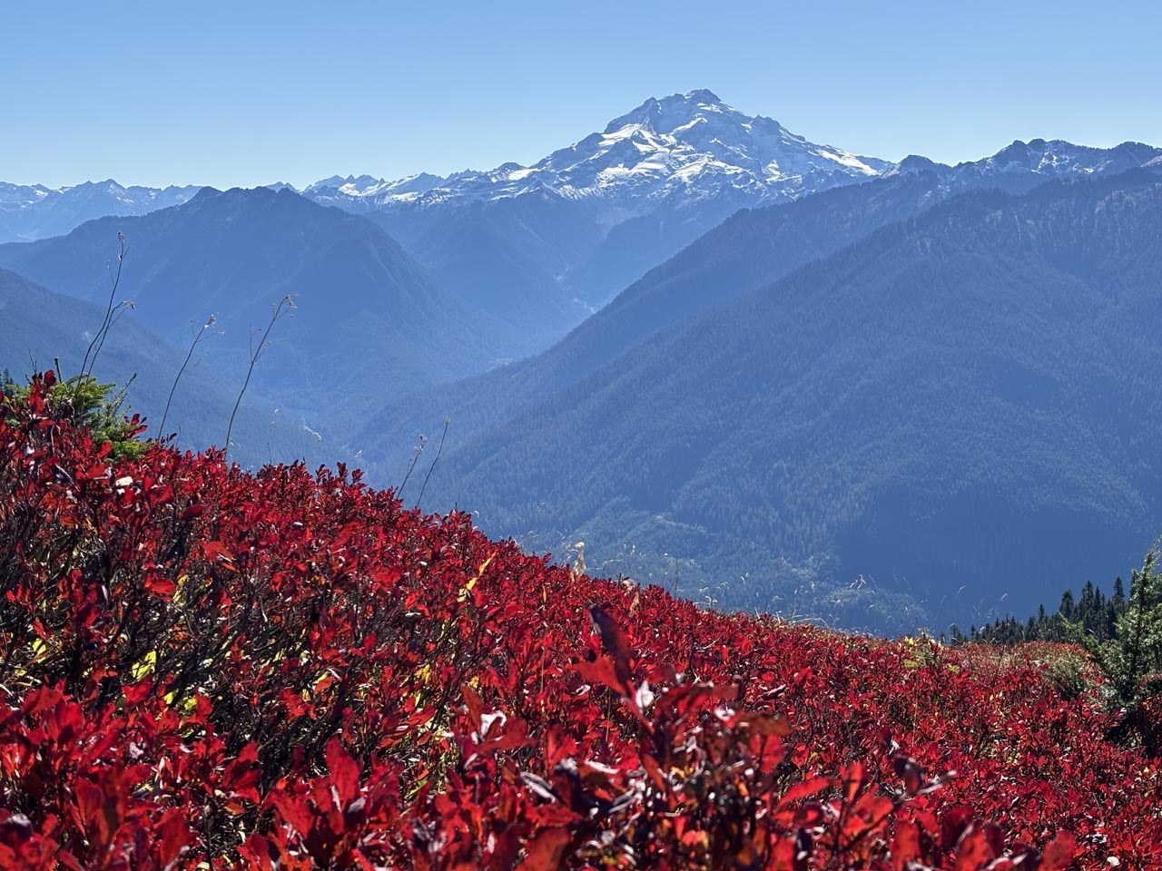
The lower section is a little brushy but there are still some wildflowers hanging on, although the maples are all changing color. Higher up the maples and ferns give way to a true alpine paradise, with meadows and slopes full of fire-red huckleberry bushes, pikas squeaking among the rocks, and the occasional crystal-clear tarn. Beyond the meadows the true workout begins, with a very steep last mile worth of switchbacks to the lookout. Fortunately the tread is firm and even, if a bit slippery in places.
Perhaps the greatest show-stopper (for me at least) is the up-close view of Glacier Peak sitting just beyond the valley below. Second prize goes to the view of Mount Baker and Shuksan not too far off to the northwest, followed by the impressive jagged peaks of the North Cascades directly north and northeast. It took us over three hours to reach the top, partly because of the steepness of that last mile but also due to the constant breaks to snap pictures.
The lookout itself has the walkway missing on one side, so folks need to take turns climbing onto it. There was enough room at the top for several parties to sit, eat lunch and admire the 360-degree view, which I think we all agreed we wanted to take home with us. Curiously there were lots of ladybugs at the summit flying around and landing on everybody. That was it for bugs however. After about a half hour my friend and I reluctantly started to head back, and the descent was pretty uneventful aside from yet more breaks for pictures. We finally made it back to the trailhead around 3:30pm, and by then there were 18 vehicles total parked there.


Comments