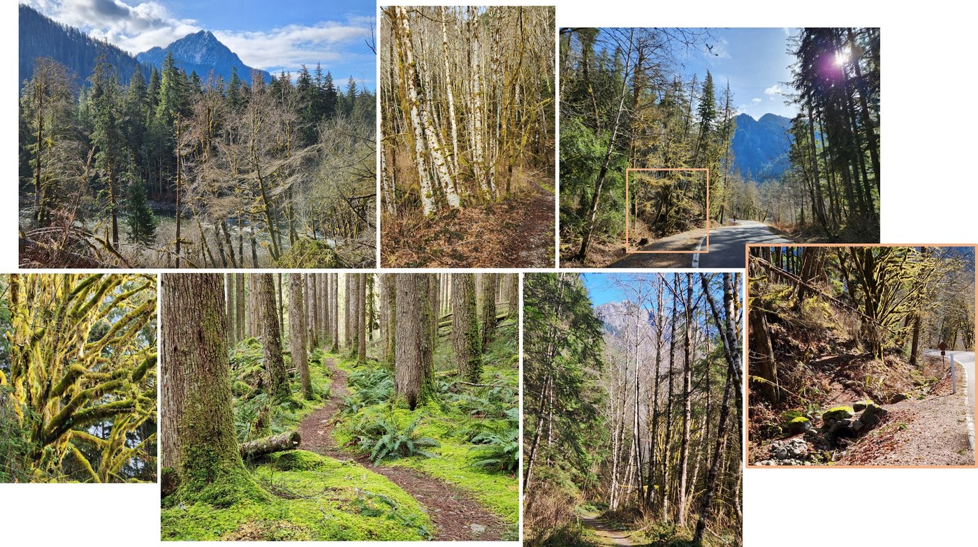
One doesn't hike this trail for panoramic views or gorgeous waterfalls. But if you like gently rolling and winding trails, with moss covered trees and rocks catching the dappled sunshine filtering through the trees, with lichens, fungi and ferns (guilty as charged) then this might be a good choice. These woods are famous for the collection of moss on the trees (especially the maples) that makes them look like giant stuffed apparitions.
The trail starts at the Middle Fork trailhead just on the other side of the access road. I got there at 8:15 AM (early for me), missing much of the morning rush hour. The single pit toilet was shabby, but relatively clean and stocked. The lot was nearly empty, but then it was a Friday morning. On the trail before 8:30.
The trail warms up nicely on the level, with an immediate immersion in green moss. After passing the campground on the right and a couple of switchbacks it intersected the CCC road heading off to the left. The road climbed gently, passing through a nice alder wood for a while where I enjoyed the early morning sunshine on the white tree trunks. The elevation gained here paid off. Once I entered the coniferous forest the trail mostly wound around on a level, with minor dips and rises. The ground is covered with mosses of many types with ferns popping through the moss and many red huckleberry bushes, still several weeks from leafing out. Old man's beard (actually a lichen) hung from branches, sometimes glistening in a patch of sunshine. I saw no flowers (still winter) and just a few birds. Oftentimes I hear the pretty song of the Pacific Wren, but they are very elusive. This time I caught sight of one who was intently watching me while alerting everyone of my presence.
The map shows two "dangerous stream crossings" along the trail. Last time I was on this trail we were stopped by the first swift stream at about 2.4 miles from the parking lot, choosing to turn around there and eat lunch next to the water. The flow was moderate today and I noticed that several large rocks had been strategically places to hop across. It was easy to cross today (using my poles for security) but may be very different in the middle of a heavy snowmelt event. The second crossing, about a mile further on, was dry today. There was water running under the rocks.
I followed the trail to its end point on the middle fork road about a quarter mile west of the Lower CCC Road trailhead which has a small parking lot. There is a large curve around a rock outcropping separating the two trailheads. The one for the upper trail is hard to see from the road so I included a picture showing it closer.
Totals for this trail were 7.6 miles round trip and just under 800 feet gained. I was back at the car about 1:00 which allowed me to miss the afternoon rush hour going home. Bonus!


Comments
M.J.B. on CCC Road: Upper Trailhead
Wow what a great detailed trip report! Nice work. Love especially the pictures with even the appropriate rocks marked to cross the stream. Love your references to the mosses as well. Again, very nice job. MJB
Posted by:
M.J.B. on May 07, 2025 12:36 PM
GoodKarma on CCC Road: Upper Trailhead
Thanks. The report is not very current, of course, but I think the moss and lichen are always enjoyable. Soon the red huckleberries will be ripe. Enjoy.
Posted by:
GoodKarma on May 07, 2025 01:39 PM