Background: Hikes up Wolf Creek in 2015 and 2017 were rewarding because they featured an interesting mountain river, spring flowers and nice autumn colors. Both of these hikes ended at the North Fork of Wolf Creek – about 2.70 miles one way (see Figure 1). What was further up valley and what had the Cedar Creek Fire of 2021 done to the Wolf Creek Watershed; these questions suggested a hike that would go further than 2.7 miles. This watershed is framed by many peaks over 8,000 feet and graced by several spectacular subalpine meadows.
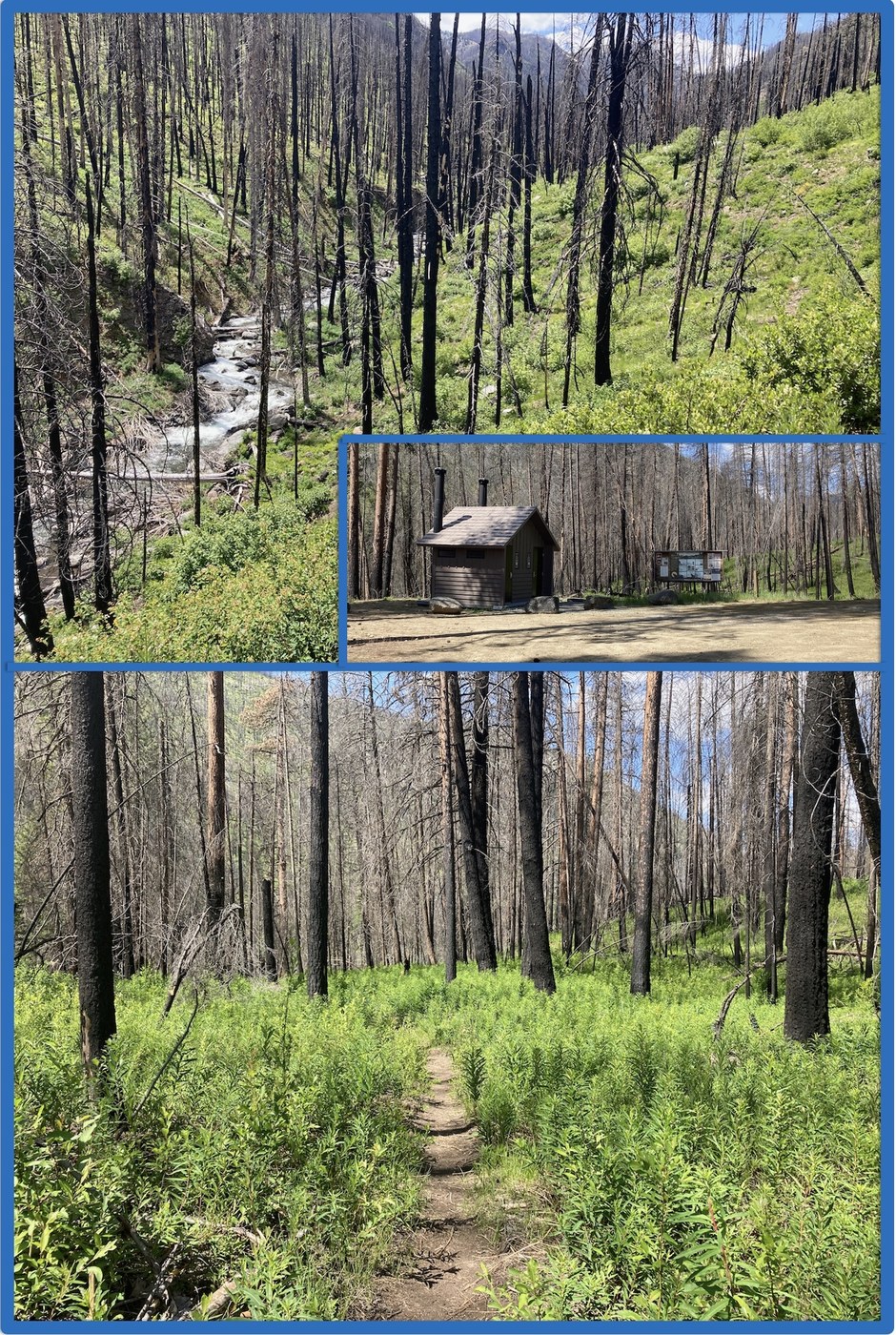
Approach: Wolf Creek Road from the Twin Lakes Road and USFS Road 5505 over Virginia Ridge take one to the Trailhead parking area (2950 ft) and Trail #527. As one gets higher and higher on the road over Virginia Ridge, the evidence of the 2021 fire and its impact increases. As one drops to the trailhead, one is submersed in almost completely burned forest (including the destruction of the former facility and corral). These have been replaced and done well.
The Trail: Begins next to the facility and trail signage and enters what was once a forest. As one descends there are occasional groups or individual survivors. There is evidence of clearing since the fire, but also evidence that the windstorm of Sunday has knocked over two large, fire killed trees. The trail drops about 250 feet vertically and almost reaches the edge of the stream – across the way, there is an irrigation intake diversion. The trail soon starts up and then down (but always less down than up), then again, enters a couple of linked benches where it remains relatively flat, with small ups and smaller down. At ~2.7 miles and 3,087 feet, it reaches the North Fork – one goes 100 feet up stream and there is a wonderful, well-made log bridge. There is a long almost level section, drops a little and then begins the real up. Lots of ins and out of dry and wet gullies, continued significant ups and small downs. As I approached the six-mile point, with no substantial shade since about the 4.7-mile point, with a pattern of only dead overstory trees (if still standing) and robust understory recovery, and with only a pattern of continued ins and outs and ups and down, I turned around. I had left the car at 11:15 and it was 2:30. Going down was easier – had my first real rest and food at the shady forested part near the 4.7-mile up point (wished I had made a formal rest there on the way up). The last up was tough. Reached the car just before 5:00.
The trail is in generally excellent condition with probably a dozen or more logs to cross, some more complex than others. Many covered with lots of charcoal. For mountain bikers (only allowed to the Wilderness Sign) and especially horse riders, several of these are major obstacles. There is a contest between the willow, lupine (in full bloom), fireweed (will be blooming in a week or so), snowbrush and snowberry to see which will crowd the trail the most. Several places seeing the trail was difficult, but clear where the trail was. Wolf Creek was really hit hard by the fire, there are sections where you can count the green trees on just one hand turning a 360-degree circle. The recovery of the understory is impressive. I would not want to be on this trail under high wind conditions. It is difficult to go on any hike in the Methow and either not walking through a fire scarred landscape or seeing one not far in the distance. These fire scarred landscapes are also short on shade, but the vistas can be better.
The stream is a real joy as it was snow melt full, robust on its trip to the Methow Valley, full of pools, riffles, and short falls, and emitted a constant noise only varying by the directness of one’s ears to the stream.
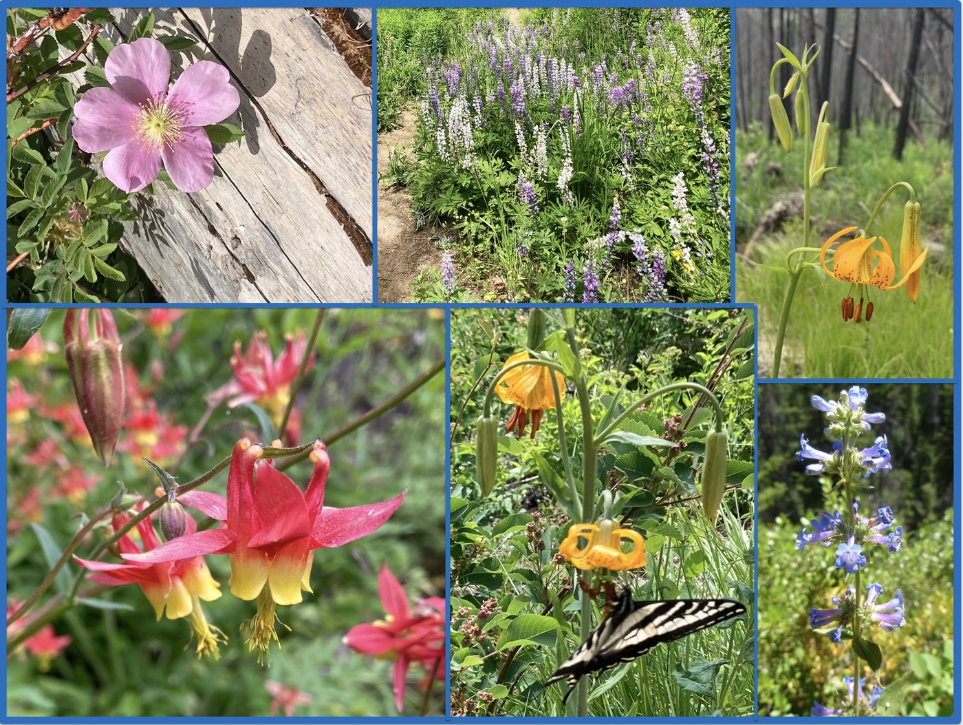
Flora and fauna – fauna were scarce, one native squirrel, one chipmunk, lots of birds, mostly evidenced by their songs, a nice contrast to either the sound from the stream or the wind blowing through the landscape. Deer and elk footprints? The floral displays were spectacular – lupine (silver and purple), snowbrush, columbine, red-osier dogwood, Nootka rose, penstemon, arnica, tiger lily, etc. Snowbrush and rose added wonderful smells to the air.


Comments
Rolan on Wolf Creek
Nice Report! Yes, on the return, that last climb always seems to take forever!
I have a minor correction to your comments. Mountain bikes are not allowed on this trail as it is in the Lake Chelan-Sawtooth Wilderness.
Posted by:
Rolan on Jun 08, 2025 03:15 PM