
We arrived at the Denny Creek Falls / Franklin Falls parking lot at around 10:30 a.m., and there were still a handful of parking spots available. A ranger was actively issuing ticket slips to cars without a valid pass (such as the Northwest Forest Pass), so be sure to display one.
The trail to the waterslide rocks was in excellent condition, and the log bridge over Denny Creek was sturdy. The waterslide rocks made for a perfect lunch spot with scenic views of the creek. Both the small waterfalls and the creek had a strong, steady flow.
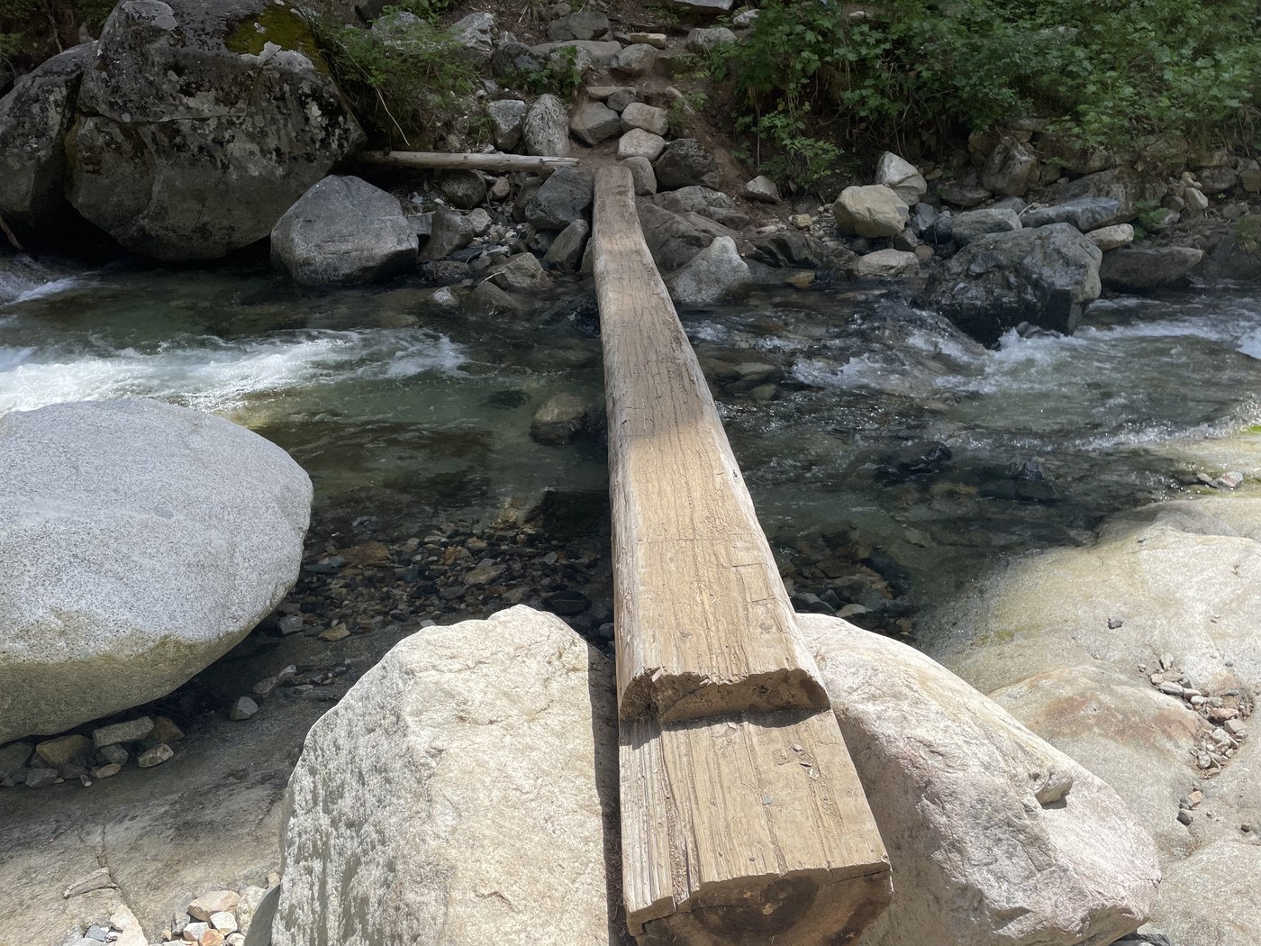
About a mile in from the trailhead, we reached a creek crossing located at the waterslide rocks. There was only a single log with a flattened top to get across—and with the fast-moving current below, it was the only option. Since I am not great with heights, I took my time crossing this narrow log. To make this section for crossing safer anytime, year-round, a rebuilt bridge or simply a much wider, bigger, flattened -top log would tremendously help!
Past the forest, we entered a talus field that was steep and rocky. I had to slow down to navigate the loose rocks. Keekwulee Falls looked stunning against the deep blue sky from the trail viewpoint and had a powerful flow. We decided not to continue on to SnowshoeFalls, as recent trip reports—and hikers we met on the trail—confirmed it is not visible from the trail.
According to my phone’s fitness app, we completed a 5-mile round trip with 853 feet of elevation gain.
The trail to Franklin Falls, nearby Denny Creek, was in great condition overall, though we did notice some litter, including a banana peel and an abandoned stroller that should be removed. By mid-afternoon, the area around the falls had become quite crowded. The rock steps leading down to Franklin Falls were slippery, so sturdy shoes are definitely recommended. The waterfall itself was incredibly powerful—we sat for a while just taking in the view. There were also a few other scenic viewpoints along the trail that offered great spots to stop and watch the river’s strong current. According to my fitness app, the round trip was closer to 3 miles with 407 feet of elevation gain, which is longer than the 2-mile round trip listed on WTA.
Type of Hike
Day hikeTrail Conditions
Trail in good conditionRoad
Road suitable for all vehiclesBugs
No bugsSnow
Snow free

Comments
- Uli on Denny Creek
This crossing log came from a naturally blown down tree on the hillside just above the slides. Maybe at some time in the future the USFS will cut down a suitable tree to build a sturdy 2-stringer bridge, but there are currently no plans. I'm just happy the log wasn't washed away this past winter.
Posted by:
- Uli on Jun 08, 2025 07:55 PM
Charmy on Denny Creek
Thank you for the explanation. Hopefully, a sturdier replacement (crossing log) will be built soon.
Posted by:
Charmy on Jun 08, 2025 08:50 PM