Since it was such a nice weekend, decided to leave after work on Friday for a two night backpacking trip up to Waptus Lake. I planned to camp a few miles in after hiking the first night, camp at the lake on Saturday, then hike out on Sunday.
Road to trailhead: a few potholes after you leave the pavement but nothing too bad.
Trailhead: When I got there Friday evening there were maybe 10 vehicles there. Toilet was open and fully stocked. Very quiet. When I returned on Sunday mid-day parking lot was full. Lots of people hanging out at the swimming hole on the copper river.
Trail: First off be warned, the elevation gain is not really accurate in how I would measure it. It measures the elevation gain between the trailhead in the lake, not the total climbed, and the trail goes up and down a fair bit. It says the trail only has 700 ft elevation, but I measured about 2500 ft elevation gain when factoring in the up and down the whole way. The trail is amazing though. There are a couple deeper creek crossings that I decided to ford, covered below. I didn't see another hiker on Friday evening, and stopped at the campsite just after hour creek. There was one other group there but there is plenty of room to set up another tent and keep plenty of room. There was a back country toilet at this site. Something that I didn't see any mention anywhere is that there is a really cool waterfall you can see right from the campsite. Very worth stopping even if you aren't camping here! Saturday morning I got an early start. At about 6 miles from the trailhead it climbs up to a really nice mountain view up the valley. Right after that it comes back down to the river and there is a beautiful campsite right along the river. We stopped there on the way out and the way back for a short break and to enjoy the river. It was empty each time. I decided to not ford the Waptus River (more on that below) and went to the Quick Creek Camp (no sign of the creek?). No one was there when I arrived. This spot is a great campsite. Big waterfront on the lake with a beautiful beach. Fire ring was there. Several big flat spots to use for a tent. Some great spots to sit and some rocks to cook on. And a nicer back country toilet at this site, which was well signed with wooden signs and ribbons. Only saw two other people on the way out. Passed a handful on the way out, along with two groups of people on horses. There were several blowdowns that were crossable but could be tricky and annoying.
Waptus River Crossing: I chose not to do this one. I talked to someone on Saturday morning who was on their way out. They said they tried it on Friday and it was waist deep (he was tall-ish) and they abandoned it and didn't complete it. I talked to someone who did it mid-day on Saturday and it was about crotch deep. They completed it. I talked to a pair that did it on Friday morning with a dog and it was thigh deep, but they came back across Saturday afternoon and it was waist deep again. Their words "we almost lost our dog, we regretted going across and wouldn't do it again." Seems like it is high right now, lower in the morning, higher in the afternoon. Doable. But seeing as how I had my dog with me and I would have to carry him along with my pack I decided not to do it.
Creek Crossings: There is a creek at about 3 miles (Hour Creek) that was high enough that we decided to wade across. Nothing too bad. It was knee deep (I am 6ft, but short legs for my height). Some small trees were down across the creek but didn't look too sturdy. There is another creek crossing a little over 4.5 miles from the trailhead (unnamed on the map, but with a really pretty waterfall) that was also had some very small trees over as a possible bridge, but I didn't want to chance it. The crossing here was lower thigh deep on me. Honestly with the heat it was a welcome break to wade through the water. I included pictures below of the two creek crossings and my route.
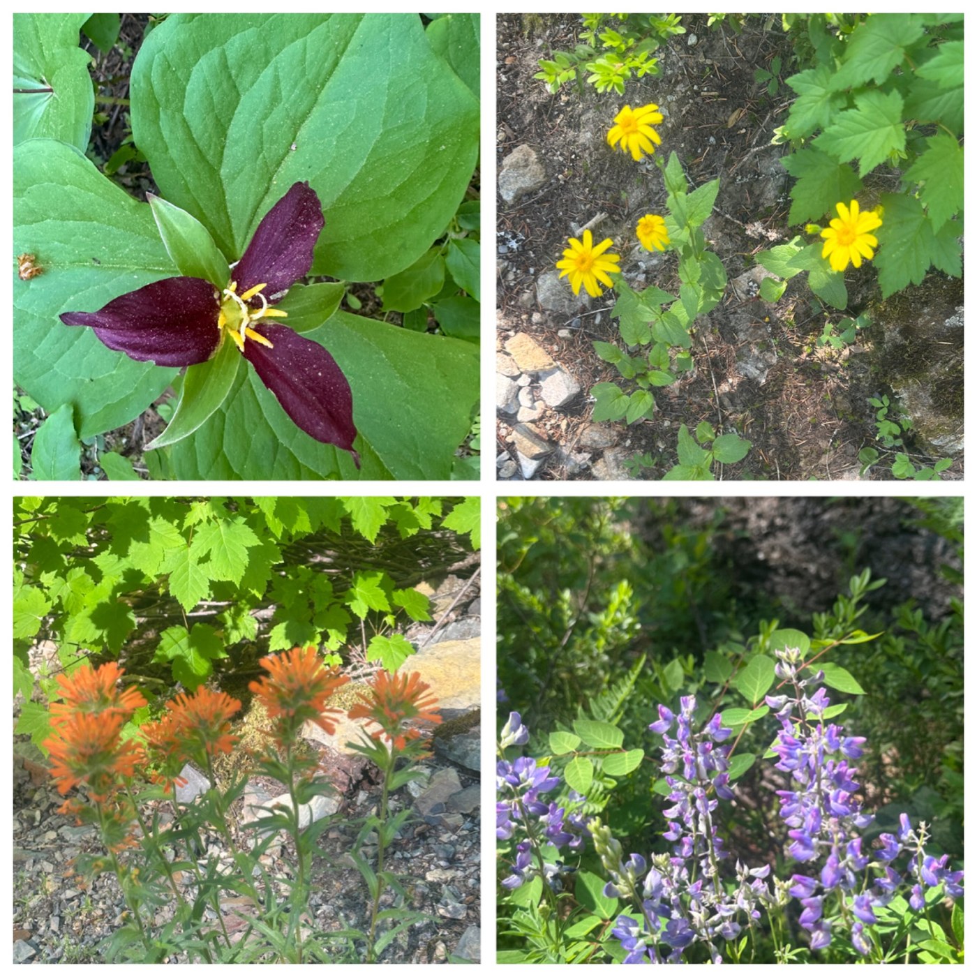
Wildflowers: I saw lupine, paintbrush, trillium, and heartleaf, along with a lot of other forest wild flowers that are common this time of year. Pictures below.
Wildlife: Some squirrels on the trail, lots of birds around the lake, including several hummingbirds, eagles (saw some feathers at the campsite), a merlin, Steller's Jay, Swainson's Thrush, Golden-Crowned Kinglet, Yellow-rumped Warbler, and lots of frogs around the lake, both seen and especially heard.
Overall, I measured a little over 20 miles and a little over 2500 ft elevation gain. Wish I could have gone further, but it was a great June backpacking trip with amazing weather. Looking forward to coming back when the river is a little lower to explore this area some more.


Comments