
The Road: Reading the WTA writeup and recent trip reports I was expecting a really bad road to the trailhead. I was pleasantly surprised to find the road pretty good.
Driving to Cooper lake is paved. Just before the lake the road goes left toward Mineral Creek and becomes dirt. This section up to Copper Pass has a fair amount of washboard but otherwise is a good wide forest road.
Just after Copper Pass, turn left on a forest road (Gaia calls it No name basin road). The road is not as wide but is in very good shape with just a few potholes. There are a few places with deep ruts from water runoff. I drive a Toyota Highlander SUV with 8-inch clearance, but I expect any car could make it up the road. I only saw one turn-off along the road, bare left and continue. There was one very narrow section with a deep drop on the left (driver side). Also, there are a few sporadic sections where brush will hit both sides of the car. I did not scratch my car, but it could happen.
The road ends at the trailhead with a nice gravel parking area along the road.
No Name Ridge Trail: The first 2.4 miles along the trail follows No Name Ridge. There are many views along this section. I liked looking at the Stuart range. I could also spot Thorp Lookout with a good zoom on my camera. On my return I could see Three Queens on one side of the ridge and Hinman/Daniel snow covered range on the other side
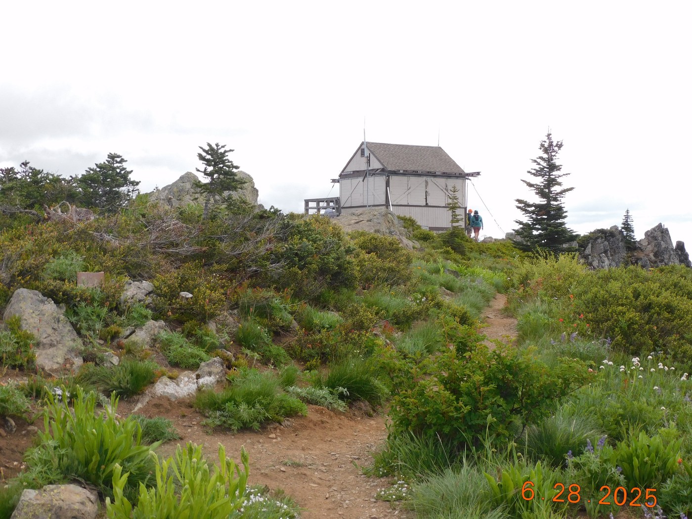
At 2.4 miles the trail name changes to Kachess Ridge Trail, at the junction with Red Mountain trail. (Note Red Mountain trail also goes to Little Joe Lake and to the Thorp Creek trailhead). From this junction, it was about 1 mile to the junction with Thorp Creek trail and 2 miles to the lookout.
Snow conditions: There are several short sections with snow, but most are easy to cross over. However, between the Thorp Creek junction and the junction to the summit, there are 2 sections that are a little more difficult. Only one of these will take extra care to get around. The difficult snowfield covers the trail on a steep switchback. Hikers have made a boot-path going off trail, covering plant life, to make a shortcut. I followed the boot-path instead of putting on micro-spikes. It can be slippery. In fact, on my way down, I slipped on my last step in the snow (the snow was cold).
Summary: I am glad I drove this road and took this route. The views are gorgeous at the top and along the no name ridge line. Total distance was 8.7 miles round trip, and 1980 feet altitude gain.


Comments
John Morrow on No Name Ridge - Thorp Mountain, Thorp Mountain Lookout via Thorp Creek
Thanks for the road update. It was improved last August to deliver firefighters to the fires nearby and provide for a better fuel break as possible contingency fireline. One fire was just east of No Name on a spur ridge. Part of the Kachess Complex, a set of individual lighting fires from Thomas Mountain to Stave Creek. None grew thanks for suppression efforts and favorable weather.
Posted by:
John Morrow on Jun 29, 2025 05:24 PM
John Morrow on No Name Ridge - Thorp Mountain, Thorp Mountain Lookout via Thorp Creek
https://inciweb.wildfire.gov/incident-publication/waowf-kachess-complex/kachess-complex-fire-final-update-august-17th-2024-08-17-2024
Posted by:
John Morrow on Jun 29, 2025 05:25 PM