

This was our first time hiking this trail. First thing to note is that the road to the trailhead was rough with deep potholes as soon as the paved road ends. High clearance vehicles will have no problem. Low clearance vehicles will struggle. Second thing to note is the location of the trailhead - you will definitely miss it unless you've hiked it before or you're using a navigation system because not only is there no sign at the "trailhead", but the "parking area", is a slight bulge in the road that can accommodate 2 vehicles max. The road continues so you'll drive right past it if you don't know where to stop.
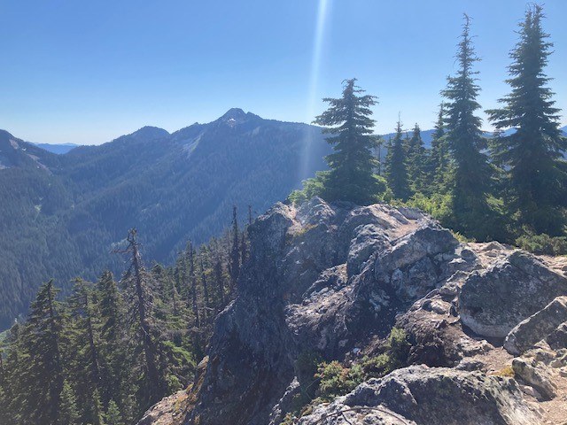
Although short, the entire trail is a continuous uphill grade with the first half consisting mostly of very rocky switchbacks and the second half being a series of straighter approaches eventually leading to the final push up to what normally feels like where a Fire Look Out would have been, but is too small to support one. However, you will see evidence of some structure (that included electricity), that used to be at the top. Once at the top, you have a fantastic view in nearly all directions (only a few trees block a true 360 degree view). Bugs were a minor nuisance at some parts along the trail but not bad at all at the top. We also saw plenty of butterflies which was nice.
Possibly due to the obscurity of the trailhead, you will likely find yourself either the only one's on the trail, or sharing it with only 2 or 3 other groups which is always a good thing imo. Although most of the trail is within tree line providing plenty of shade, there are some view points along the way.
Including about 20 minutes to take in the views at the top and eat a little food, total roundtrip time for us as just under 2 hours.
-Tom


Comments
There used to be a radio beacon up there used for airplanes from the 1930’s.
Posted by:
Seattle_Wayne on Jul 08, 2025 04:04 PM