
We set out to hike most of the PNTs section 6 over the 4th of July week. Traveling from Seattle to Loomis we parked at the Cold Creek campground. The road to the campground was well maintained and passable for most vehicles. Parking at the trailhead was plentiful.
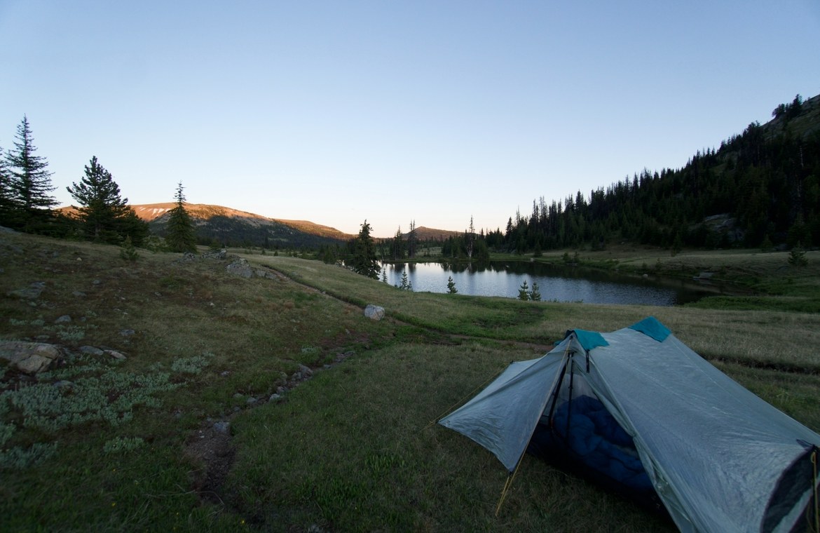
The trail starts heading slightly downhill following a well defined winter snowshoe trail. Almost immediately the trail dives into a meadow where the path just sort of disappears from view. Not to worry there are red snowshoe trail markers in the trees marking the way. As you make your way through the trail you are rewarded by your first glimpses of what's to come, towering peaks and rolling fields. Reaching the first burned out section of the trail you encounter several downed logs dotting the trail. This will become a regular thing the further you head into the Pasayten... Crossing these logs and exiting the burn you find yourself on an exposed grass hillside. Traversing the hillside the trail will intermittently disappear and reappear. Several broken trail markers were observed through this section. At some point the trail completely disappears and you're left to figure out a path that works best at the moment. Continue pushing and you enter the Pasayten Wilderness! The first night we pushed up to Loudoun lake. During the drier months (July-September) likely this is your only water source in Horseshoe basin. Mosquitoes and Horse Flies are heavy around the lake so plan accordingly. At the lake we were rewarded with a brief glimpse of a rare wolverine heading down for a drink!
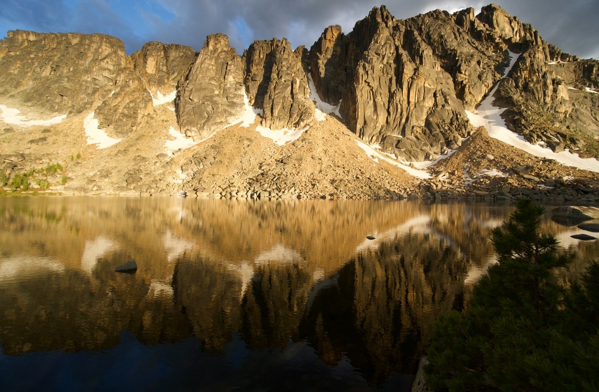
The second morning we arose early knowing we had a long 18 mile day ahead of us. Moving quickly across the remainder of the exposed ridgeline we dropped into the forest. Popping in and out of heavy tree cover we made our way to Upper Cathedral Lake. Water sources were beginning to get scarce along the route due to an early snow melt. Along the way we took time to stop at the historical Tungsten Mine site where the original bunk house and some of the mine machinery are still present. Arriving at the end of our day we climbed to the top of Cathedral pass where the views are stunning! Upper Cathedral lake is like nothing else in the Pasayten. A towering cliff band aptly named amphitheater mountain borders the lake giving it an otherworldly feel.
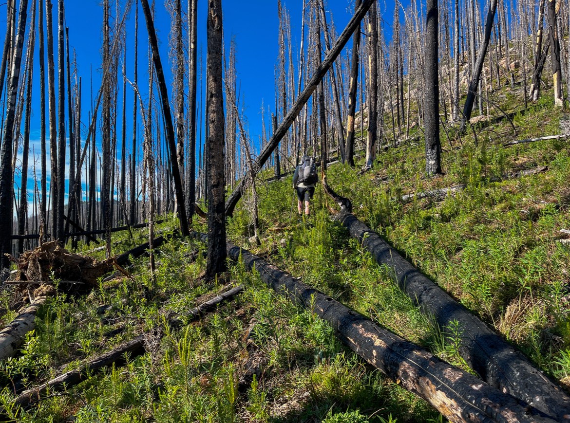
Leaving Cathedral Lake the next day we made a quick detour to Remmel lake, this detour is HIGHLY recommended! After passing the historic Spanish Cabin site (still used today by the forest service) you enter a major burn area. This is where the punishing conditions really start. Miles of exposed dry land and dozens of downed log crossings lead you to the canyon of the Ashnola river. The eastern side of the canyon progressively worsens in condition the closer to the river you get. We counted 50 downed trees across the trail and several areas where the trail is collapsing. At the bottom of the canyon dense regrowth has begun to pop up leaving the trail barely visible. Camping at the river is plentiful and flat.
Fording the Ashnola river to start the day we found the trail on the Western side of the canyon to be in even worse shape than the east. Again we counted 50 downed trees across the trail with chest high vegetation the whole way up. While this can be an annoyance, scary, and difficult terrain to pass through, it's also what makes this trail so special! A strong sense of being completely alone begins to envelop you as you make your way up the hillside. At this point in the trail you are at one of the most remote spots in WA. As you reach the top the brush opens up into a meadow that houses the historic Baker Brown cabin site. It's worth noting that we went off trail here and were able to find a water spring flowing in a cluster of trees at the far West end of the madow about halfway up the hillside. Passing Peeve Pass you are again in a burn zone. Dozens of downed trees lead you to a grassy ridgeline where you have a brief moment of reprieve from stepping over logs. That moment is short lived as you descend into another burn zone. Finally popping out and making your way up Bunker hill. (Only 1 water source could be found in that 8 mile stretch, Dean Creek.) Bunker hill (really Bunker Mountain) hosts some of the most breathtaking views of the Pasayten. It is worth taking an extended break at the top. Finally as the day was getting late we began the descent off Bunker hill towards Bunker Creek. We found a single tent site about half way down the Western slope of Bunker Hill next to a creek. Hindsight being 2020 this is where we should have camped and would recommend others to camp here! After that tent site you reenter a burn zone. The trail here is in absolutely terrible condition. We lost count of downed logs on the trail after 200. The final 4 switchbacks that descend to Bunker Creek are dangerous, crumbling, and very difficult to navigate. The topography of this area is essentially a funnel where all of the downed trees eventually end up as they shift during the winter storm cycles. We pushed into camp late that evening around 2000hrs, finding a nice spot on the east bank of Pasayten river (there are also 3 or 4 sites on the West side of the river if needed). Black bear scat lined our campsite but options for pitching a tent in this area are SLIM!
The following morning we started out by fording the Pasayten river to the western bank. Carnes mark the location of the trail. Mostly flat hiking with maybe 60 downed trees in 6 miles! A breeze compared to the previous day's adventure! At the Pasayten airstrip we took our time eating a big lunch and taking advantage of the water spicket near the pit toilet. Continuing south along the Robinson creek trail we ran into people for the third time in a week. That evening camping at Berk Creek. We found this campsite to be well maintained with room for several tents.
Our final day on the trail we had very few downed trees. Making this one of the more enjoyable sections to get into a bit of a flow. The trail peaks at Robinson Pass giving you stunning views towards Mazama. As the trail winds back down there is some overgrowth, and 2 ankle deep water fords. Along this trail we ran into two more groups of hikers, a novelty after spending an entire week seeing only a handful of other people.
Arriving at our car in the early afternoon we were saddened to be getting off trail. While incredibly challenging the Pasayten Wilderness holds some of the most unique and beautiful areas in the Cascades. It also gives you a rare opportunity to walk back in time. Where trails were more or less not defined and reliance on overland navigational skills was required. Given the current status of the Pasayten Wilderness it's safe to say that you are unlikely to find a wilderness experience similar to it anywhere in WA.
Comments
Nice arc, envy your wolverine sighting. I thought the PNT saw regular crews.
Posted by:
Christian Gustafson on Jul 10, 2025 07:18 AM