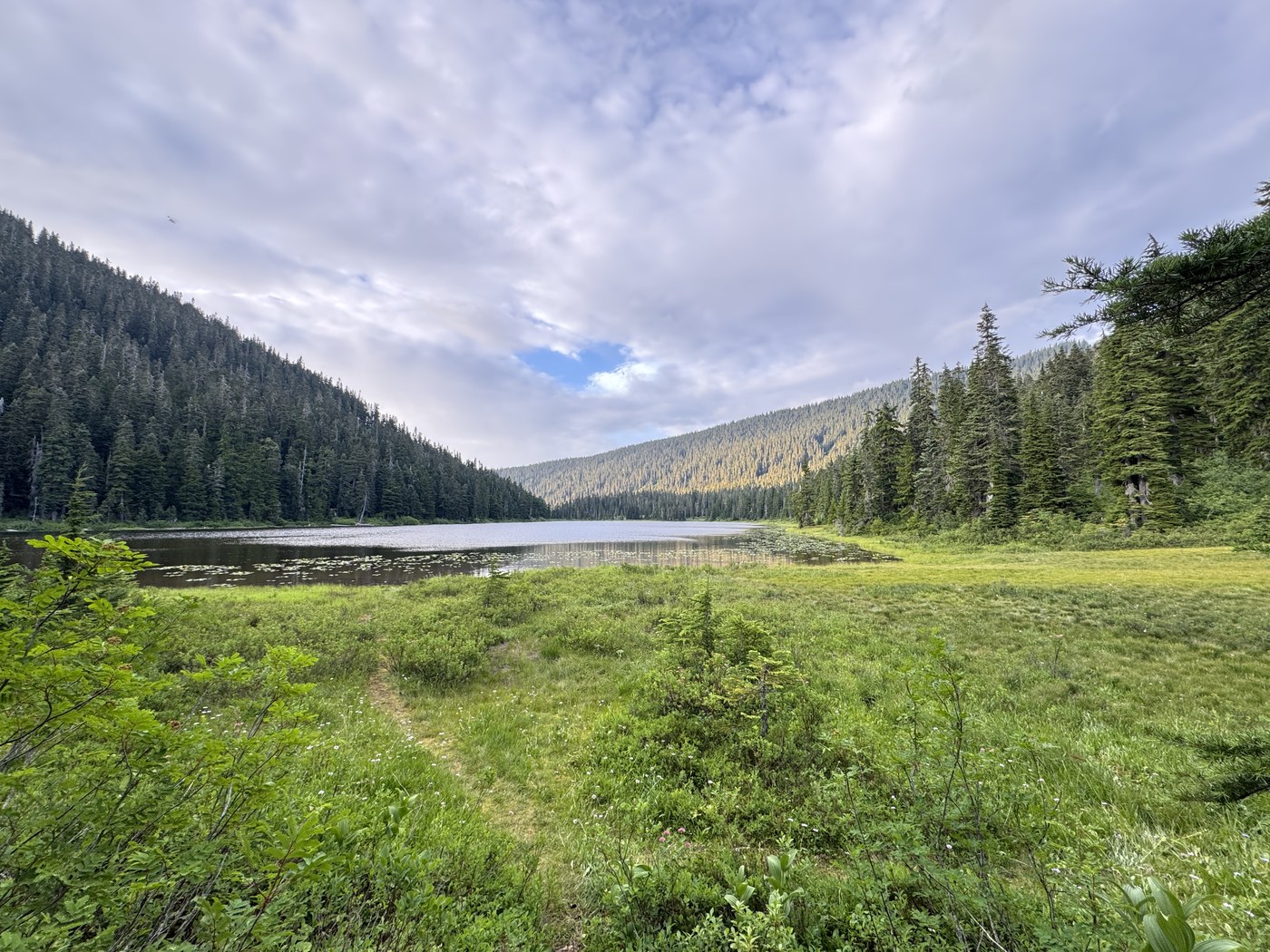
Summary. Overnight at Lake Janus, out-and-back from Stevens Pass via a portion of the Pacific Crest Trail’s Section Special K.
- I clocked in 20 miles round trip over six hours and 40 minutes of moving time.
- Parking was no sweat at the ski resort.
- The incline is down-and-up-and-down-and-up, though never too strenuous of a grade.
- The trail is very well maintained, though overgrown at times.
- It was quite busy at the lakes – as expected on a summer weekend. That was mitigated by plenty of solitude along stretches of the PCT.
- Plenty of wildflowers along the trail, as well as an abundance of huckleberries in the meadows of Lake Janus.
Parking. I parked my car at Lot D of Stevens Pass Ski Resort, near the southern trailhead of PCT Section K. There’s a bathroom here and ample parking – especially considering it’s connected to all the parking lots across the mountain. Here, I found two single-stall restrooms. There was an archery completion this weekend, bringing lots of RVs and campers to the lot.
Day one: Stevens Pass to Lake Janus. I began my ascent at 8:30 AM. In the first mile alone, I was stunned by the wildflowers dotting the trail: aster, western pearly everlasting, plume thistle, paintbrush, and yarrow are the ones I managed to photograph. I’m sure there’s more.
Portions of the initial section are overgrown, though there were no other obstacles throughout the hike. The gentle 200-foot descent from Stevens Pass was mostly shaded through second-growth forest. Interestingly enough, the first two miles had vaults and hand-holes in the middle of the trail – implying there’s some sort of linear underground infrastructure right underneath. (I’m guessing power or communications, since I build public works for a living.)
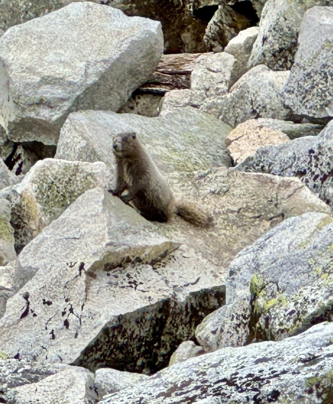
The first boulder patch – at about mile two – offers stunning views of Lichtenberg Mountain and Welldigger’s Ass. (Actual name of the peak – I didn’t even need to make a butt joke for that one. Nice.) Here, I was greeted by a very charismatic Hoary Marmot that could Whistle better than Flo Rida.
Silence and solitude marked the next three miles of the trek, until Lichtenberg Mountain came into full focus around mile five. Here, a moderate incline stays consistent, gaining almost 1,000 feet in less than three miles: the bulk of the climb. Once Lake Valhalla came near, the trail sounded more like Alki Beach than the backcountry. (No hate though. It’s great that folks are getting outdoors.) I decided to keep hustling towards Lake Janus, declining to hike down to Valhalla’s busy, sandy beach. This junction was at mile five.
For the next four miles, I lost the elevation I had gained on the trek to Valhalla. The crowds thinned down significantly after the junction to Smithbrook Trail at mile 7.7. Now I realized I could’ve started from a closer trailhead – and perhaps have summited Grizzly Peak – but oh well. I’m still glad I got to kick some dirt along the PCT.
At mile 8.5, the downhill transitioned into a gentle incline of 300 feet, over the final mile or-so to camp. I finished my day’s walk at 12:30 PM, just in time for lunch.
I was greeted by a bustling Lake Janus, which I did not expect based on the WTA description. When scoping out campsites, a territorial (yet very polite) bride informed me she’s having her wedding on the lake shore, with her group taking the three western campsites near the boulders. I’m very happy for the newlyweds, though I could’ve used some less screaming when they decided to take some photos near my campsite.
I took the campsite farthest east on the south lakeshore, right next to the marshy meadows. There was some flat enough ground to pitch my tent. There were also plenty of trees nearby for a hammock and a clothesline. A series of social trail made it easy to meander towards the vault toilet. Just a few dozen feet away from the lake shore, water access was easy enough, though the area was marshy and difficult to walk in. This presents a similar issue getting in-and-out of a swim, where a foot always managed to get stuck in the muddy lake floor.
The best part about this campsite? So. Many. Huckleberries. 180-degrees of huckleberries surrounding my home-for-a-night. I went to sleep early because I got tired of swatting mosquitoes and horse flies.
Some numbers from day one:
- Ten miles of distance.
- 1,800 feet of climb, 1,700 feet of loss.
- 3,800 feet above sea level at the lowest point. 5,100 feet at the highest.
- Four hours of elapsed time hiking. Three and a half hours spent moving.
- 20 and a half minutes per mile average moving pace.
Day two: Lake Janus to Stevens Pass. I slept until 9 AM, enjoyed two much-needed cups of Bailey’s and coffee, and began the trek to the car at 10:45 AM. The trip back did not have anything of note that wasn’t already mentioned above. I got to my car at 2 PM.
Statistics from day two:
- 9.8 miles of distance (less wandering.)
- 1,700 feet of climb, 1,800 feet of loss.
- 3,800 and 5,100 feet above sea level at the lowest and highest points, respectively.
- Three hours and 30 minutes elapsed. Three hours and eleven minutes spent moving.
- 19 and a half minutes per mile average moving pace.
In closing. Wonderful hike with weekend crowds. Next time, I’d do this starting at the Smithbrook Trailhead. I’d like to bag Grizzly Peak and also spend a night at Pear Lake. (Insert butt joke here.)
Land acknowledgement. Every community and each ecosystem owe their existence to the generations past who created the history that has led to this very moment. The Mount Baker-Snoqualmie & Okanogan-Wenatchee National Forests are on the cultural & ancestral land of the Skykomish, Snoqualmie, Snohomish, Tulalip, Coville, Wenatchee, Okanogan, and all Coast Salish & Central Washington tribes. We’re thankful for their stewardship, past and present – honoring the resiliency of the tribes and the land itself.


Comments